MyTopo
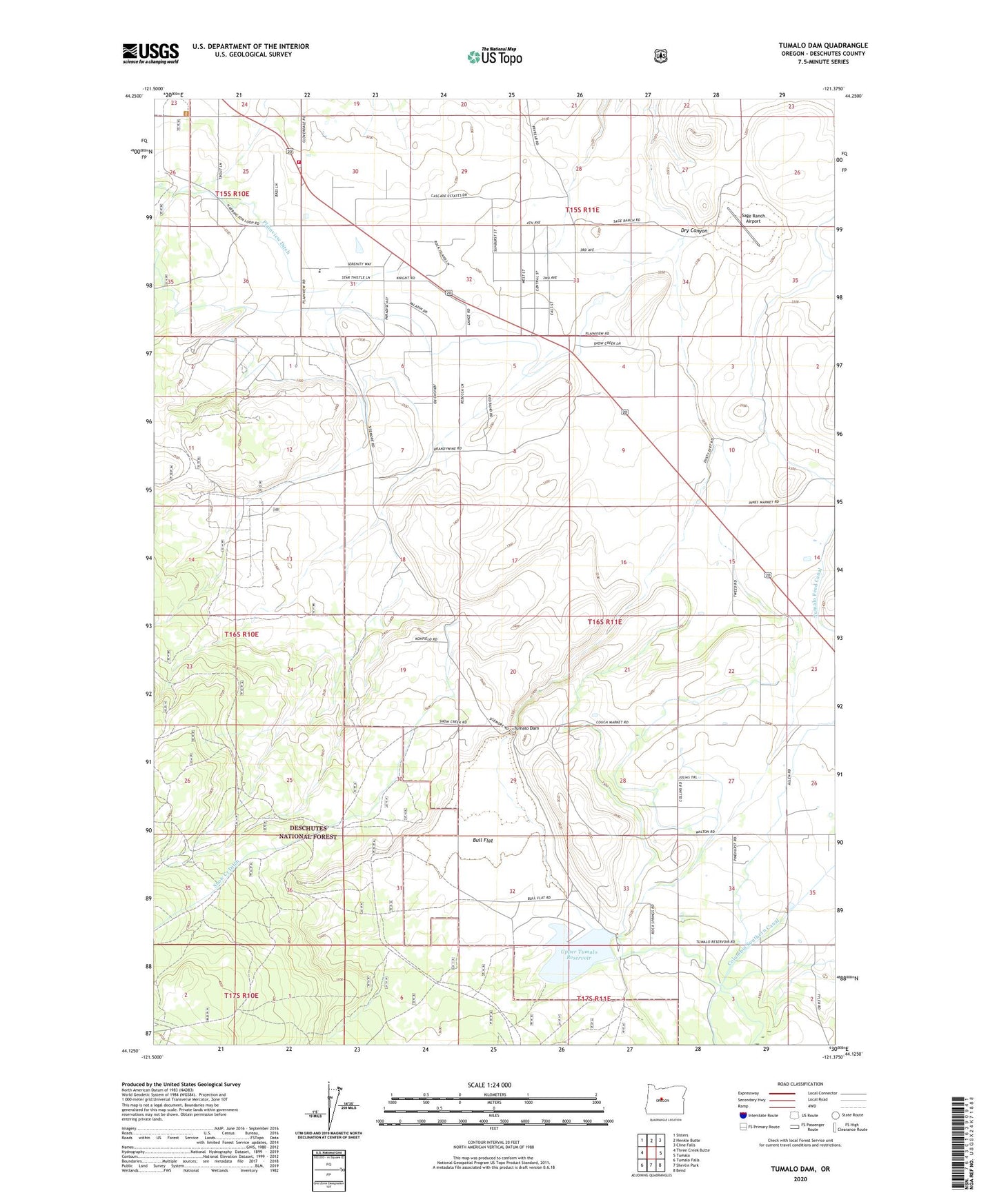
Tumalo Dam Oregon US Topo Map
Couldn't load pickup availability
Also explore the Tumalo Dam Forest Service Topo of this same quad for updated USFS data
2023 topographic map quadrangle Tumalo Dam in the state of Oregon. Scale: 1:24000. Based on the newly updated USGS 7.5' US Topo map series, this map is in the following counties: Deschutes. The map contains contour data, water features, and other items you are used to seeing on USGS maps, but also has updated roads and other features. This is the next generation of topographic maps. Printed on high-quality waterproof paper with UV fade-resistant inks.
Quads adjacent to this one:
West: Three Creek Butte
Northwest: Sisters
North: Henkle Butte
Northeast: Cline Falls
East: Tumalo
Southeast: Bend
South: Shevlin Park
Southwest: Tumalo Falls
This map covers the same area as the classic USGS quad with code o44121b4.
Contains the following named places: Bridges Academy, Bull Creek, Bull Creek Dam, Bull Flat, Bull Spring Creek, Cloverdale Rural Fire Protection District Station 2, Columbia Southern Canal, Gist, Gist Post Office, Plainview, Plainview Ditch, Plainview Grange, Plainview School, Sage Ranch Airport, Sisters Rodeo Grounds, Snow Creek Ditch, Tillicum Park/Chase Ranch, Tumalo Dam, Tumalo Feed Canal, Upper Tumalo Reservoir