MyTopo
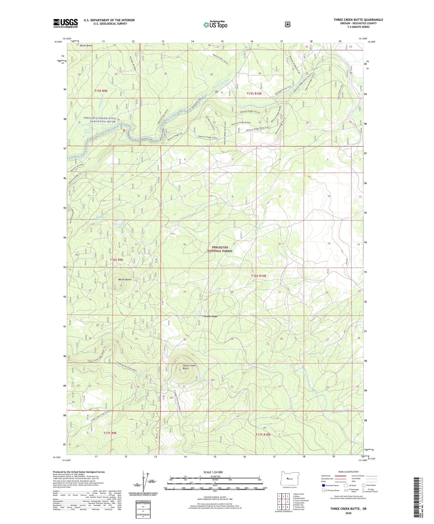
Three Creek Butte Oregon US Topo Map
Couldn't load pickup availability
Also explore the Three Creek Butte Forest Service Topo of this same quad for updated USFS data
2023 topographic map quadrangle Three Creek Butte in the state of Oregon. Scale: 1:24000. Based on the newly updated USGS 7.5' US Topo map series, this map is in the following counties: Deschutes. The map contains contour data, water features, and other items you are used to seeing on USGS maps, but also has updated roads and other features. This is the next generation of topographic maps. Printed on high-quality waterproof paper with UV fade-resistant inks.
Quads adjacent to this one:
West: Trout Creek Butte
Northwest: Black Crater
North: Sisters
Northeast: Henkle Butte
East: Tumalo Dam
Southeast: Shevlin Park
South: Tumalo Falls
Southwest: Broken Top
This map covers the same area as the classic USGS quad with code o44121b5.
Contains the following named places: Black Pine Spring, Black Pine Spring Recreation Site, Lower Three Creek, Lower Three Creek Sno-Park, Maxwell Ditch, Melvin Butte, Melvin Creek, Melvin Spring, Pole Creek Ditch, Pole Creek Swamp, Three Creek, Three Creek Butte