MyTopo
Denio Nevada US Topo Map
Couldn't load pickup availability
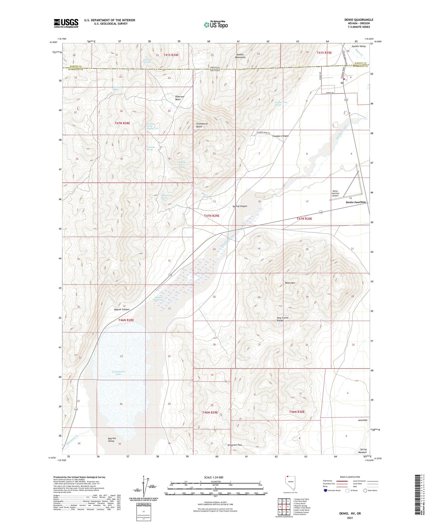
2021 topographic map quadrangle Denio in the states of Nevada, Oregon. Scale: 1:24000. Based on the newly updated USGS 7.5' US Topo map series, this map is in the following counties: Humboldt, Harney. The map contains contour data, water features, and other items you are used to seeing on USGS maps, but also has updated roads and other features. This is the next generation of topographic maps. Printed on high-quality waterproof paper with UV fade-resistant inks.
Quads adjacent to this one:
West: Bog Hot Springs
Northwest: Oregon End Table
North: Van Horn Basin
Northeast: Colony Ranch
East: Wilder Creek Ranch
Southeast: Denio Summit
South: Vicksburg Canyon
Southwest: Alder Creek Ranch
Contains the following named places: Alberson Basin, Alberson Basin Spring, Albertson Ranch, Antelope, Baltazor Hot Spring, Black Mountain, Bobcat Canyon, Chokecherry Spring, Continental Lake, Cowden Canyon, Cowden Mine, Cowden Mine Spring, Denio, Denio Census Designated Place, Denio Creek, Denio Elementary School, Denio Junction Airport, Denio Post Office, Denio Volunteer Fire Department, Emigrant Pass, Erquiaga Spring, Erquiaga Spring Number Two, Hall Mine, Hot Lake, Mineral Creek, Mustang Spring, Overton, Spring Canyon, State Line Spring, Strawberry Butte, Thousand Creek, Warm Springs Mining District, ZIP Code: 89404