MyTopo
Wilhoit Oregon US Topo Map
Couldn't load pickup availability
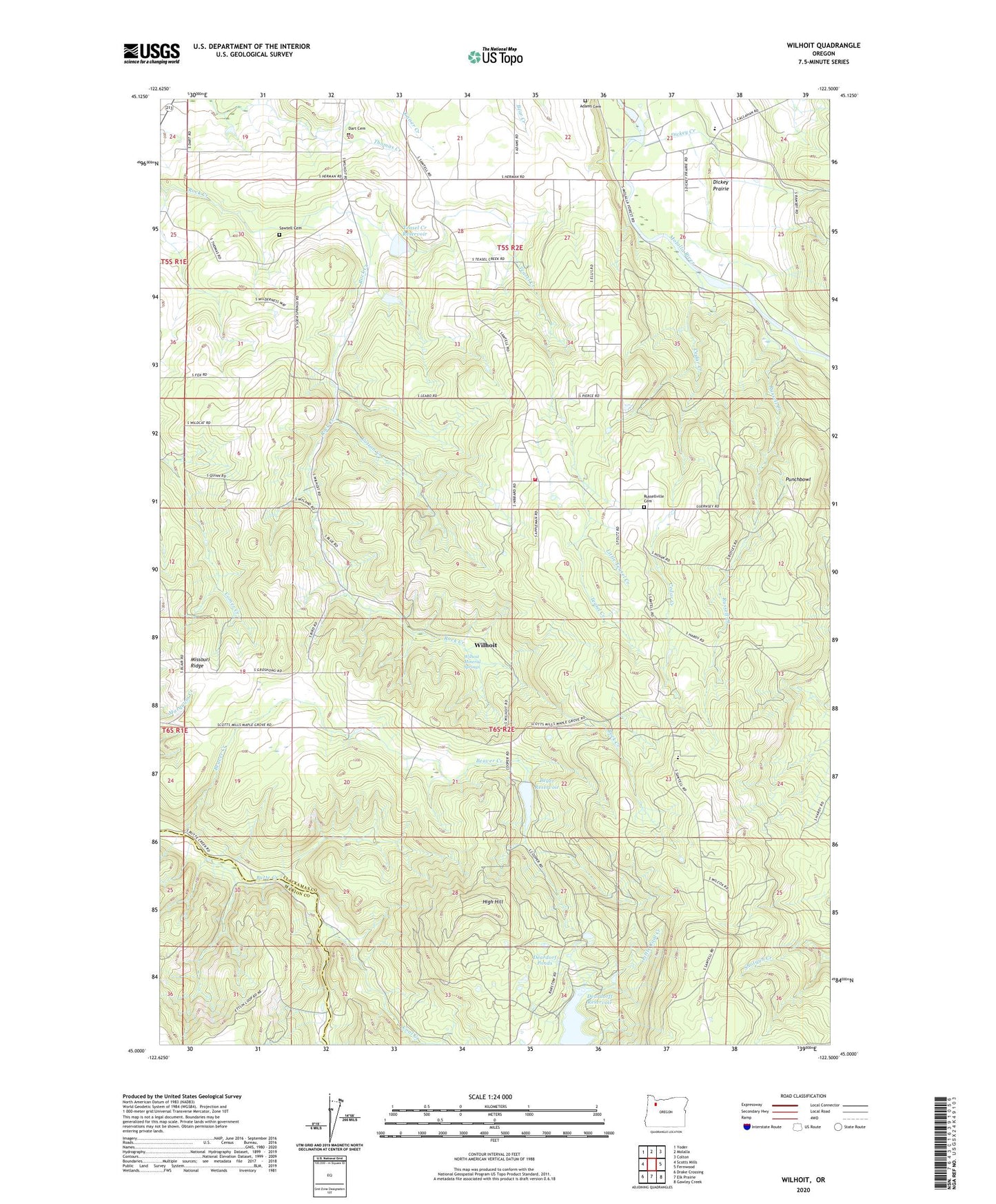
2020 topographic map quadrangle Wilhoit in the state of Oregon. Scale: 1:24000. Based on the newly updated USGS 7.5' US Topo map series, this map is in the following counties: Clackamas, Marion. The map contains contour data, water features, and other items you are used to seeing on USGS maps, but also has updated roads and other features. This is the next generation of topographic maps. Printed on high-quality waterproof paper with UV fade-resistant inks.
Quads adjacent to this one:
West: Scotts Mills
Northwest: Yoder
North: Molalla
Northeast: Colton
East: Fernwood
Southeast: Gawley Creek
South: Elk Prairie
Southwest: Drake Crossing
Contains the following named places: Adams Cemetery, Beaver Creek, Beaver Lake School, Berrenth Quarry, Beyer Reservoir, Cedar Creek, Coal Creek, Cotton Creek, Dart Cemetery, Deardorf Ponds, Deardorff Reservoir, Dickey Creek, Dickey Prairie, Dickey Prairie Elementary School, Hermans, High Hill, Kokel Corner, Little Teasel Creek, Maple Grove Elementary School, Missouri Ridge, Molalla Rural Fire Protection District 73 Main Station, Neil Beyer Dam, Punchbowl, Russell Creek, Russellville, Russellville Community Cemetery, Sawtell Cemetery, Teasel Creek, Teasel Creek Dam, Teasel Creek Reservoir, Wildcat School, Wilhoit, Wilhoit Mineral Springs, Wilhoit Post Office, Wilhoit Springs County Park, Yoder Quarry, ZIP Code: 97038