
MyTopo
Winchester Oregon US Topo Map
Couldn't load pickup availability
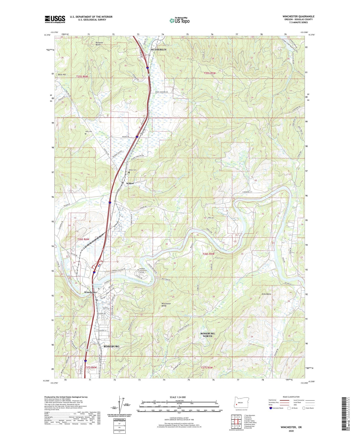
2020 topographic map quadrangle Winchester in the state of Oregon. Scale: 1:24000. Based on the newly updated USGS 7.5' US Topo map series, this map is in the following counties: Douglas. The map contains contour data, water features, and other items you are used to seeing on USGS maps, but also has updated roads and other features. This is the next generation of topographic maps. Printed on high-quality waterproof paper with UV fade-resistant inks.
Quads adjacent to this one:
West: Garden Valley
Northwest: Tyee Mountain
North: Sutherlin
Northeast: Nonpareil
East: Oak Creek Valley
Southeast: Dixonville
South: Roseburg East
Southwest: Roseburg West
Contains the following named places: Akin, Amacher County Park, Amacher County Park Boat Ramp, Clover Creek, Cooper Creek, Davis Creek, Davis Hill, Deady, Dixon Creek, Douglas County Fire District 2 Station 4, Douglas County Forest Products Biomass Production, Echo Butte, Mar-Linn Log Pond, Mar-Linn Timber Corporation Log Pond Dike, Omro Post Office, Otey Cemetery, Redbell, Richards Butte, Roseburg North Census Designated Place, Roseburg Winchester Water Treatment Plant, Short Creek, Umpqua Community College, Umpqua Community College Amphitheatre, Umpqua Community College Jacoby Auditorium, Wilbur, Wilbur Cemetery, Wilbur Post Office, Winchester, Winchester Baldy, Winchester Dam, Winchester Elementary School, Winchester Post Office, Winchester Reservoir, ZIP Codes: 97494, 97495


