MyTopo
Tyee Mountain Oregon US Topo Map
Couldn't load pickup availability
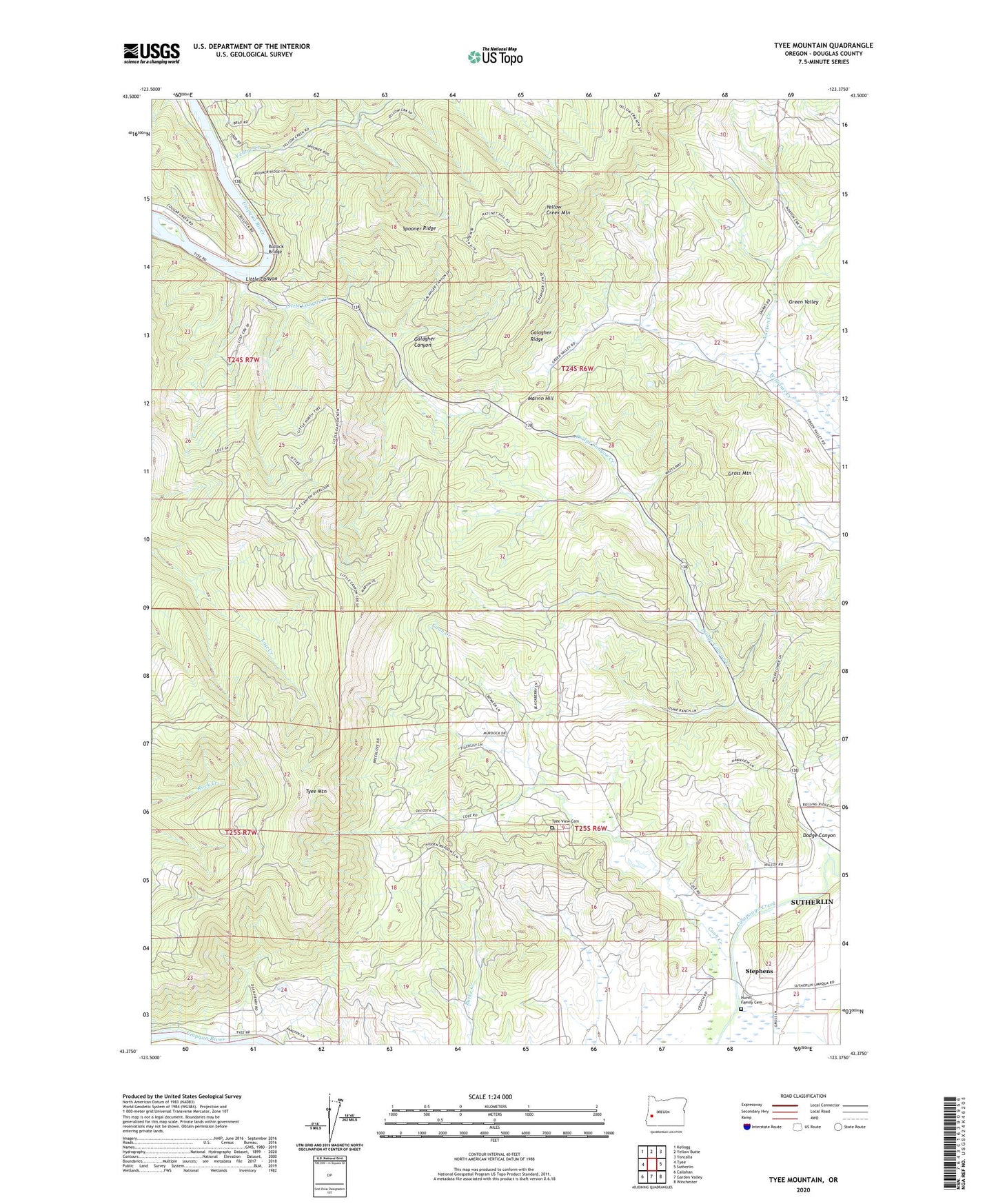
2023 topographic map quadrangle Tyee Mountain in the state of Oregon. Scale: 1:24000. Based on the newly updated USGS 7.5' US Topo map series, this map is in the following counties: Douglas. The map contains contour data, water features, and other items you are used to seeing on USGS maps, but also has updated roads and other features. This is the next generation of topographic maps. Printed on high-quality waterproof paper with UV fade-resistant inks.
Quads adjacent to this one:
West: Tyee
Northwest: Kellogg
North: Yellow Butte
Northeast: Yoncalla
East: Sutherlin
Southeast: Winchester
South: Garden Valley
Southwest: Callahan
This map covers the same area as the classic USGS quad with code o43123d4.
Contains the following named places: Bullock Bridge, Camp Tyee, Coon Creek, Dodge Canyon, Dodge Canyon Creek, Galagher Canyon, Galagher Ridge, Gross Mountain, Hurst Family Cemetery, Little Canyon, Little Canyon Creek, Marvin Hill, Spooner Ridge, Stephens, Stephens Post Office, Tyee Mountain, Tyee Mountain Recreation Area, Tyee View Cemetery, Yellow Creek, Yellow Creek Mountain, ZIP Code: 97462