
MyTopo
Wolf Run Oregon US Topo Map
Couldn't load pickup availability
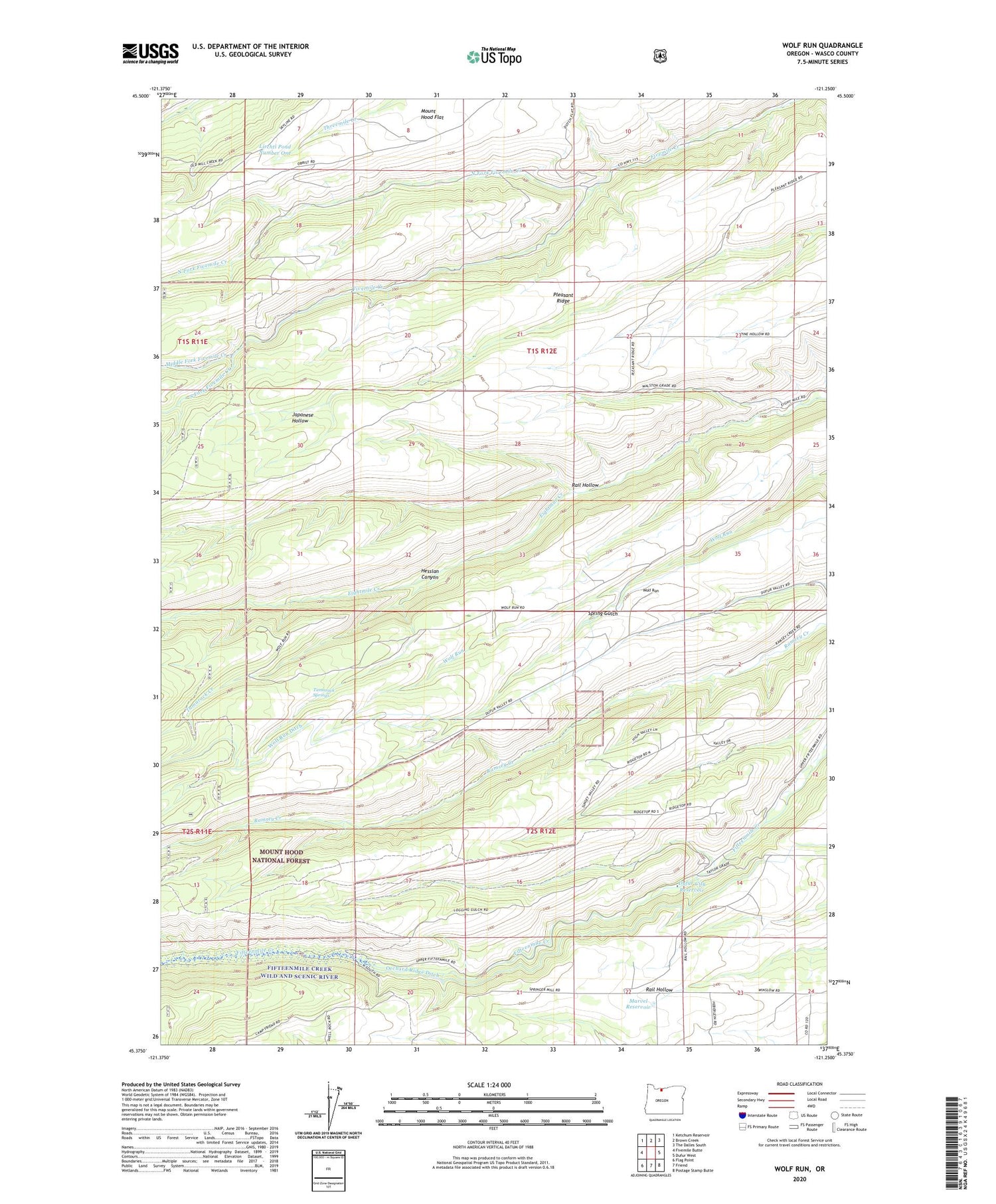
2020 topographic map quadrangle Wolf Run in the state of Oregon. Scale: 1:24000. Based on the newly updated USGS 7.5' US Topo map series, this map is in the following counties: Wasco. The map contains contour data, water features, and other items you are used to seeing on USGS maps, but also has updated roads and other features. This is the next generation of topographic maps. Printed on high-quality waterproof paper with UV fade-resistant inks.
Quads adjacent to this one:
West: Fivemile Butte
Northwest: Ketchum Reservoir
North: Brown Creek
Northeast: The Dalles South
East: Dufur West
Southeast: Postage Stamp Butte
South: Friend
Southwest: Flag Point
Contains the following named places: Dufur City Reservoir, Hesslan Canyon, Kelly Cistern, Liechti Pond Number One, Lyda Ranch Airstrip, Marvel Reservoir, Middle Fork Fivemile Creek, North Fork Fivemile Creek, Orchard Ridge Ditch, Pleasant Ridge, Pleasant Ridge School, Rail Hollow, South Fork Fivemile Creek, Spring Gulch, Tamarack Creek, Tamarack Springs, Taylor Post Office, Taylorville, Wolf Run, Wolf Run Community Hall, Wolf Run Ditch


