MyTopo
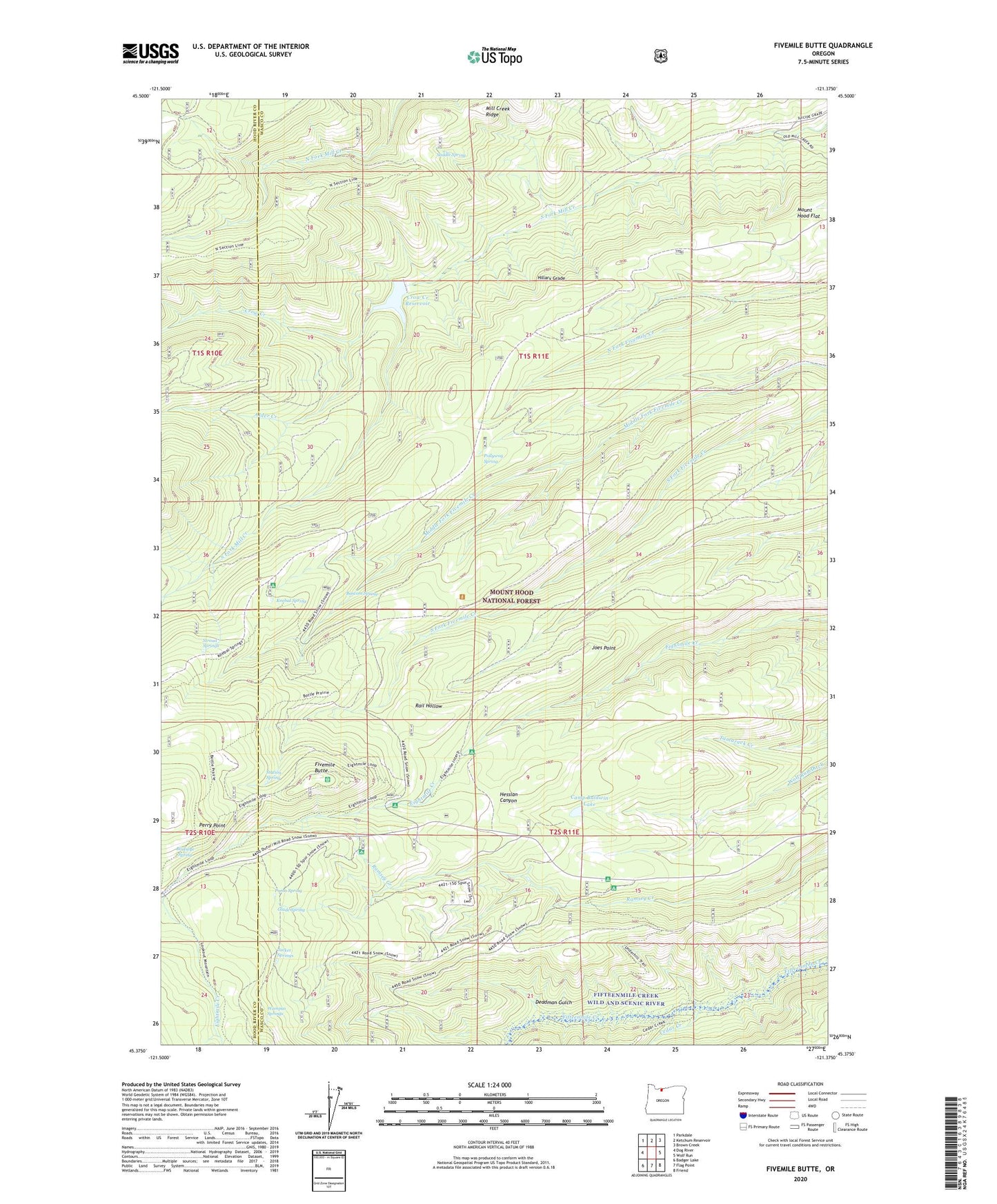
Fivemile Butte Oregon US Topo Map
Couldn't load pickup availability
Also explore the Fivemile Butte Forest Service Topo of this same quad for updated USFS data
2023 topographic map quadrangle Fivemile Butte in the state of Oregon. Scale: 1:24000. Based on the newly updated USGS 7.5' US Topo map series, this map is in the following counties: Wasco, Hood River. The map contains contour data, water features, and other items you are used to seeing on USGS maps, but also has updated roads and other features. This is the next generation of topographic maps. Printed on high-quality waterproof paper with UV fade-resistant inks.
Quads adjacent to this one:
West: Dog River
Northwest: Parkdale
North: Ketchum Reservoir
Northeast: Brown Creek
East: Wolf Run
Southeast: Friend
South: Flag Point
Southwest: Badger Lake
This map covers the same area as the classic USGS quad with code o45121d4.
Contains the following named places: Alder Creek, Bascom Spring, Birdseye Spring, Bottle Prairie Trail, Camp Baldwin, Camp Baldwin Lake, Cedar Creek, Crow Creek, Crow Creek Dam, Crow Creek Reservoir, Deadman Gulch, Eightmile Crossing Recreation Site, Fifteenmile Creek Trail, Fifteenmile Creek Wild and Scenic River, Fivemile Butte, Glade Spring, Hillary Grade, Jacket Springs, Joes Point, Joe's Point Quarry, Johns Mill Trail, Knebal Spring, Knebal Spring Recreation Site, Lower Eightmile Crossing Recreation Site, Pebble Ford Recreation Site, Perry Point, Pollywog Spring, Puma Spring, Saddle Spring, Skyline Quarry, Station Spring, Stroud Springs, Underhill Recreation Site, Wampus Springs