MyTopo
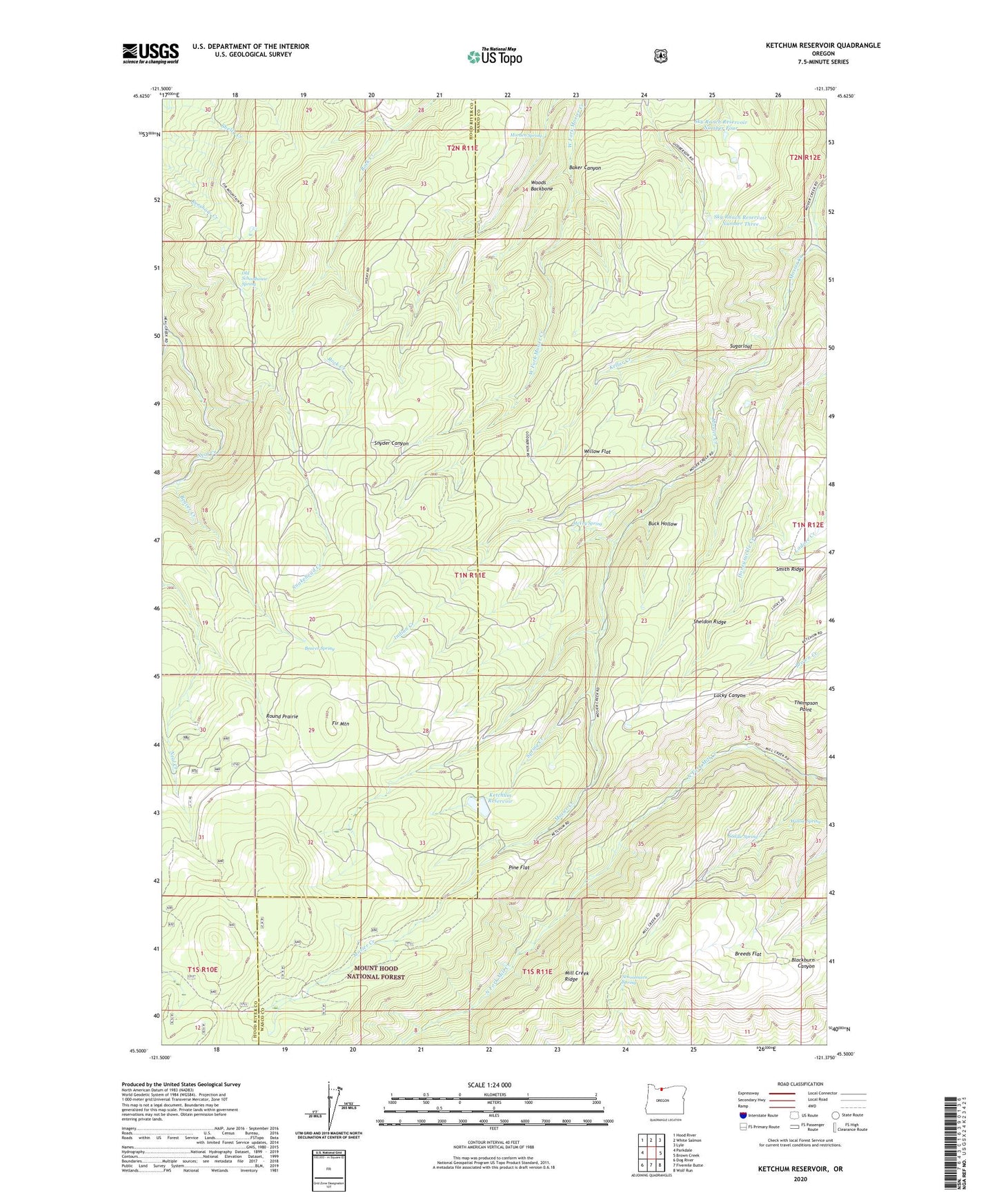
Ketchum Reservoir Oregon US Topo Map
Couldn't load pickup availability
Also explore the Ketchum Reservoir Forest Service Topo of this same quad for updated USFS data
2023 topographic map quadrangle Ketchum Reservoir in the state of Oregon. Scale: 1:24000. Based on the newly updated USGS 7.5' US Topo map series, this map is in the following counties: Wasco, Hood River. The map contains contour data, water features, and other items you are used to seeing on USGS maps, but also has updated roads and other features. This is the next generation of topographic maps. Printed on high-quality waterproof paper with UV fade-resistant inks.
Quads adjacent to this one:
West: Parkdale
Northwest: Hood River
North: White Salmon
Northeast: Lyle
East: Brown Creek
Southeast: Wolf Run
South: Fivemile Butte
Southwest: Dog River
This map covers the same area as the classic USGS quad with code o45121e4.
Contains the following named places: Baker Canyon, Beaver Creek, Beaver Spring, Breeds Flat, Buck Hollow, Fir Mountain, Honeysuckle Creek, Indian Creek, Kellar Creek, Ketchum Dam, Ketchum Ranch, Ketchum Reservoir, Lucky Canyon, McVey Spring, Mill Creek Ridge, Morden Spring, Neal Creek Lateral, Old Schoolhouse Spring, Pine Flat, Round Prairie, Saddle Camp, Saddle Spring, Schoolmarn Spring, Sheldon Ridge, Sky Ranch Reservoir Number Four, Sky Ranch Reservoir Number Three, Smith Ridge, Snakehead Creek, Spring Creek, Sugarloaf, Thompson Point, West Fork Neal Creek, Willow Flat, Willow Spring, Woods Backbone, ZIP Code: 97040