MyTopo
Worden Oregon US Topo Map
Couldn't load pickup availability
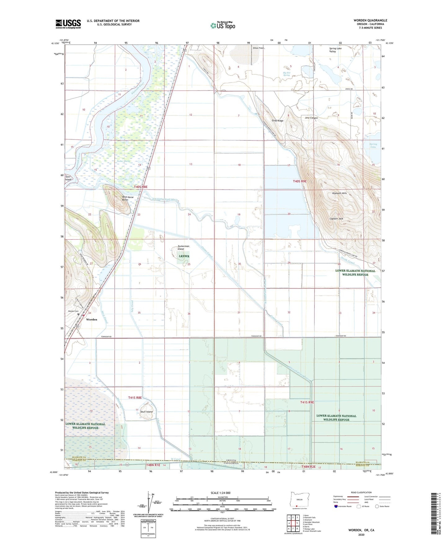
2020 topographic map quadrangle Worden in the state of Oregon. Scale: 1:24000. Based on the newly updated USGS 7.5' US Topo map series, this map is in the following counties: Klamath, Siskiyou. The map contains contour data, water features, and other items you are used to seeing on USGS maps, but also has updated roads and other features. This is the next generation of topographic maps. Printed on high-quality waterproof paper with UV fade-resistant inks.
Quads adjacent to this one:
West: Hamaker Mountain
Northwest: Keno
North: Klamath Falls
Northeast: Altamont
East: Lost River
Southeast: Lower Klamath Lake
South: Sheepy Lake
Southwest: Dorris
Contains the following named places: Ady, Ady Canal, Big Hot Spring, Captain Jack, Center Canal, Furber Marsh, Gray Ridge, Holland, Jory Canyon, Keno Rural Fire Protection District Station 2, Klamath Hills Trailhead, Klamath Strait, Klamath Strait Drain, Lake Miller, North Canal, Skull Island, Tulana Farms, United States Bureau of Reclamation Pumping Plant E, United States Bureau of Reclamation Pumping Plant F, West Canal, Wild Horse Butte, Worden, Worden Cemetery, Worden Post Office, Zuckerman Island