MyTopo
Wrangle Butte Oregon US Topo Map
Couldn't load pickup availability
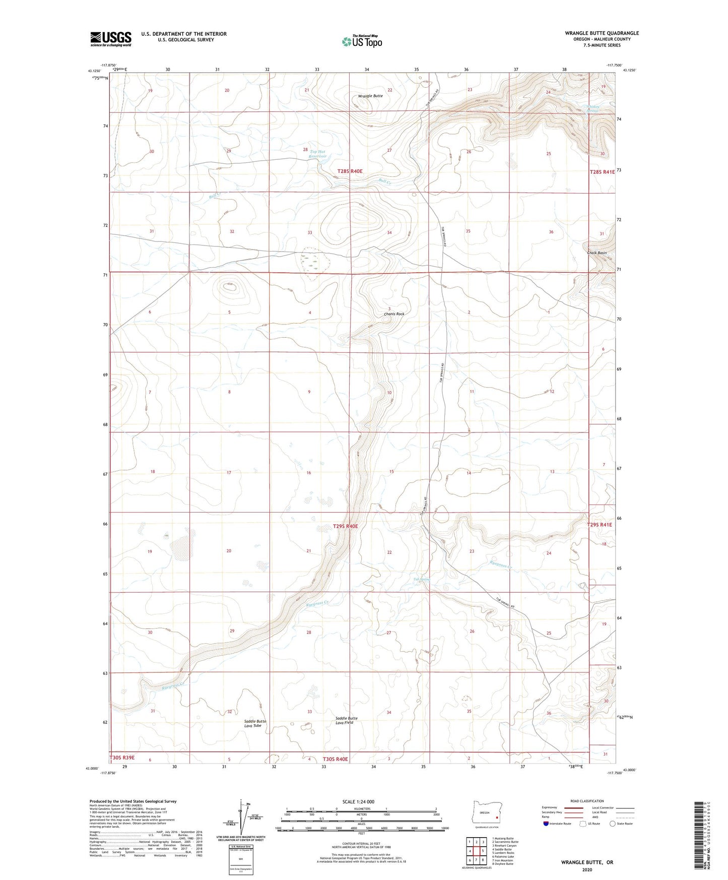
2023 topographic map quadrangle Wrangle Butte in the state of Oregon. Scale: 1:24000. Based on the newly updated USGS 7.5' US Topo map series, this map is in the following counties: Malheur. The map contains contour data, water features, and other items you are used to seeing on USGS maps, but also has updated roads and other features. This is the next generation of topographic maps. Printed on high-quality waterproof paper with UV fade-resistant inks.
Quads adjacent to this one:
West: Saddle Butte
Northwest: Mustang Butte
North: Sacramento Butte
Northeast: Rinehart Canyon
East: Lambert Rocks
Southeast: Owyhee Butte
South: Iron Mountain
Southwest: Palomino Lake
This map covers the same area as the classic USGS quad with code o43117a7.
Contains the following named places: Chanis Rock, Top Hat Reservoir, Tub Spring, Whiskey Springs, Wrangle Butte