MyTopo
Mustang Butte Oregon US Topo Map
Couldn't load pickup availability
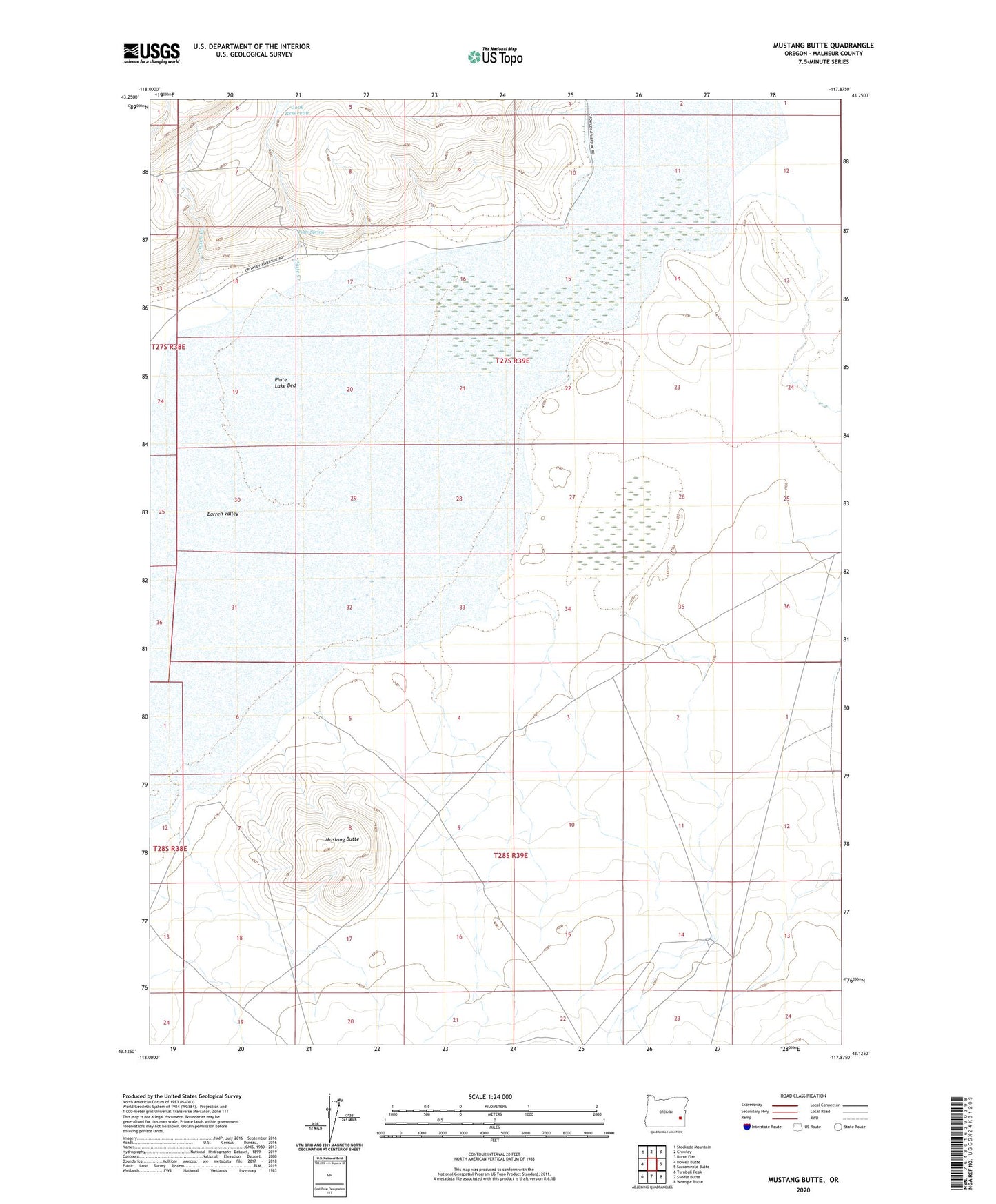
2023 topographic map quadrangle Mustang Butte in the state of Oregon. Scale: 1:24000. Based on the newly updated USGS 7.5' US Topo map series, this map is in the following counties: Malheur. The map contains contour data, water features, and other items you are used to seeing on USGS maps, but also has updated roads and other features. This is the next generation of topographic maps. Printed on high-quality waterproof paper with UV fade-resistant inks.
Quads adjacent to this one:
West: Dowell Butte
Northwest: Stockade Mountain
North: Crowley
Northeast: Burnt Flat
East: Sacramento Butte
Southeast: Wrangle Butte
South: Saddle Butte
Southwest: Turnbull Peak
This map covers the same area as the classic USGS quad with code o43117b8.
Contains the following named places: Barren Valley, Cook Reservoir, Couch Creek, Crowley Guard Station, Mooreville, Mooreville Post Office, Mustang Butte, Piute Creek, Piute Lake Bed, Piute Spring, Rocky Canyon