MyTopo
Rinehart Canyon Oregon US Topo Map
Couldn't load pickup availability
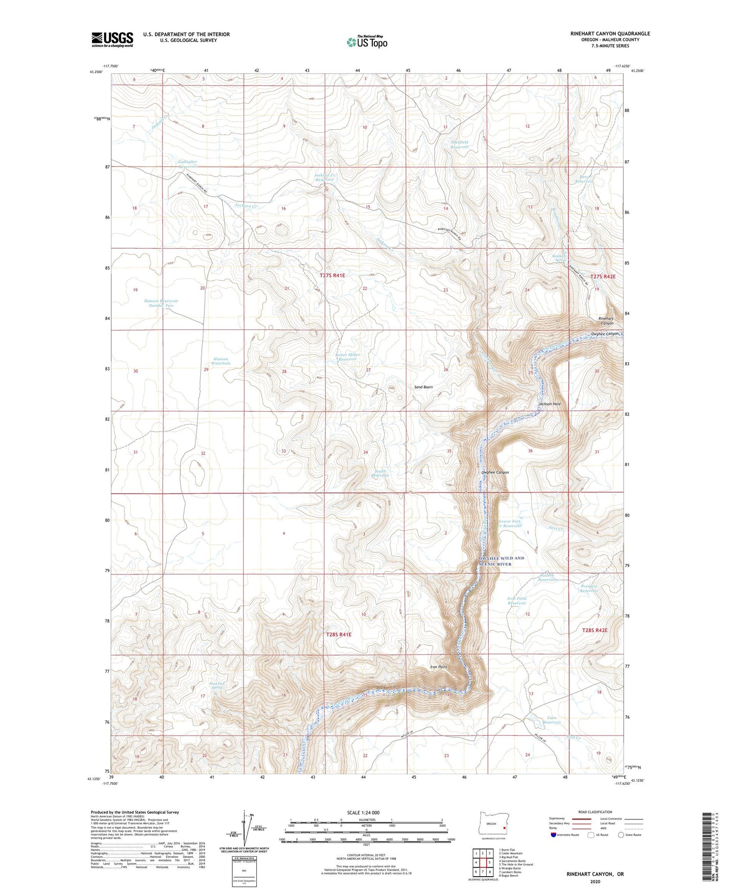
2023 topographic map quadrangle Rinehart Canyon in the state of Oregon. Scale: 1:24000. Based on the newly updated USGS 7.5' US Topo map series, this map is in the following counties: Malheur. The map contains contour data, water features, and other items you are used to seeing on USGS maps, but also has updated roads and other features. This is the next generation of topographic maps. Printed on high-quality waterproof paper with UV fade-resistant inks.
Quads adjacent to this one:
West: Sacramento Butte
Northwest: Burnt Flat
North: Cedar Mountain
Northeast: Big Mud Flat
East: The Hole in the Ground
Southeast: Bogus Bench
South: Lambert Rocks
Southwest: Wrangle Butte
This map covers the same area as the classic USGS quad with code o43117b6.
Contains the following named places: Bens Reservoir, Cave Reservoir, Fort Creek, Gallagher Reservoir, Hanson Reservoir Number Two, Hanson Waterhole, Hoot Owl Spring, Iron Point, Iron Point Reservoir, Jackson Creek, Jackson Creek Reservoir, Jackson Hole, Lower Fort Creek Reservoir, Lower Miller Reservoir, Mud Creek, Owyhee Canyon, Pothole Reservoir, Prospect Reservoir, Rinehart Canyon, Rinehart Creek, Rinehart Ranch, Rinehart Spring, Rock Dam, Sand Basin, South Reservoir, Stanfield Reservoir