MyTopo
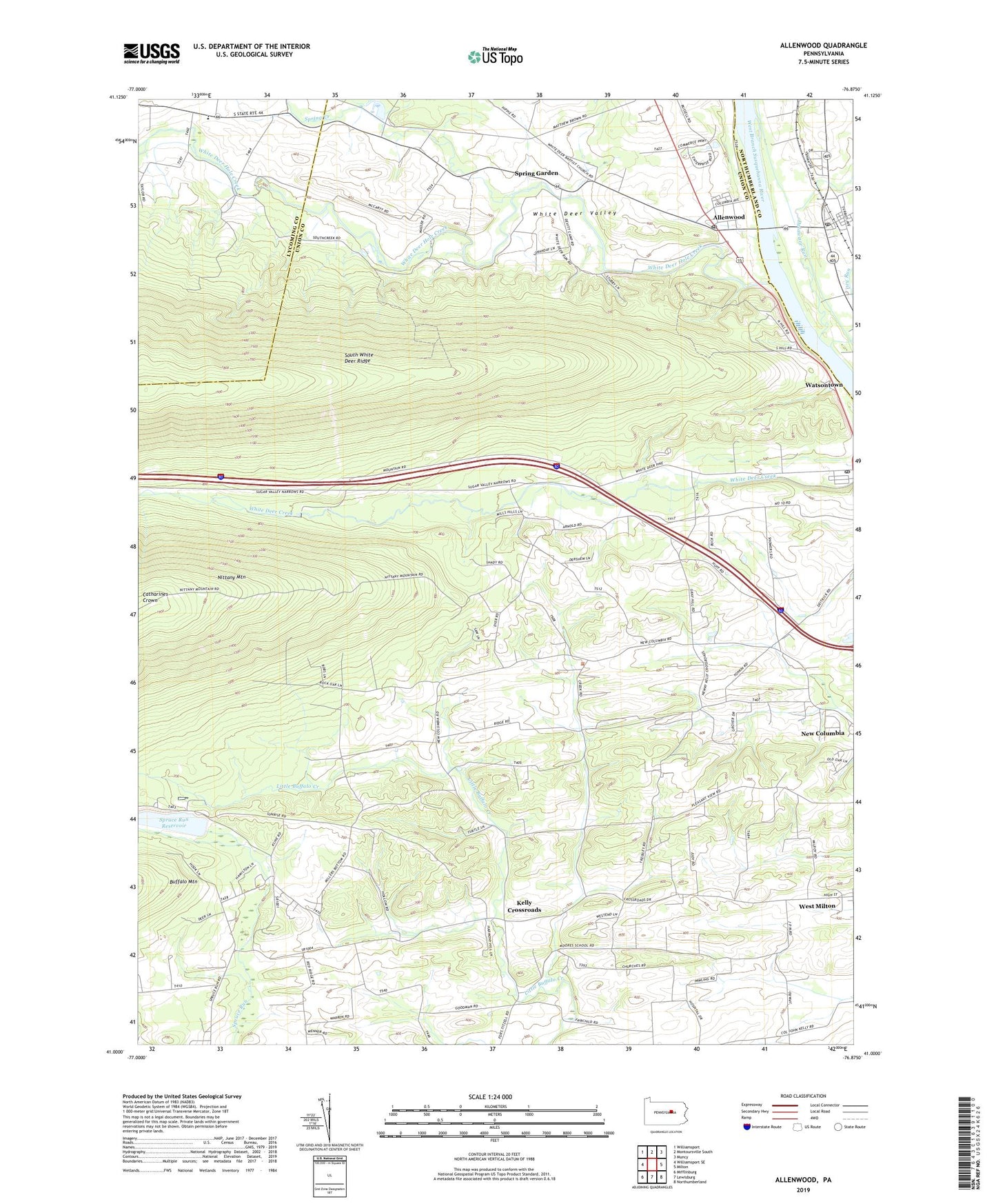
Allenwood Pennsylvania US Topo Map
Couldn't load pickup availability
2023 topographic map quadrangle Allenwood in the state of Pennsylvania. Scale: 1:24000. Based on the newly updated USGS 7.5' US Topo map series, this map is in the following counties: Union, Lycoming, Northumberland. The map contains contour data, water features, and other items you are used to seeing on USGS maps, but also has updated roads and other features. This is the next generation of topographic maps. Printed on high-quality waterproof paper with UV fade-resistant inks.
Quads adjacent to this one:
West: Williamsport SE
Northwest: Williamsport
North: Montoursville South
Northeast: Muncy
East: Milton
Southeast: Northumberland
South: Lewisburg
Southwest: Mifflinburg
This map covers the same area as the classic USGS quad with code o41076a8.
Contains the following named places: Allenwood, Allenwood Census Designated Place, Allenwood Post Office, Catharines Crown, Central School, Delaware Run, Devitt Home, Dewart, Dewart Post Office, Dry Run, Furnace School, Kelly Crossroads, Moore School, New Columbia Census Designated Place, Old Furnace, Pleasant Creek School, Ramsey School, Robin School, Saint Johns Church, Saint Peters Church, Spring Creek, Spring Garden, Spruce Reservoir Dam, Spruce Run Reservoir, Sunrise Church, Sunrise School, Township of Gregg, Township of White Deer, West Milton Census Designated Place, Wetzell School, White Deer Church, White Deer Dam, White Deer Hole Creek, White Deer Post Office, White Deer Valley, White Deer Valley Camp, Yokum School, ZIP Codes: 17730, 17856, 17886