MyTopo
Mifflinburg Pennsylvania US Topo Map
Couldn't load pickup availability
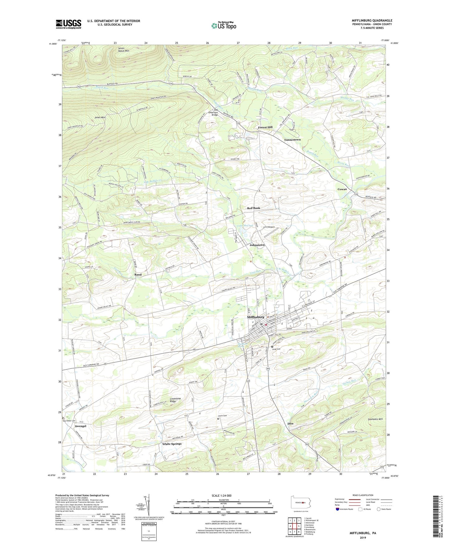
2023 topographic map quadrangle Mifflinburg in the state of Pennsylvania. Scale: 1:24000. Based on the newly updated USGS 7.5' US Topo map series, this map is in the following counties: Union. The map contains contour data, water features, and other items you are used to seeing on USGS maps, but also has updated roads and other features. This is the next generation of topographic maps. Printed on high-quality waterproof paper with UV fade-resistant inks.
Quads adjacent to this one:
West: Hartleton
Northwest: Carroll
North: Williamsport SE
Northeast: Allenwood
East: Lewisburg
Southeast: Freeburg
South: Middleburg
Southwest: Beavertown
This map covers the same area as the classic USGS quad with code o40077h1.
Contains the following named places: Borough of Mifflinburg, Centennial School, Chambers Spring, Church of the Brethren, Coal Run, Cornelius School, Cowan, Dice, End O'Narrows Bridge, Forest Hill, GAE Airport, Green Grove School, Johnstown, Lake McClure, Lewis Cemetery, Limestone Ridge, Long Cemetery, Louden School, Mifflinburg, Mifflinburg Community Ambulance Company 14, Mifflinburg Elementary School, Mifflinburg Hose Company 3, Mifflinburg Middle School, Mifflinburg Police Department, Mifflinburg Post Office, North Branch Buffalo Creek, Pontius School, Rand, Rand School, Rapid Run, Red Bank, Red Bank School, Saint Peters Church, Sand Bridge State Park, State Game Lands Number 201, Stone Haven Camp, Stony Run, Swengel Post Office, Tannertown, Township of Limestone, Township of West Buffalo, Turkey Run, Turkey Run School, Union County, Wehrs School, Western Area High School, White Springs, WWMC-FM (Mifflinburg), ZIP Codes: 17844, 17880