MyTopo
Bradford Pennsylvania US Topo Map
Couldn't load pickup availability
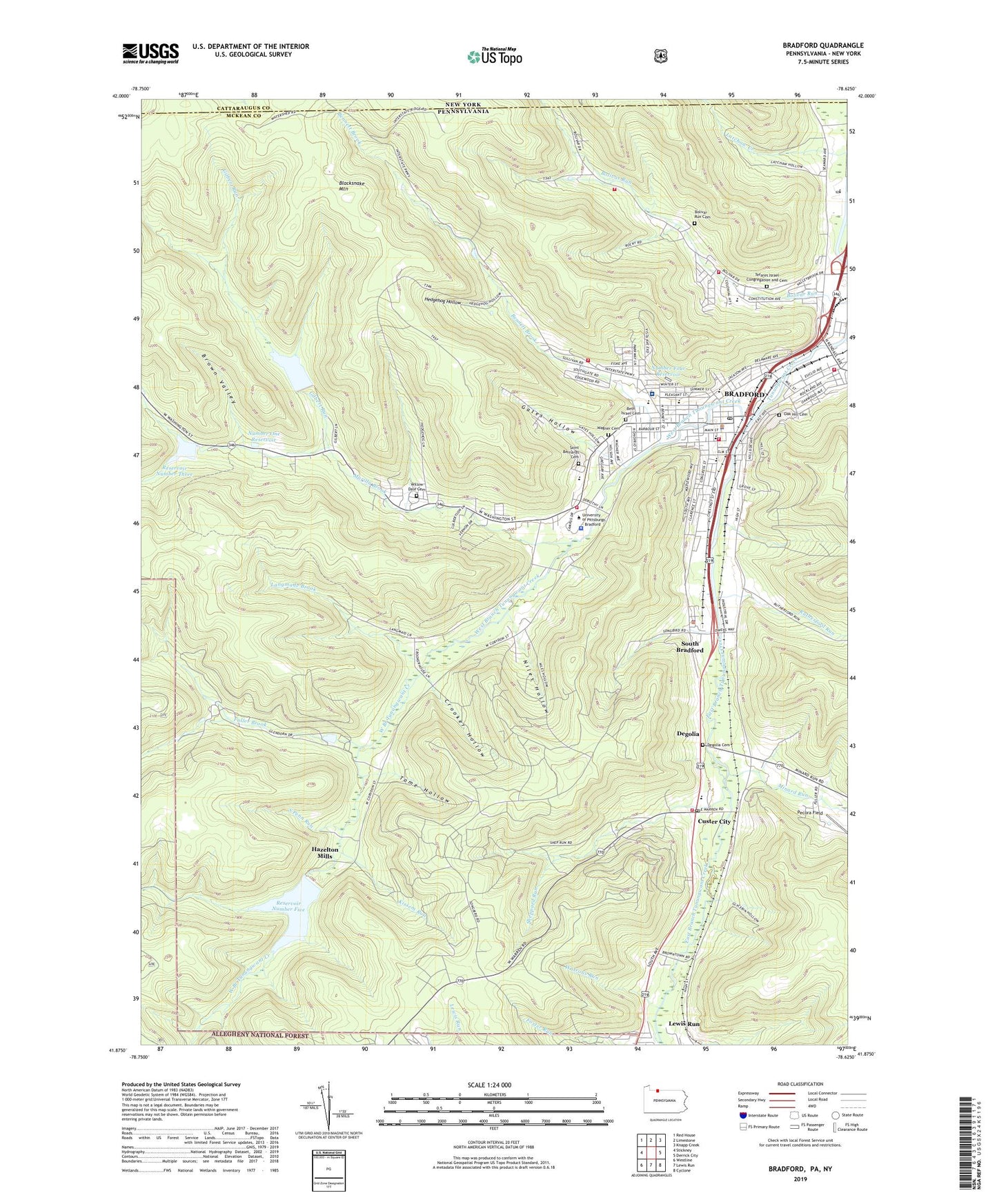
2019 topographic map quadrangle Bradford in the states of Pennsylvania, New York. Scale: 1:24000. Based on the newly updated USGS 7.5' US Topo map series, this map is in the following counties: McKean, Cattaraugus. The map contains contour data, water features, and other items you are used to seeing on USGS maps, but also has updated roads and other features. This is the next generation of topographic maps. Printed on high-quality waterproof paper with UV fade-resistant inks.
Quads adjacent to this one:
West: Stickney
Northwest: Red House
North: Limestone
Northeast: Knapp Creek
East: Derrick City
Southeast: Cyclone
South: Lewis Run
Southwest: Westline
Contains the following named places: Beacon Hill Lookout Tower, Bennett Brook, Bennett Brook School, Beth Israel Cemetery, Blacksnake Mountain, Bolivar Run Cemetery, Bolivar Run School, Bradford, Bradford Area Senior High School, Bradford City Fire Department Central - Station 1, Bradford City Fire Department East Bradford, Bradford City Number Five Dam, Bradford City Number Three Dam, Bradford City Number Two Dam, Bradford Fire and Ambulance, Bradford Oil Field, Bradford Police Department, Bradford Post Office, Bradford Regional Medical Center, Bradford Township Police Department, Bradford Township Volunteer Fire Department - Station 15 - 1, Brown Valley, Central Christian High School, City of Bradford, Control Tower Building, Criminal Forensic Lab Building, Crooker Hollow, Crooker School, Custer City, Custer City Post Office, Custer City Private School, Degolia, Degolia Cemetery, Derrick City Volunteer Fire Department Station 11A, East Bradford Station, East Branch Tunungwant Creek, Emery Towers School, Emily Dickinson House, Ernest Hemingway House, F Scott Fitzgerald House, Fifth Ward School, Foster Brook, Foster Run, Frame-Westerberg Commons, Fuller Brook, Gates Hollow, George G Blaisdell Elementary School, Gertrude Stein House, Gilbert Run, Hangar Building, Hanley Library, Hazelton Mills, Hedgehog Hollow, Herman Melville House, Hobson Place School, Howard, Howard Junction Station, James Baldwin House, Kendall Creek, Kendall Residence Halls, Kessel Athletic Complex, Kissem Run, Langmade Brook, Latchaw Creek, Marilla Brook, Marilla Brook School, McKean Residence Halls, Meadow Brook, Miller Airport, Minard Run, Niles Hollow, Number Four Reservoir, Number One Reservoir, Nusbaum Chemical Plant, Oak Hill Cemetery, Pecora Field, Reed-Colt House, Reservoir Number Five, Reservoir Number Three, Reservoir Number Two, Rutherford Run, Saint Bernard Elementary School, Saint Bernards Cemetery, School Street Junior High School, Second Ward School, Sheppard Run, Songbird School, South Bradford, South Penn Run, Student Laundry Building, Swarts Hall, T S Ellot House, Tefares Israel Congregation and Cemetery, Third Ward School, Tome Hollow, Township of Bradford, Two Mile Run, University of Pittsburgh - Bradford Campus, University of Pittsburgh Bradford Census Designated Place, Wagner Cemetery, Walt Whitman House, Watrous Run, WESB-AM (Bradford), West Bradford, West Branch Elementary School, West Branch Tunungwant Creek, Willa Cather House, William Faulkner House, Willow Dale Cemetery, Zora Neale Hurston House, ZIP Code: 16725