MyTopo
Bullis Mills Pennsylvania US Topo Map
Couldn't load pickup availability
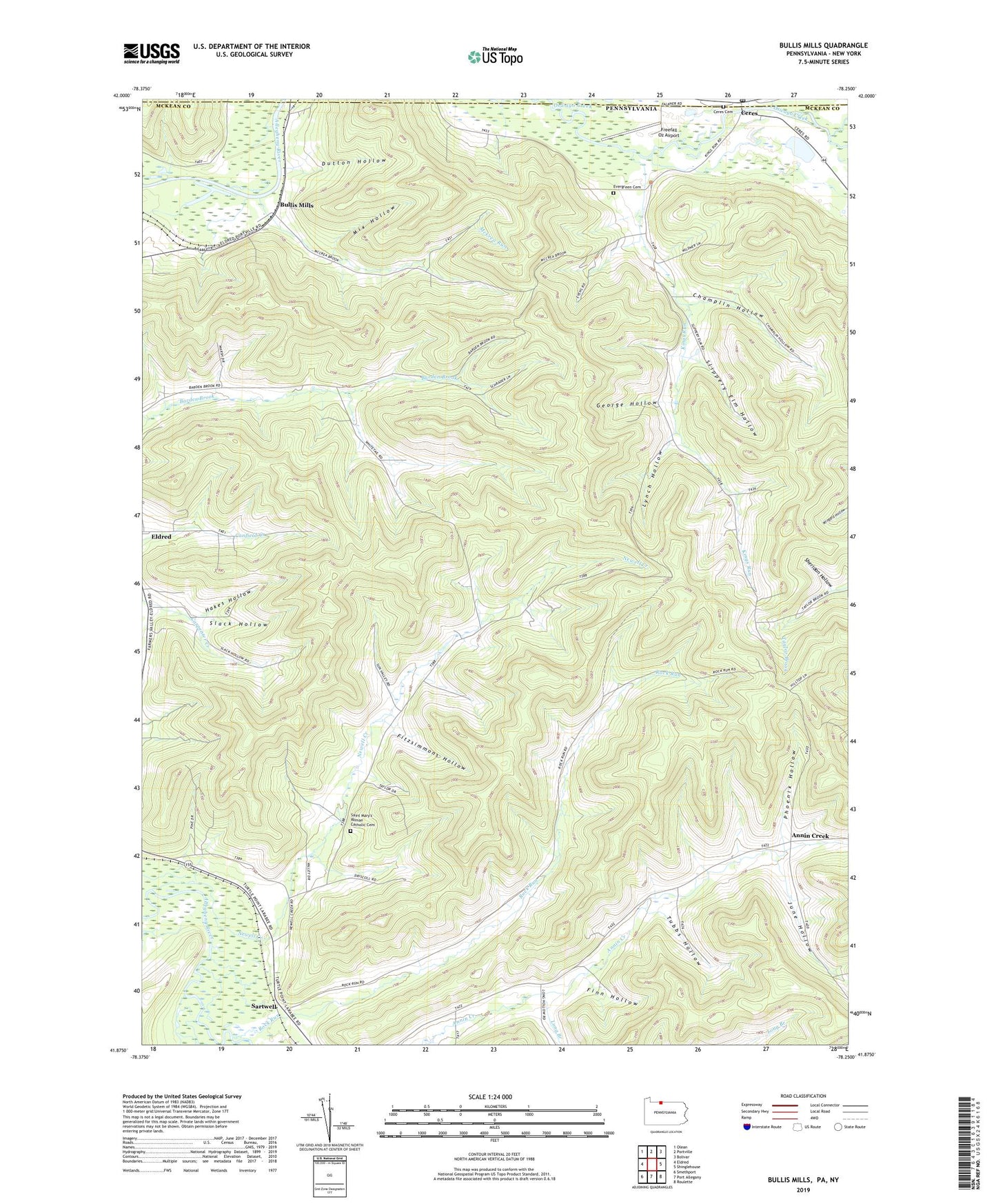
2023 topographic map quadrangle Bullis Mills in the states of Pennsylvania, New York. Scale: 1:24000. Based on the newly updated USGS 7.5' US Topo map series, this map is in the following counties: McKean, Allegany, Cattaraugus. The map contains contour data, water features, and other items you are used to seeing on USGS maps, but also has updated roads and other features. This is the next generation of topographic maps. Printed on high-quality waterproof paper with UV fade-resistant inks.
Quads adjacent to this one:
West: Eldred
Northwest: Olean
North: Portville
Northeast: Bolivar
East: Shinglehouse
Southeast: Roulette
South: Port Allegany
Southwest: Smethport
This map covers the same area as the classic USGS quad with code o41078h3.
Contains the following named places: Annin Creek, Annin Creek School, Bullis Mills, Ceres, Ceres Cemetery, Ceres Post Office, Champlin Hollow, Dutton Hollow, Evergreen Cemetery, Finn Hollow, Fitzsimmons Hollow, Freefall Oz Airport, George Hollow, Hakes Hollow, June Hollow, Kings Run, Little Genesee Creek, Long Branch, Lower Kings Run School, Lynch Hollow, McCrea Run, Mix Hollow, Newell Creek, Newell Creek School, Open Brook, Phoenix Hollow, Rock Run, Rock Run School, Saint Marys Church, Saint Mary's Roman Catholic Cemetery, Sartwell, Sartwell Oil Field, Sheridan Hollow, Slack Hollow, Slippery Elm Hollow, Township of Annin, Township of Ceres, Tubbs Hollow, Wesleyan Church, ZIP Codes: 16731, 16750