MyTopo
Burnt Cabins Pennsylvania US Topo Map
Couldn't load pickup availability
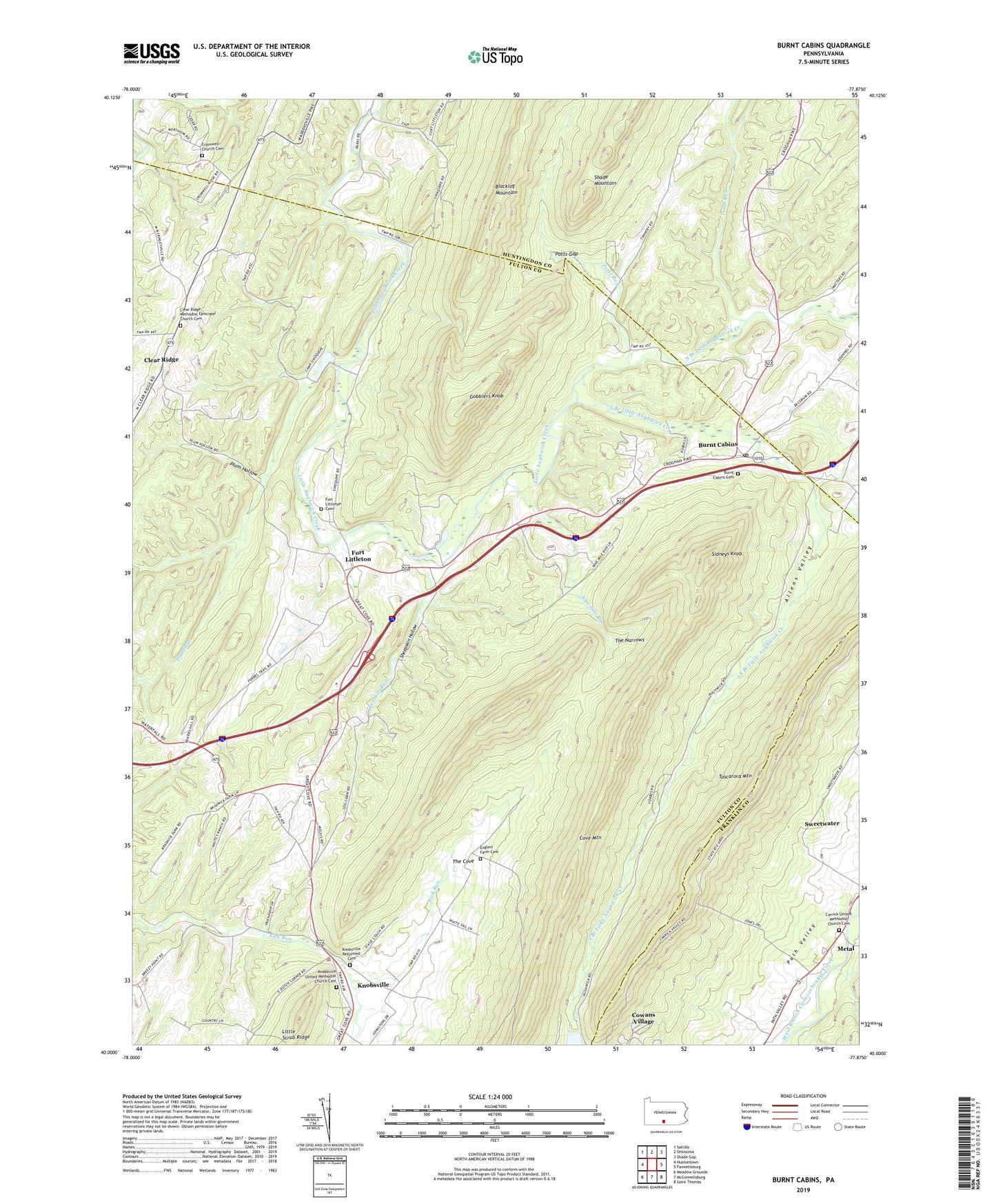
2019 topographic map quadrangle Burnt Cabins in the state of Pennsylvania. Scale: 1:24000. Based on the newly updated USGS 7.5' US Topo map series, this map is in the following counties: Fulton, Huntingdon, Franklin. The map contains contour data, water features, and other items you are used to seeing on USGS maps, but also has updated roads and other features. This is the next generation of topographic maps. Printed on high-quality waterproof paper with UV fade-resistant inks.
Quads adjacent to this one:
West: Hustontown
Northwest: Saltillo
North: Orbisonia
Northeast: Shade Gap
East: Fannettsburg
Southeast: Saint Thomas
South: McConnellsburg
Southwest: Meadow Grounds
Contains the following named places: Allen Trail, Allens Valley, Bird Run Trail, Bird Trail, Burnt Cabins, Burnt Cabins Cemetery, Burnt Cabins Post Office, Camp Sinoquipe, Camp Sinoquipe Lake, Camp Sinoquipe Lake Dam, Carrick United Methodist Church Cemetery, Clear Ridge, Clear Ridge Church, Clear Ridge Methodist Episcopal Church Cemetery, Cove Trail, Cowans Gap State Park, Cowans Trail, Cowans Village, Cromwell Church, Cromwell Church Cemetery, Ellisic Trail, Englert Farm Cemetery, Fairview School, Forbes Road Trail, Fort Littleton, Fort Littleton Cemetery, Fox Trail, Gobblers Knob, Heath Trail, Horseshoe Trail, Jones Trail, Knobsville, Knobsville Reformed Cemetery, Knobsville United Methodist Church Cemetery, Loop Trail, Metal, Ninemile Run, North Branch Little Aughwick Creek, Plum Hollow, Plum Run, Potts Gap, Potts Run, Ramsey Path, Sharpe Trail, Sheepskin Hollow, Sidneys Knob, South Branch Little Aughwick Creek, Sweetwater, Tenmile Run, The Cove, The Narrows, Todd Trail, Township of Dublin, Trout Run, Wagner Trail, West Point School, ZIP Codes: 17215, 17223