MyTopo
Bushkill Pennsylvania US Topo Map
Couldn't load pickup availability
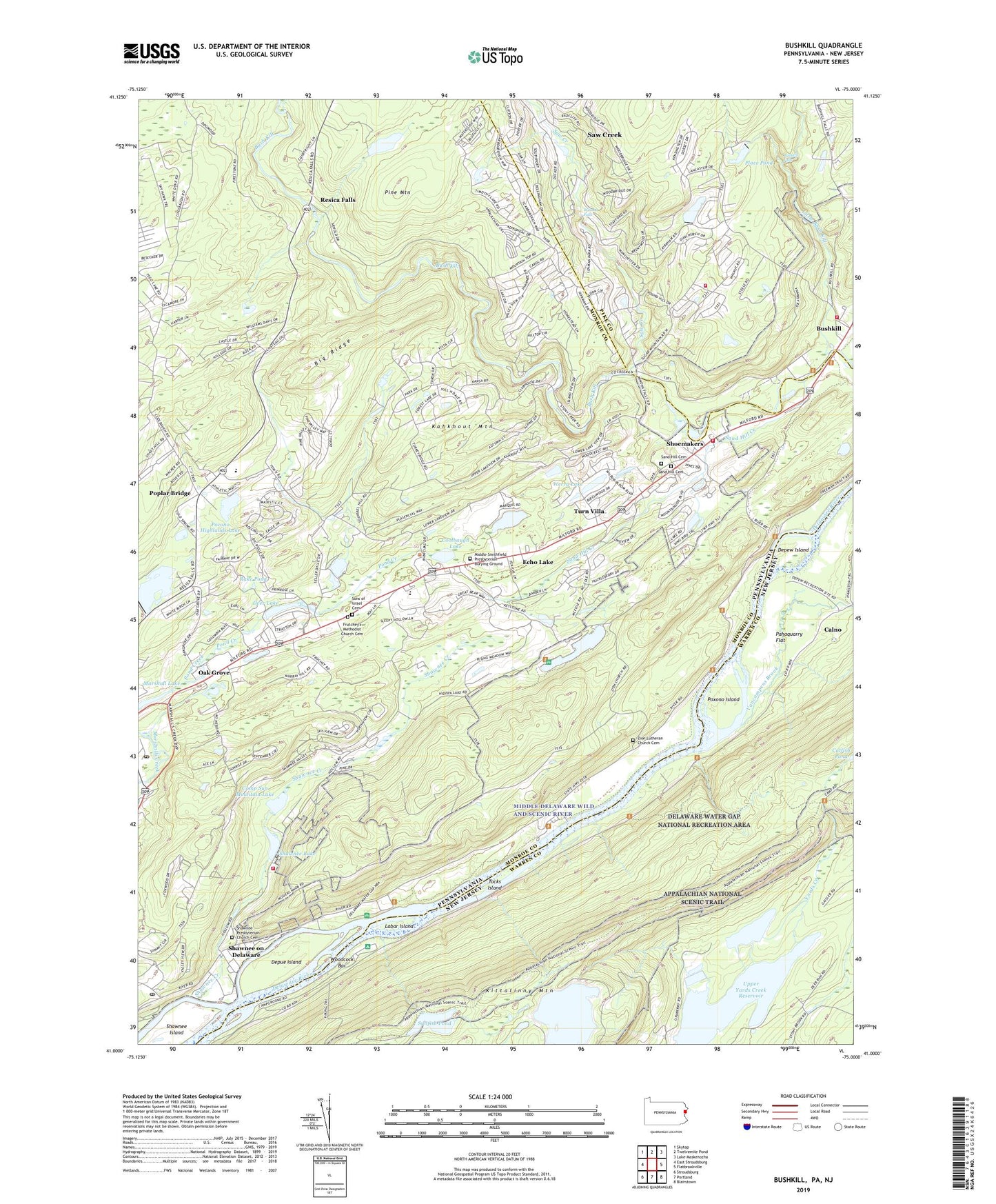
2023 topographic map quadrangle Bushkill in the states of Pennsylvania, New Jersey. Scale: 1:24000. Based on the newly updated USGS 7.5' US Topo map series, this map is in the following counties: Monroe, Warren, Pike. The map contains contour data, water features, and other items you are used to seeing on USGS maps, but also has updated roads and other features. This is the next generation of topographic maps. Printed on high-quality waterproof paper with UV fade-resistant inks.
Quads adjacent to this one:
West: East Stroudsburg
Northwest: Skytop
North: Twelvemile Pond
Northeast: Lake Maskenozha
East: Flatbrookville
Southeast: Blairstown
South: Portland
Southwest: Stroudsburg
This map covers the same area as the classic USGS quad with code o41075a1.
Contains the following named places: Auxiliary Reservoir Dam, Big Ridge, Boy Scout Reservation, Bushkill, Bushkill Emergency Squad Corps Station 3 Bushkill Station, Bushkill Falls, Bushkill Fire Company Station 24 Oak Ridge, Bushkill Fire Company Station 24 Sugar Mountain, Calno, Calno School, Camp Sun Mountain Dam, Camp Sun Mountain Lake, Castle Rock Acres, Central School, Coolbaugh, Coolbaugh Lake, Davidson Dam, Deer Lake, Depew Island, Depue Island, Dimicks Ferry, Echo Lake, Echo Lake Post Office, Ellenberger School, Fernwood Golf Course, Fernwood Ski Area, Frutchey, Frutchey's Methodist Church Cemetery, Glen Ridge Club, Hidden Lake, Hidden Lake Dam, Indian Lake Camp Dam, Kahkhout Mountain, Labar Island, Little Bush Kill, Lower Yards Creek Reservoir, Marshall Lake, Marshalls Creek Post Office, Meadow Lake, Meadow Lake Dam, Middle Smithfield Church, Middle Smithfield Elementary School, Middle Smithfield Presbyterian Burying Ground, Mount Nebo School, Mountain Top Estates, Mountain View School, National Park Service - Bushkill Fire Department, Oak Grove, Pahaquarry Flat, Pardee Place Dam, Pine Mountain, Place Pond, Pocmont Lodge Dam, Pocono Highland Dam, Pocono Highlands Lake, Poplar Bridge, Poplar Bridge School, Poxono Island, Rake Dam, Rake Pond, Rakes Dam, Resica Falls, Sand Hill Cemetery, Sand Hill Church, Sand Hill Creek, Sand Hill School, Saw Creek, Saw Creek Census Designated Place, Saw Creek Ski Area, Shawnee Creek, Shawnee Dam, Shawnee Fire Company Station 36, Shawnee Island, Shawnee Lake, Shawnee Mountain Ski Area, Shawnee on Delaware, Shawnee on Delaware Post Office, Shawnee Presbyterian Church Cemetery, Shoemakers, Sons of Israel Cemetery, Sunfish Pond, Suzie Creek, Tocks Island, Township of Middle Smithfield, Township of Pahaquarry, Turn Villa, Upper Reservoir Dam, Upper Yards Creek Reservoir, Vancampens Brook, Werry Lake, Werry Lake Dam, Wesley Church, White Heron Dam, White Heron Lake, Wicks Dam, Winona Falls, Winona Lakes, Woodcock Bar, YMCA Dam, Zion Church, Zion Lutheran Church Cemetery, ZIP Codes: 18302, 18335, 18356