MyTopo
Edinboro South Pennsylvania US Topo Map
Couldn't load pickup availability
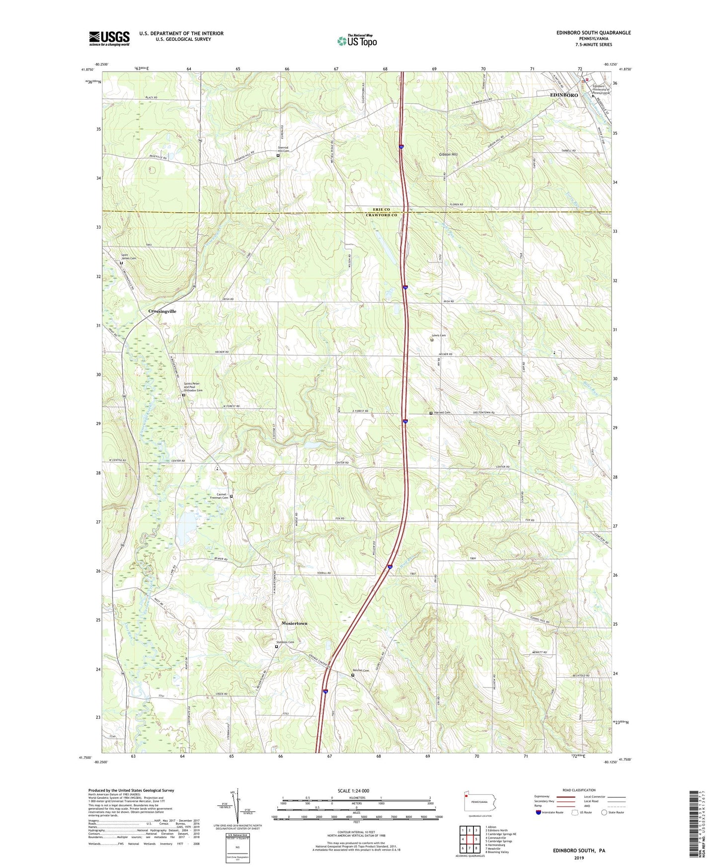
2023 topographic map quadrangle Edinboro South in the state of Pennsylvania. Scale: 1:24000. Based on the newly updated USGS 7.5' US Topo map series, this map is in the following counties: Crawford, Erie. The map contains contour data, water features, and other items you are used to seeing on USGS maps, but also has updated roads and other features. This is the next generation of topographic maps. Printed on high-quality waterproof paper with UV fade-resistant inks.
Quads adjacent to this one:
West: Conneautville
Northwest: Albion
North: Edinboro North
Northeast: Cambridge Springs NE
East: Cambridge Springs
Southeast: Blooming Valley
South: Meadville
Southwest: Harmonsburg
This map covers the same area as the classic USGS quad with code o41080g2.
Contains the following named places: Carmel - Freeman Cemetery, Carr Run, Central Erie County Paramedic Association - Edinboro Station, Clausen School, Crossingville, Culbertson Hills Airport, Cussewago Township School, Daniels School, Dundon School, Edinboro, Edinboro Police Department, Edinboro University of Pennsylvania, Edinboro Volunteer Fire Department 38, Freeman School, Gibson Hill, Gibson School, Gospel Hill Church, Harned Cemetery, Himebaugh School, Homan School, Hotchkiss School, Kearney School, Lewis Cemetery, Lewis Church, Mosiertown, Reichel Cemetery, Saint James Cemetery, Saints Peter and Paul Orthodox Cemetery, Sandbank School, Sherred Hill School, Sherrod Hill Cemetery, State Game Lands Number 152, State Game Lands Number 269, Stebbins Cemetery, Tobin Farms, Township of Cussewago, Waldo School, West Branch Cussewago Creek, Whites School, ZIP Code: 16440