MyTopo
Carroll Pennsylvania US Topo Map
Couldn't load pickup availability
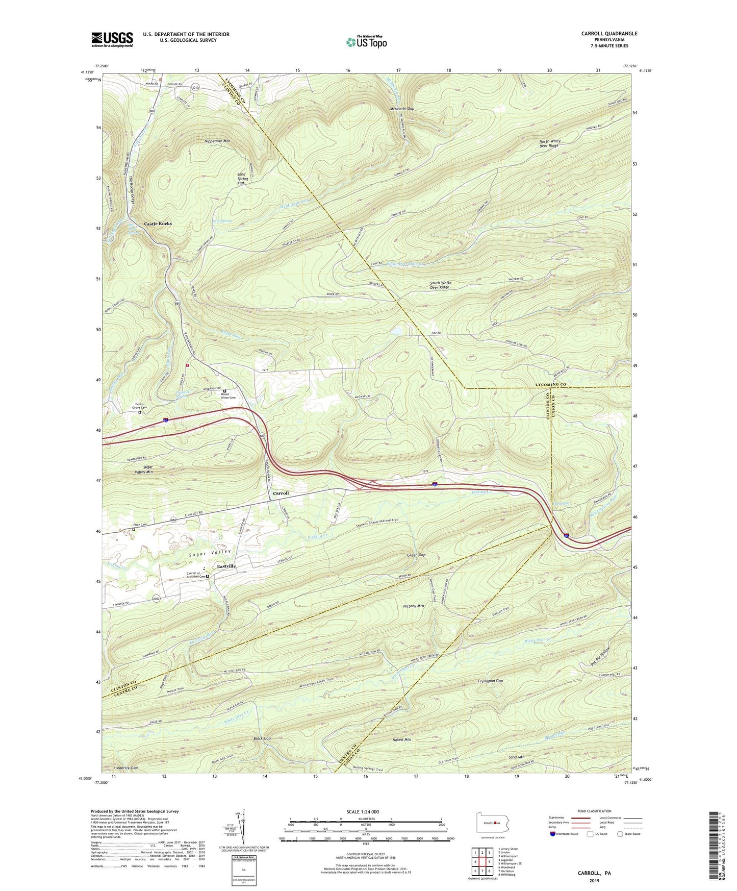
2023 topographic map quadrangle Carroll in the state of Pennsylvania. Scale: 1:24000. Based on the newly updated USGS 7.5' US Topo map series, this map is in the following counties: Clinton, Lycoming, Union, Centre. The map contains contour data, water features, and other items you are used to seeing on USGS maps, but also has updated roads and other features. This is the next generation of topographic maps. Printed on high-quality waterproof paper with UV fade-resistant inks.
Quads adjacent to this one:
West: Loganton
Northwest: Jersey Shore
North: Linden
Northeast: Williamsport
East: Williamsport SE
Southeast: Mifflinburg
South: Hartleton
Southwest: Woodward
This map covers the same area as the classic USGS quad with code o41077a2.
Contains the following named places: Bald Eagle State Forest Ranger Station, Betterton Trail, Big Mountain Trail, Big Rock Spring, Black Gap, Brushy Ridge Trail, Bucks Gap Trail, Captain Green Monument, Carroll, Castle Rocks, Chestnut Flat Trail, Church of Brethren Cemetery, Crabapple, Crabapple Path, Cracker Bridge Trail, Dry Hollow Trail, Dunbar Trail, Duncan Trail, East End Trail, East Point Fire Tower, Eastville, Eastville Run, Fourth Gap Trail, Frying Pan Gap Trail, Fryingpan Gap, Gann Run, Gottshall Run, Grape Vine Trail, Green Gap, Green Gap Trail, Green Grove Cemetery, Heintz Trail, Hemlock Spring, Hoffey School, Horse Path, Kelly Trail, Krape Run, Little Gap Trail, Mags Path, McCall Dam, McCalls Dam State Park, McMurrin Gap, Meixell Trail, Mount Blessing Camp, Mount Union Cemetery, Mount Union Church, Naked Mountain, Nippenose Mountain, North White Deer Ridge, Pennsylvania Conservation and Natural Resources District 12 Tiadaghton Forest, Pine Hollow Trail, Pot Pie Hollow, Price Cemetery, Rauchtown, Rauchtown Lookout Tower, Ravensburg State Park, Reed Trail, Refuge Trail, Rockey Run, Rocky Corner Trail, Sand Mountain, Sand Mountain Tower, Sand Spring, Sand Spring Flat, Schroyer Trail, Schwenks Gap, Schwenks Gap Trail, Shakespeare Club, Sheller Shanty Trail, Sugar Valley Church, Tea Spring, The Rocky Gorge, Three Hills Trail, Walters Trail, Webster Trail, Welshans Trail, Wet Rock Trail, White Deer Creek Trail, Windsor Camp