MyTopo
Loganton Pennsylvania US Topo Map
Couldn't load pickup availability
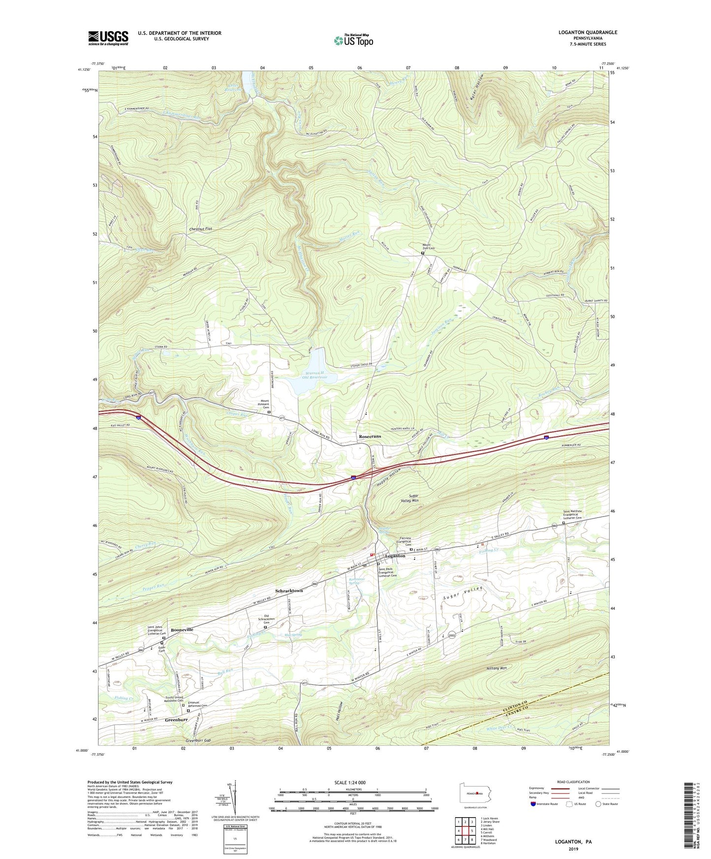
2023 topographic map quadrangle Loganton in the state of Pennsylvania. Scale: 1:24000. Based on the newly updated USGS 7.5' US Topo map series, this map is in the following counties: Clinton, Centre. The map contains contour data, water features, and other items you are used to seeing on USGS maps, but also has updated roads and other features. This is the next generation of topographic maps. Printed on high-quality waterproof paper with UV fade-resistant inks.
Quads adjacent to this one:
West: Mill Hall
Northwest: Lock Haven
North: Jersey Shore
Northeast: Linden
East: Carroll
Southeast: Hartleton
South: Woodward
Southwest: Millheim
This map covers the same area as the classic USGS quad with code o41077a3.
Contains the following named places: Blue Spring, Boiler Trail, Booneville, Borough of Loganton, Bull Run, Chestnut Flat, Cooper Run, East Kammerdiner Run, Emanuel Reformed Cemetery, Erron Trail, Esher Cemetery, Fairview Evangelical Cemetery, Game Refuge Trail, Gardner Trail, Greenburr, Hall Hollow, Hall Spring, Hopple Hollow, Jamison Run, Kammerdiner Cross Line Trail, Keller Reservoir, Kemmerer School, Kemmerer Spring, Kemmerer Trail, Kettle Trail, Kyler Trail, Lerch Trail, Loganton, Loganton Post Office, Lucus Run, Matter Run, Mill Creek, Miller Trail, Mount Pleasant Cemetery, Mount Pleasant Church, Mount Zion Cemetery, Mount Zion Church, Nittany Mountain Trail, Old Schracktown Cemetery, Parker Shanty Trail, Pepper Run, Rockey School, Rosecrans, Rosecrans Bog Natural Area, Saint Johns Evangelical Lutheran Cemetery, Saint Matthew Evangelical Lutheran Cemetery, Saint Pauls Evangelical Lutheran Cemetery, Schracktown, Smeltz Pond Trail, Snead Hol Trail, Spring Run, Spruce Run, Sugar Grove School, Sugar Valley Area School, Sugar Valley Volunteer Fire Company Station 13, Sulphur Spring, Township of Crawford, Township of Greene, Trinity United Methodist Cemetery, Tunis Run, Warren H Ohl Dam, Warren H Ohl Reservoir, Washburn Run, ZIP Code: 17747