MyTopo
Central City Pennsylvania US Topo Map
Couldn't load pickup availability
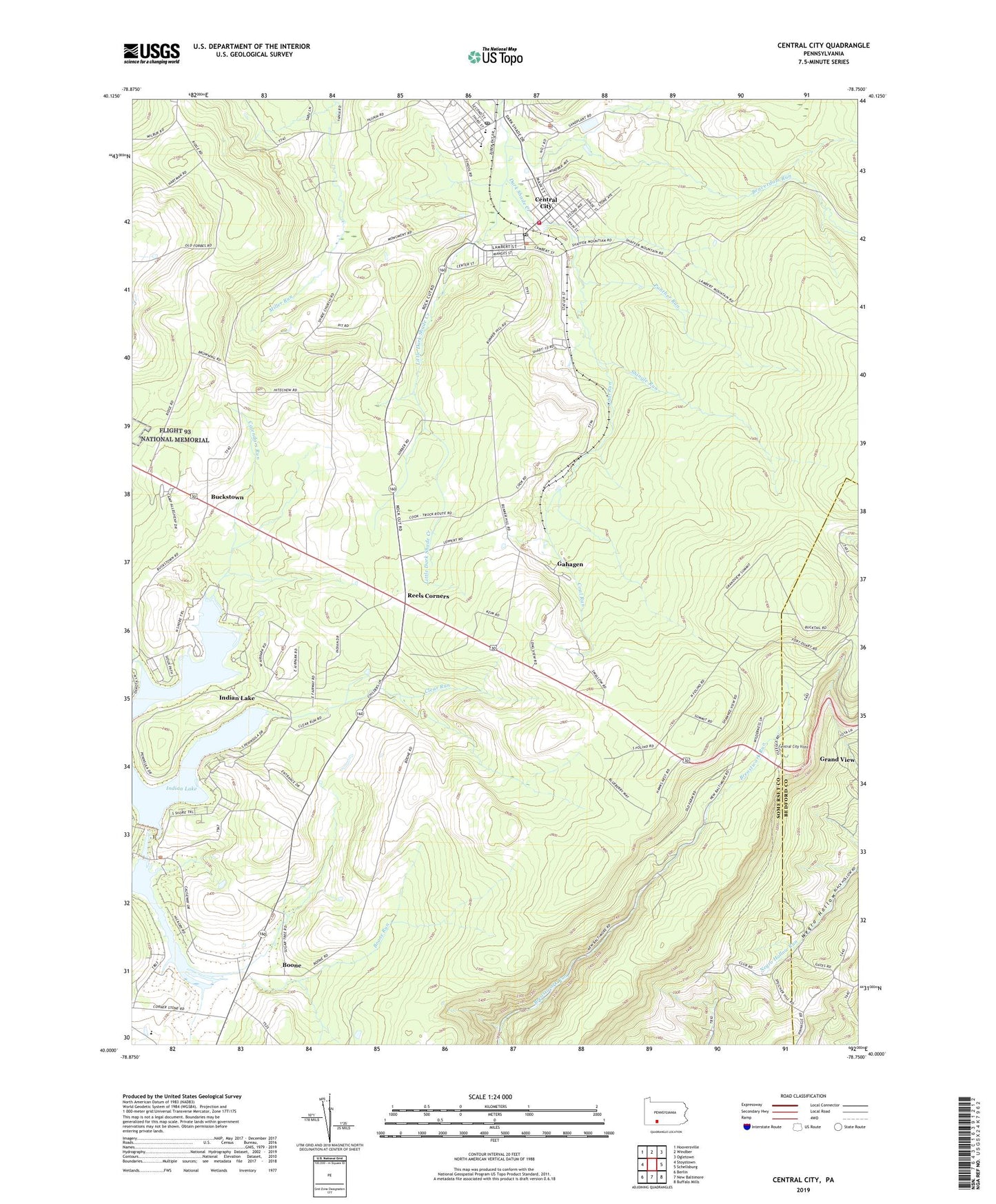
2023 topographic map quadrangle Central City in the state of Pennsylvania. Scale: 1:24000. Based on the newly updated USGS 7.5' US Topo map series, this map is in the following counties: Somerset, Bedford. The map contains contour data, water features, and other items you are used to seeing on USGS maps, but also has updated roads and other features. This is the next generation of topographic maps. Printed on high-quality waterproof paper with UV fade-resistant inks.
Quads adjacent to this one:
West: Stoystown
Northwest: Hooversville
North: Windber
Northeast: Ogletown
East: Schellsburg
Southeast: Buffalo Mills
South: New Baltimore
Southwest: Berlin
This map covers the same area as the classic USGS quad with code o40078a7.
Contains the following named places: Beaverdam Run, Boone, Boone Run, Borough of Central City, Borough of Indian Lake, Buckstown, Buckstown School, Cairnbrook, Cairnbrook Census Designated Place, Cairnbrook Post Office, Calendars Run, Central City, Central City Fire Department - Station 626, Central City Post Office, Central City Quarry, Central City Vista, Clear Run, Coal Run, Dubstardt School, Fairview School, Fraziers Pass, Gahagen, Grand View, Huksin 3 4 and 6 Mines Station, Indian Lake, Indian Lake Airpark, Indian Lake Dam, Lake Stonycreek, Laurel Run, Little Dark Shade Creek, Miller School, Panther Run, Reels Corners, Reitz 3 and 4 Mines Station, Ridge School, Shade Church, Shade Township Police Department, Shingle Run, Sinne Sawmill, State Game Lands Number 228, Statler Hill Lookout Tower, Township of Shade, WWZE-FM (Central City), ZIP Codes: 15924, 15926