MyTopo
Schellsburg Pennsylvania US Topo Map
Couldn't load pickup availability
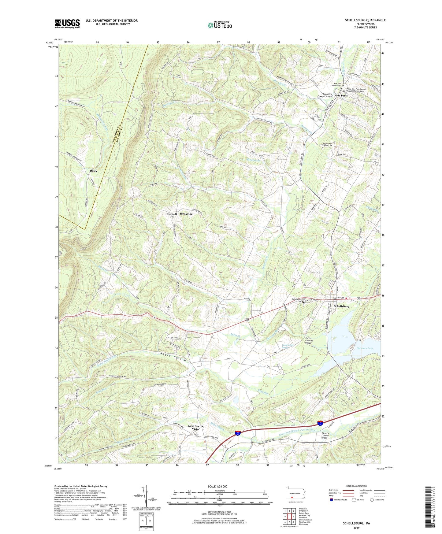
2023 topographic map quadrangle Schellsburg in the state of Pennsylvania. Scale: 1:24000. Based on the newly updated USGS 7.5' US Topo map series, this map is in the following counties: Bedford, Somerset. The map contains contour data, water features, and other items you are used to seeing on USGS maps, but also has updated roads and other features. This is the next generation of topographic maps. Printed on high-quality waterproof paper with UV fade-resistant inks.
Quads adjacent to this one:
West: Central City
Northwest: Windber
North: Ogletown
Northeast: Alum Bank
East: Bedford
Southeast: Rainsburg
South: Buffalo Mills
Southwest: New Baltimore
This map covers the same area as the classic USGS quad with code o40078a6.
Contains the following named places: Allison School, Bentz Run, Borough of New Paris, Borough of Schellsburg, Burns Creek, Clay School, Colvin Covered Bridge, Cuppett Family Cemetery, Cuppett's Covered Bridge, Daley, Helixville, Helixville Cemetery, Hull Baptist Church Cemetery, Kegg Run, Linng Water Spring, Mountain Calvary Church, Negro Hollow, Negro Hollow Run, New Buena Vista, New Paris, New Paris Central School, New Paris Community Cemetery, New Paris Post Office, Pleasant View Church, Rocklick Creek, Schellsburg, Schellsburg Cemetery, Schellsburg Post Office, Shawnee Lake, Shawnee State Park, Shawnee Valley Ambulance Service - Station 17, Shawnee Valley Volunteer Fire Company - Station 37, Spicer Brook, Township of Napier, Turner's Covered Bridge, Wilt School, ZIP Code: 15559