MyTopo
Cherry Springs Pennsylvania US Topo Map
Couldn't load pickup availability
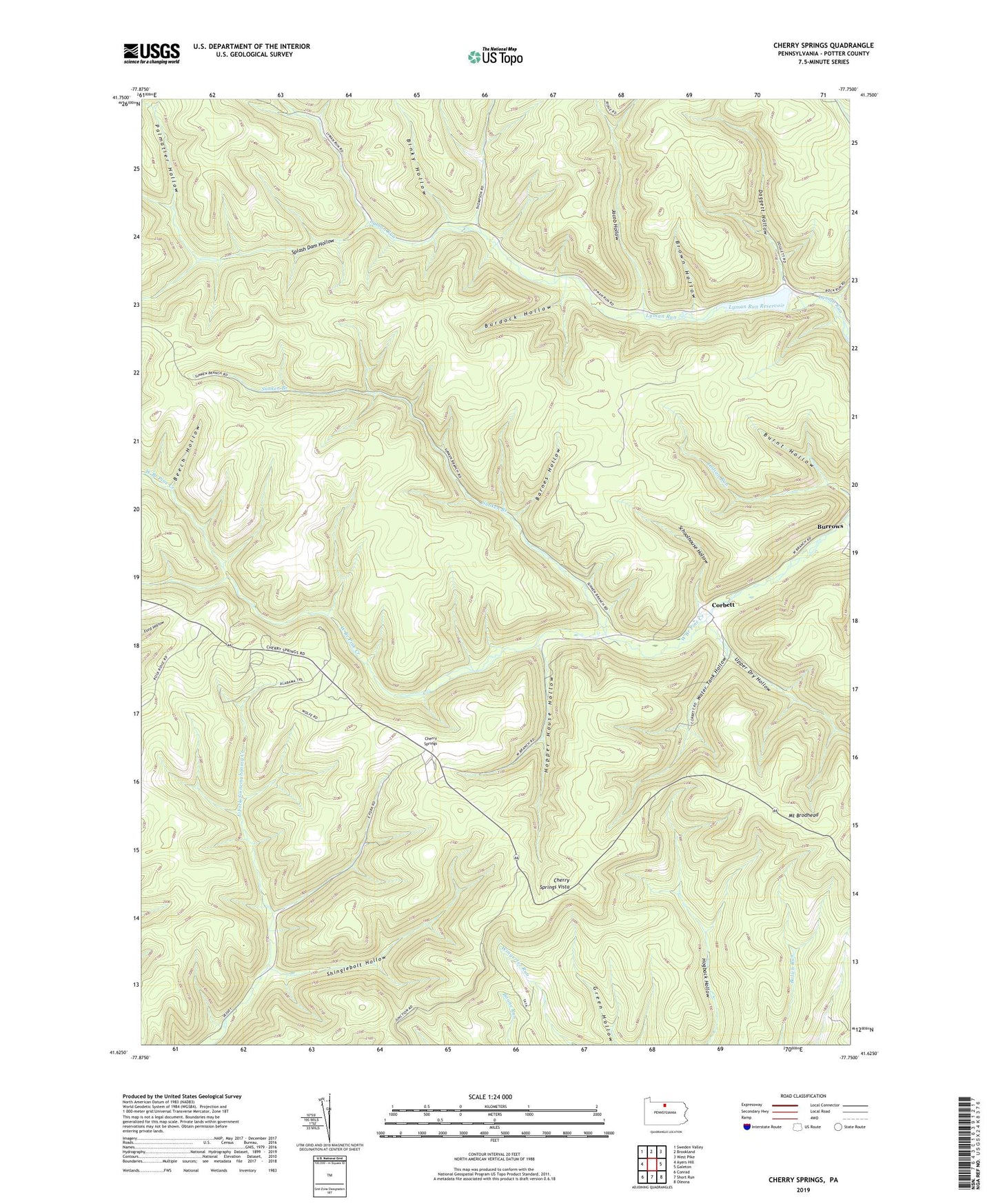
2019 topographic map quadrangle Cherry Springs in the state of Pennsylvania. Scale: 1:24000. Based on the newly updated USGS 7.5' US Topo map series, this map is in the following counties: Potter. The map contains contour data, water features, and other items you are used to seeing on USGS maps, but also has updated roads and other features. This is the next generation of topographic maps. Printed on high-quality waterproof paper with UV fade-resistant inks.
Quads adjacent to this one:
West: Ayers Hill
Northwest: Sweden Valley
North: Brookland
Northeast: West Pike
East: Galeton
Southeast: Oleona
South: Short Run
Southwest: Conrad
Contains the following named places: Alabama Trail, B and S Trail, Barnes Hollow, Bear Trail, Beech Hollow, Beehive Trail, Berry Patch Trail, Binky Hollow, Brown Hollow, Burdock Hollow, Burnt Hollow, Burrous Trail, Camp Trail, Captain Shelton Trail, Cherry Springs, Cherry Springs Airport, Cherry Springs Fire Tower, Cherry Springs Scenic Area, Cherry Springs State Park, Cherry Springs Station, Cherry Springs Vista, Chipmunk Trail, Clinton Trail, Combs Trail, Corbett, Crooks Trail, Cross Fork Brook Trail, Cross Junction, Cross Trail, Daggett Hollow, Deck Lane Trail, Dolliver Trail, Ewing Trail, Fire Tower Trail, Game Refuge Trail, Hopper House Hollow, Indian Trail, Jacob Hollow, Jacobs Trail, Kuhn Trail, Log Grade Trail, Lyman Land Trail, Lyman Log Trail, Lyman Run Camp, Lyman Run Dam, Lyman Run Reservoir, Lyman Run State Park, Maple Trail, Mount Brodhead, Old Cabin Trail, Palmatier Hollow, Palmatier Trail, Prindle Trail, Railroad Trail, Schoolhouse Hollow, Shelton Trail, Shinglebolt Hollow, Splash Dam Hollow, Sunken Branch, Switchback Trail, Upper Dry Hollow, Water Tank Hollow, White Line Trail, Wingard Trail