MyTopo
Conrad Pennsylvania US Topo Map
Couldn't load pickup availability
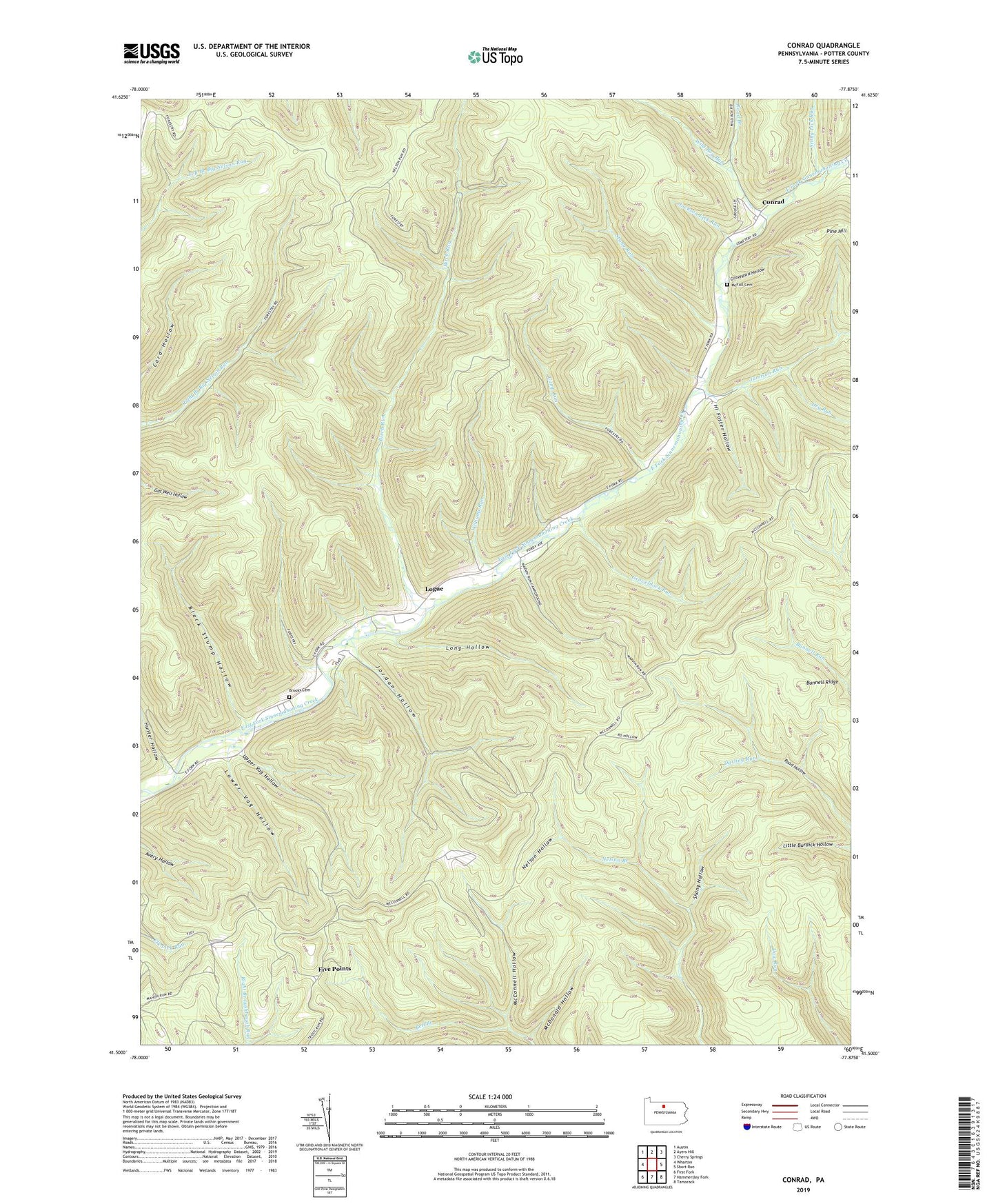
2023 topographic map quadrangle Conrad in the state of Pennsylvania. Scale: 1:24000. Based on the newly updated USGS 7.5' US Topo map series, this map is in the following counties: Potter. The map contains contour data, water features, and other items you are used to seeing on USGS maps, but also has updated roads and other features. This is the next generation of topographic maps. Printed on high-quality waterproof paper with UV fade-resistant inks.
Quads adjacent to this one:
West: Wharton
Northwest: Austin
North: Ayers Hill
Northeast: Cherry Springs
East: Short Run
Southeast: Tamarack
South: Hammersley Fork
Southwest: First Fork
This map covers the same area as the classic USGS quad with code o41077e8.
Contains the following named places: Birch Run, Black Stump Hollow, Brooks Cemetery, Bunnell Ridge, Bunnell Ridge Trail, Camp Run, Conrad, Cow Run Trail, Darling Run, Darling Run Trail, Dry Run, Five Points, Five Points Helistop, Gravel Lick Run, Gravel Lick Trail, Graveyard Hollow, Hammersley, Hi Foster Hollow, Horton Run, Hunter Hollow, Jackson Lick Run, Jamison, Jamison Run, Jordan Hollow, Little Joe Run, Logue, Long Hollow, Long Hollow Trail, Lower Vag Hollow, Marvin Run, McConnell Hollow, McDonald Hollow, McDonald Hollow Trail, McFall Cemetery, Mud Lick Run, Nelson Hollow, Nelson Hollow Trail, Pine Hill Run, Road Branch, Schoolhouse Run, Shang Hollow, Shang Hollow Trail, Stony Lick Run, Stony Run, Stony Trail, Township of Wharton, Upper Vag Hollow, Wild Boy Run, Williams Run