MyTopo
Richfield Pennsylvania US Topo Map
Couldn't load pickup availability
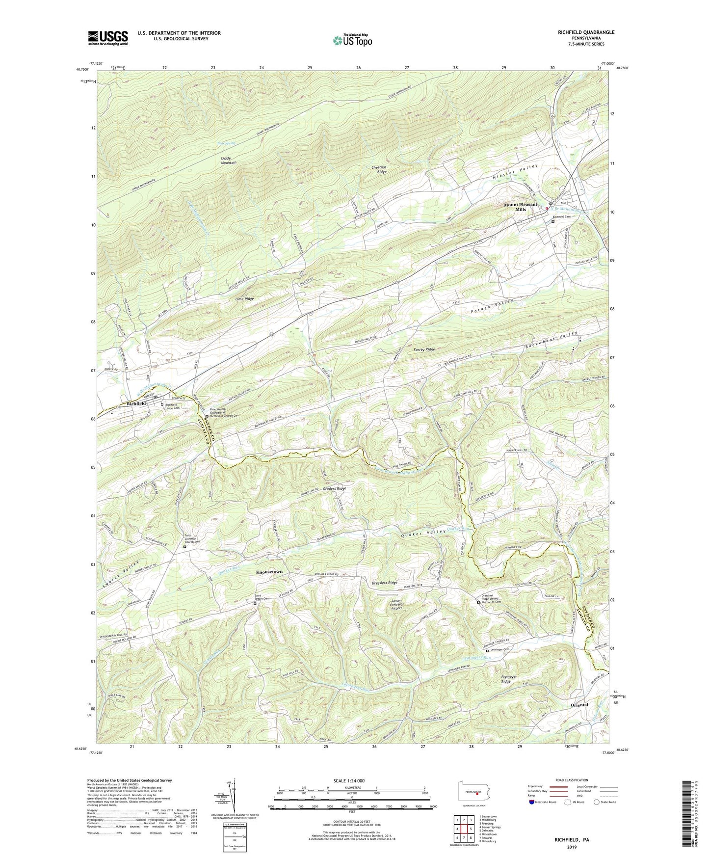
2023 topographic map quadrangle Richfield in the state of Pennsylvania. Scale: 1:24000. Based on the newly updated USGS 7.5' US Topo map series, this map is in the following counties: Snyder, Juniata. The map contains contour data, water features, and other items you are used to seeing on USGS maps, but also has updated roads and other features. This is the next generation of topographic maps. Printed on high-quality waterproof paper with UV fade-resistant inks.
Quads adjacent to this one:
West: Beaver Springs
Northwest: Beavertown
North: Middleburg
Northeast: Freeburg
East: Dalmatia
Southeast: Millersburg
South: Reward
Southwest: Millerstown
This map covers the same area as the classic USGS quad with code o40077f1.
Contains the following named places: Arbogast Church, Bear Spring, Beavertown Fire Tower, Chestnut Ridge, Crossroads Church, Daniels Church, Dresslers Church, Dresslers Ridge, Dresslers Ridge United Methodist Cemetery, East Boyer Trail, Emanuel Cemetery, Emanuel Church, Faith Church, Faith Lutheran Church Cemetery, Forrey Ridge, Fremont Fire Department Station 100, Frymoyer Airport, Frymoyer Ridge, Graders Ridge, Hiester Valley, Jansen Vineyards Airport, Knousetown, Leininger Cemetery, Leiningers Church, Leiningers Run, Lime Ridge, Mount Pleasant Mill, Mount Pleasant Mills, Mount Pleasant Mills Census Designated Place, Mount Pleasant Mills Post Office, Mount Zion Church, Oriental, Perry-West Perry School, Pine Swamp Evangelical Methodist Church Cemetery, Potato Valley, Quaker Run, Quaker Valley, Richfield, Richfield Census Designated Place, Richfield Post Office, Richfield Union Cemetery, Saint Johns Church, Saint Peters Cemetery, Saint Peters Church, Saint Thomas Church, Strouptown, The Long Woods, Township of Monroe, Township of Perry, Township of Susquehanna, Township of West Perry, Turkey Valley, ZIP Codes: 17086, 17853