MyTopo
Middleburg Pennsylvania US Topo Map
Couldn't load pickup availability
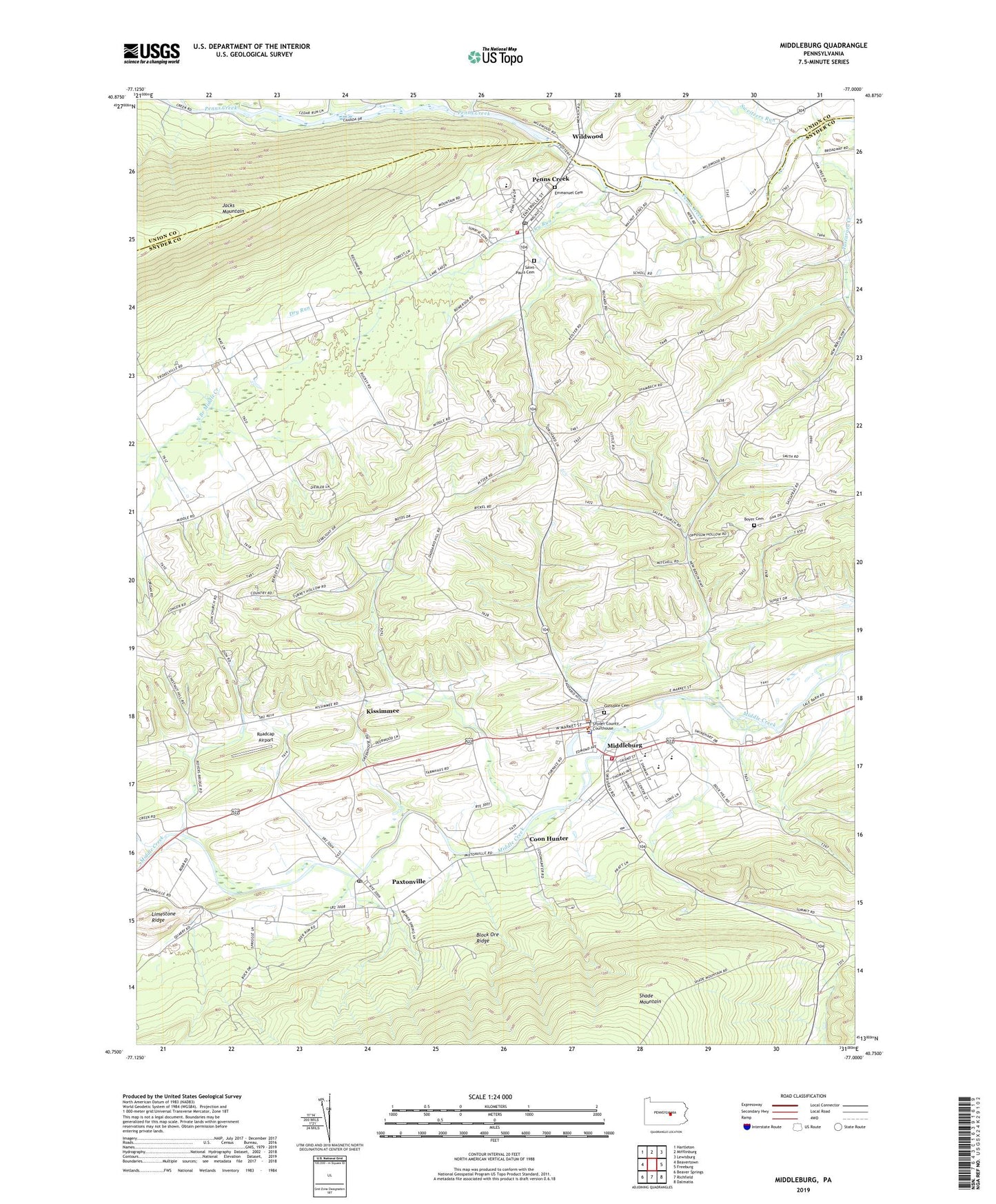
2023 topographic map quadrangle Middleburg in the state of Pennsylvania. Scale: 1:24000. Based on the newly updated USGS 7.5' US Topo map series, this map is in the following counties: Snyder, Union. The map contains contour data, water features, and other items you are used to seeing on USGS maps, but also has updated roads and other features. This is the next generation of topographic maps. Printed on high-quality waterproof paper with UV fade-resistant inks.
Quads adjacent to this one:
West: Beavertown
Northwest: Hartleton
North: Mifflinburg
Northeast: Lewisburg
East: Freeburg
Southeast: Dalmatia
South: Richfield
Southwest: Beaver Springs
This map covers the same area as the classic USGS quad with code o40077g1.
Contains the following named places: Berger School, Block Ore Ridge, Borough of Middleburg, Boyer Church, Boyer Mennonite Church Cemetery, Coon Hunter, Dry Run, Erdly School, Furnace Trail, Gilbert School, Glendale Cemetery, Hartman School, Hassinger School, Hassingers Church, Hazlett School, Herman School, Hummel Church, Kissimmee, Limestone Ridge, Middleburg, Middleburg Borough Police Department, Middleburg Post Office, Ocker School, Paxtonville, Paxtonville Census Designated Place, Paxtonville Post Office, Penns Creek, Penns Creek Ambulance Station 110, Penns Creek Census Designated Place, Penns Creek Post Office, Penns Creek Union Cemetery, Penns Creek Volunteer Fire Company Station 110, Port Ann Church, Reliance Hose Company 1 Station 50, Renninger School, Roadcap Airport, Saint Lukes Church, Saint Pauls Cemetery, Salem Church, Snyder County, Snyder County Sheriff's Office, Summit Park, Sweitzers Run, Township of Center, Township of Franklin, Tuscarora Creek, Wildwood, Zion Church, ZIP Codes: 17842, 17861, 17862