MyTopo
Dillsburg Pennsylvania US Topo Map
Couldn't load pickup availability
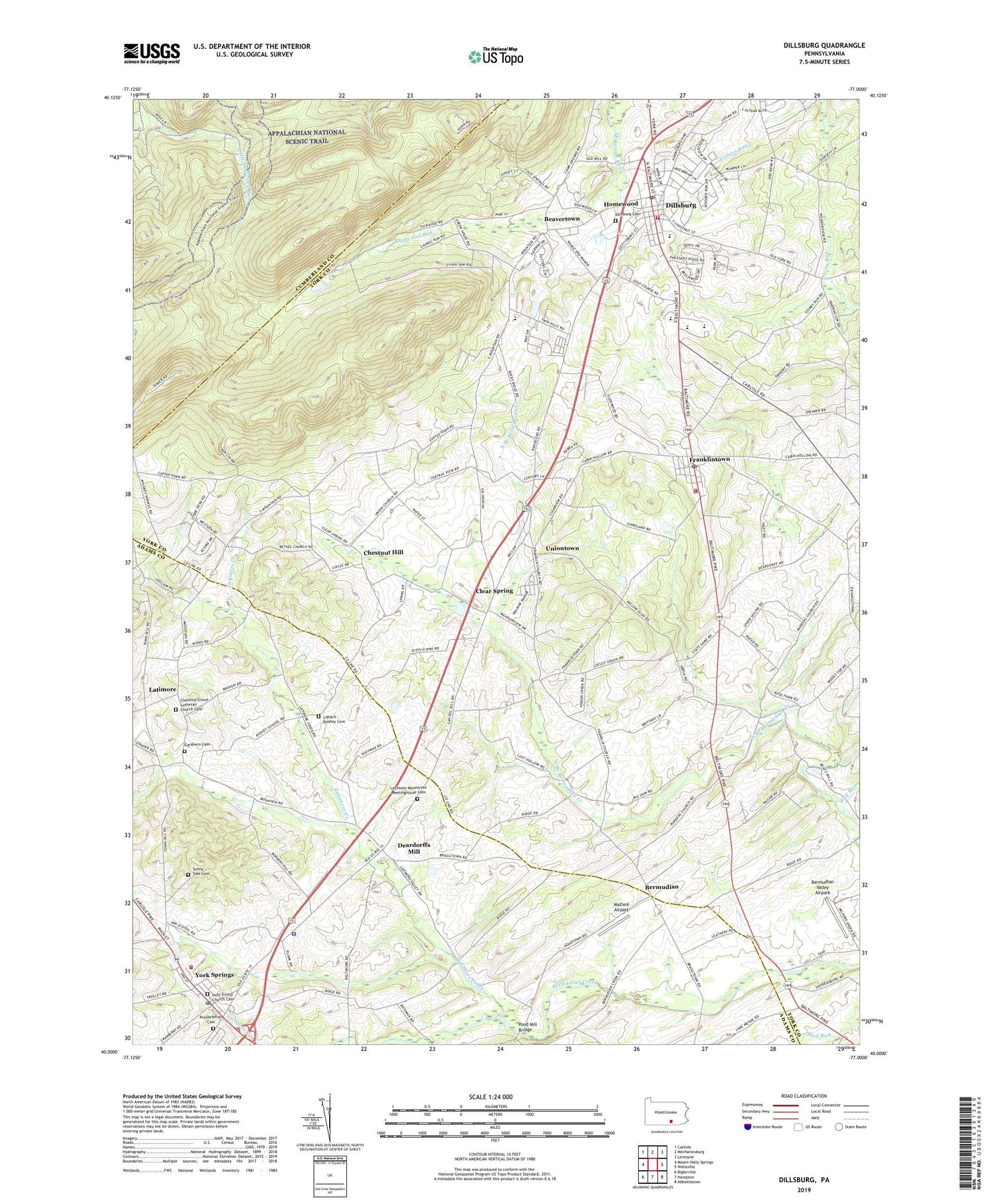
2023 topographic map quadrangle Dillsburg in the state of Pennsylvania. Scale: 1:24000. Based on the newly updated USGS 7.5' US Topo map series, this map is in the following counties: York, Adams, Cumberland. The map contains contour data, water features, and other items you are used to seeing on USGS maps, but also has updated roads and other features. This is the next generation of topographic maps. Printed on high-quality waterproof paper with UV fade-resistant inks.
Quads adjacent to this one:
West: Mount Holly Springs
Northwest: Carlisle
North: Mechanicsburg
Northeast: Lemoyne
East: Wellsville
Southeast: Abbottstown
South: Hampton
Southwest: Biglerville
This map covers the same area as the classic USGS quad with code o40077a1.
Contains the following named places: Barrens School, Beavertown, Bermudian, Bermudian Valley Airpark, Big Dam, Big Dam School, Blackberry School, Boners Hill, Borough of Dillsburg, Borough of Franklintown, Borough of York Springs, Busheys School, Camp Tuckahoe, Center Point Knob, Central School, Chestnut Grove Church, Chestnut Grove Lutheran Church Cemetery, Chestnut Hill, Chestnut Hill School, Citizens Hose Company 1 Station 64, Clear Spring, Deardorffs Mill, Dillsburg, Dillsburg Area Public Library, Dillsburg Cemetery, Dillsburg Post Office, Franklin Church, Franklintown, Franklintown Community Fire Company Station 65, Franklintown Post Office, Gardners Cemetery, Gardners Church, Glenwood School, Gochenours School, Harbolds School, Harmony Church, Holy Trinity Church Cemetery, Homewood, Kimmels School, Latimore, Latimore Church, Latimore Creek, Latimore Mennonite Meetinghouse Cemetery, Lobach - Bushey Cemetery, Locust Grove School, Long Mountain, Mathna Airport, Mechanicsville School, Northern Joint High School, Northern School, Plainfield School, Pond Mill Bridge, Pondtown Mill, Presbyterian Cemetery, Red Mount Church, Salem Church, State Game Lands Number 243, State Game Lands Number 305, State Road School, Stone Head, Stony Brook School, Sunny Side Cemetery, Swamp School, Township of Carroll, Township of Franklin, Township of Latimore, Union Church, Uniontown, United Church, Western School, White Rocks, WKCD-FM (Mechanicsburg), Wolf Run, York Springs, York Springs Fire Company 1 Station 9, York Springs Police Department, York Springs Post Office, ZIP Codes: 17019, 17372