MyTopo
Duncannon Pennsylvania US Topo Map
Couldn't load pickup availability
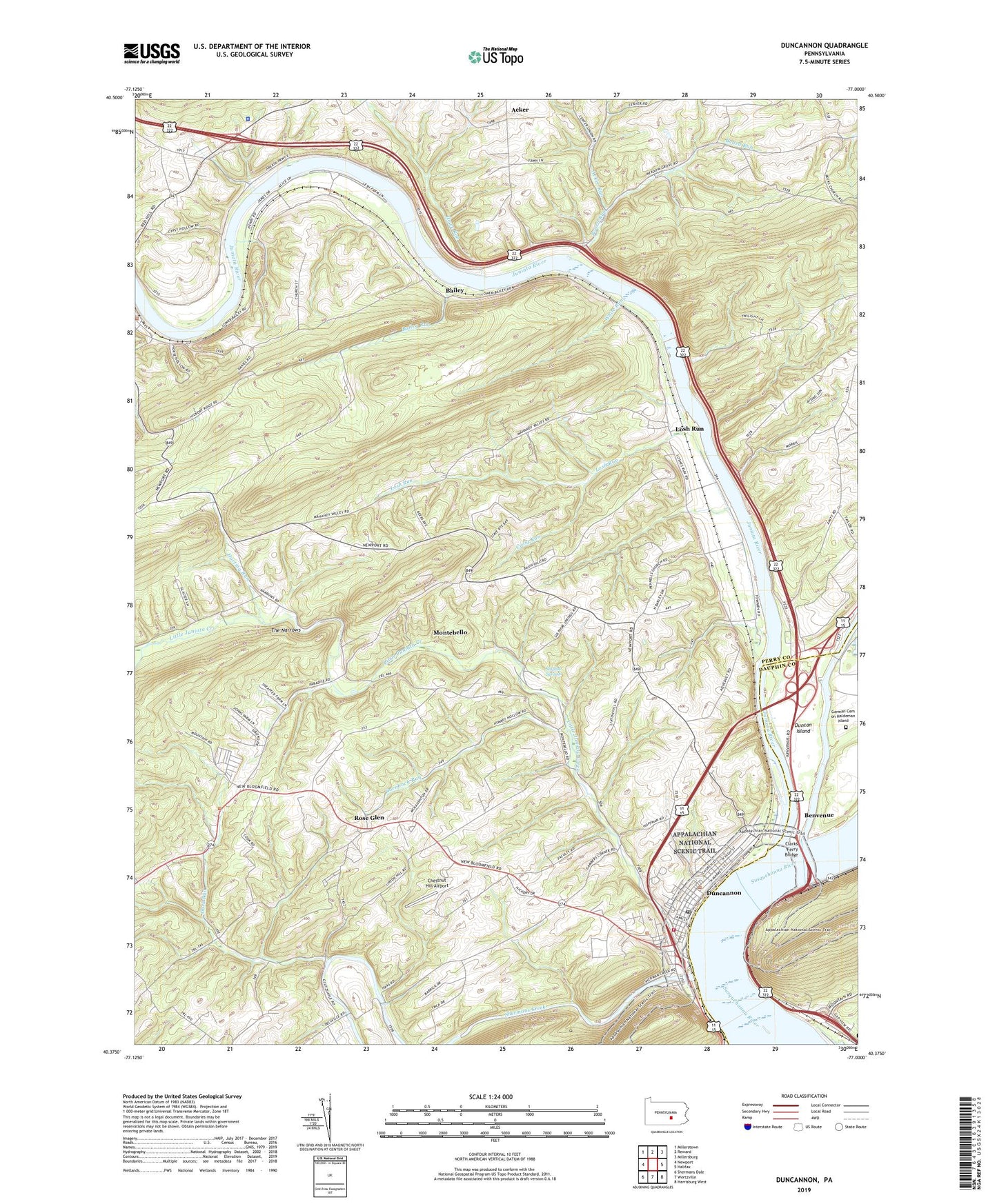
2023 topographic map quadrangle Duncannon in the state of Pennsylvania. Scale: 1:24000. Based on the newly updated USGS 7.5' US Topo map series, this map is in the following counties: Perry, Dauphin. The map contains contour data, water features, and other items you are used to seeing on USGS maps, but also has updated roads and other features. This is the next generation of topographic maps. Printed on high-quality waterproof paper with UV fade-resistant inks.
Quads adjacent to this one:
West: Newport
Northwest: Millerstown
North: Reward
Northeast: Millersburg
East: Halifax
Southeast: Harrisburg West
South: Wertzville
Southwest: Shermans Dale
This map covers the same area as the classic USGS quad with code o40077d1.
Contains the following named places: Acker, Acker Run, Amity Hall, Aqueduct, Bailey, Bailey Run, Benvenue, Board Run, Borough of Duncannon, Center School, Chestnut Hill Airport, Clarks Ferry Bridge, Craig Run, Dark Run, Dicks Ridge, Dornbach Run, Duncan Island, Duncannon, Duncannon Emergency Medical Services Station 29, Duncannon Fire Company Station 2, Duncannon Post Office, Garman Cemetery on Haldeman Island, Haldeman Island, Half Falls Mountain, Hawk Rock, Horting Run, Howe Run, Iroquois, Juniata Bridge, Juniata River, Juniata River Overlook, Kings Mill, Little Juniata Creek, Logania Church, Losh Run, Mahanoy School, Mahanoy Union Church, Miller School, Montebello, Mosquito Creek Dam, Mosquito Lake, Penn Township Consilidated School, Penn Township Police Department, Pennsylvania State Police Troop H Newport Station, Pine Grove Church, Potters School, Red Hill Church, Red Hill School, Roddy, Rose Glen, Shermans Creek, State Game Lands Number 281, State Game Lands Number 290, Sulphur Springs, Susquehanna River Overlook, The Narrows, Township of Howe, Township of Miller, Township of Wheatfield, Trimmers Rock, Weaver, White Run, ZIP Code: 17020