MyTopo
Wertzville Pennsylvania US Topo Map
Couldn't load pickup availability
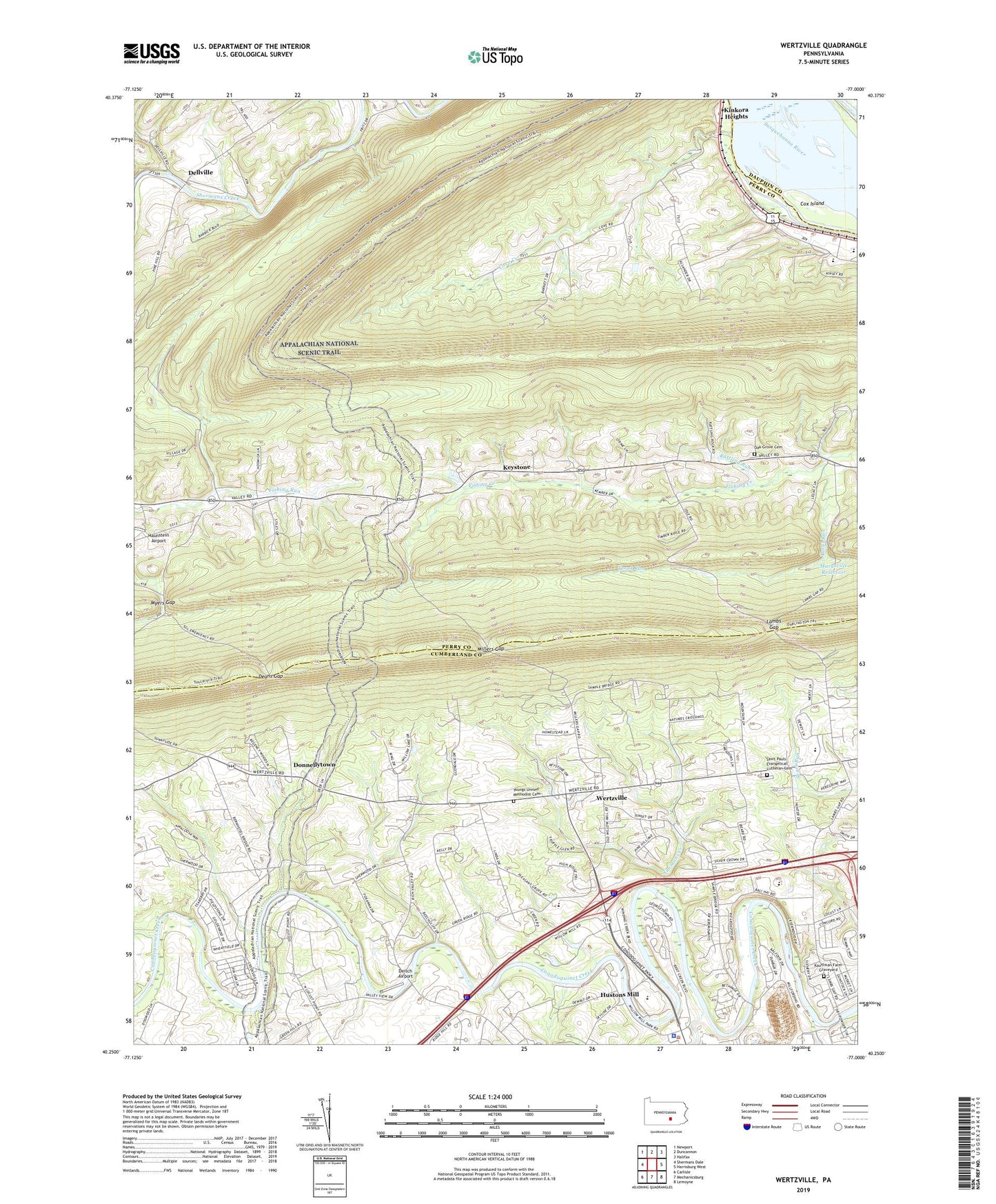
2023 topographic map quadrangle Wertzville in the state of Pennsylvania. Scale: 1:24000. Based on the newly updated USGS 7.5' US Topo map series, this map is in the following counties: Perry, Cumberland, Dauphin. The map contains contour data, water features, and other items you are used to seeing on USGS maps, but also has updated roads and other features. This is the next generation of topographic maps. Printed on high-quality waterproof paper with UV fade-resistant inks.
Quads adjacent to this one:
West: Shermans Dale
Northwest: Newport
North: Duncannon
Northeast: Halifax
East: Harrisburg West
Southeast: Lemoyne
South: Mechanicsburg
Southwest: Carlisle
This map covers the same area as the classic USGS quad with code o40077c1.
Contains the following named places: Cove Creek, Cove Forge, Cove Mountain, Cox Island, Deans Gap, Deitch Airport, Dellville, Dellville Church, Donnellytown, Eckles School, Elliots School, Fairview Hall School, Fio Forge School, Green Ridge Elementary School, Grier Point, Haunstein Airport, Hogestown Run, Hustons Mill, Ironstone Ridge, John P Hall Dam, Kauffman Farm Graveyard, Keystone, Kinkora Heights, Lambs Gap, Little Mountain, Marysville Reservoir, Middle Cove Church, Millers Gap, Myers Gap, North Country National Scenic Trail, Number 1 School, Number 2 School, Oak Grove School Cemetery, Pleasant Grove School, Rattling Run, Saint Davids Church, Saint Pauls Church, Saint Pauls Evangelical Lutheran Cemetery, Salam Church, Silver Spring Golf Course, Silver Spring Township Police Department, Simmons Creek, Simmons School, State Game Lands Number 170, Township of Penn, Township of Rye, Township of Silver Spring, Trindle Spring Run, Trout Run, Upper Dam, Wertzville, Willow Mill Park, Youngs Church, Youngs United Methodist Cemetery, ZIP Code: 17053