MyTopo
Enders Pennsylvania US Topo Map
Couldn't load pickup availability
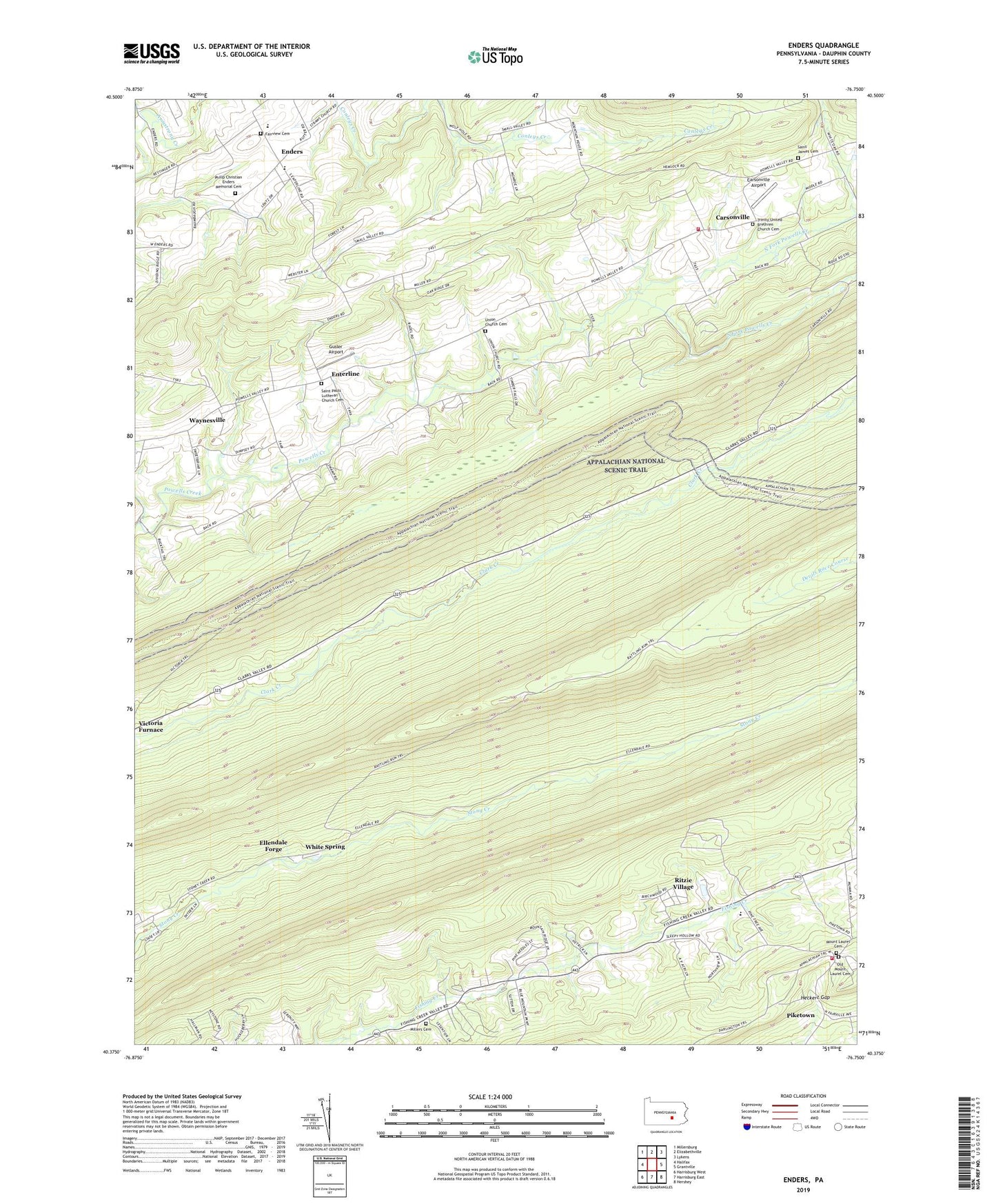
2023 topographic map quadrangle Enders in the state of Pennsylvania. Scale: 1:24000. Based on the newly updated USGS 7.5' US Topo map series, this map is in the following counties: Dauphin. The map contains contour data, water features, and other items you are used to seeing on USGS maps, but also has updated roads and other features. This is the next generation of topographic maps. Printed on high-quality waterproof paper with UV fade-resistant inks.
Quads adjacent to this one:
West: Halifax
Northwest: Millersburg
North: Elizabethville
Northeast: Lykens
East: Grantville
Southeast: Hershey
South: Harrisburg East
Southwest: Harrisburg West
This map covers the same area as the classic USGS quad with code o40076d7.
Contains the following named places: Bowerman Church, Camp Shikellimy, Carsonville, Carsonville Airport, Carsonville Volunteer Fire Company Dauphin County Station 19, Dauphin County, Devils Race Course, Dividing Ridge, Ellendale Forge, Ellendale Forge Radio Tower, Enders, Enders-Fisherville School, Enterline, Fairview Cemetery, Fishing Creek School, Gusler Airport, Heckert Gap, Joseph E. Ibberson Conservation Area, Millers Cemetery, Mount Laurel Cemetery, Mount Laurel Park, North Fork Powells Creek, Old Mount Laurel Cemetery, Peters Mountain, Philip Christian Enders Memorial Cemetery, Piketown, Powells Church, Rattling Run Trail, Ritzie Village, Saint James Cemetery, Saint James Church, Saint Pauls Lutheran Church Cemetery, Shikellimy Trail, South Fork Powells Creek, Stony Mountain Lookout Tower, Third Mountain, Township of Wayne, Trinity Church, Trinity United Brethren Church Cemetery, Union Church Cemetery, Valley Church, Victoria Trail, Water Tank Trail, West Hanover Township Fire Company 1 Station 36 - 3, White Spring, ZIP Codes: 17018, 17032