MyTopo
Grantville Pennsylvania US Topo Map
Couldn't load pickup availability
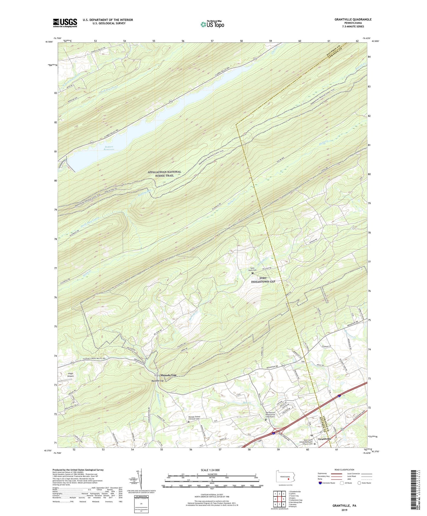
2023 topographic map quadrangle Grantville in the state of Pennsylvania. Scale: 1:24000. Based on the newly updated USGS 7.5' US Topo map series, this map is in the following counties: Dauphin, Lebanon. The map contains contour data, water features, and other items you are used to seeing on USGS maps, but also has updated roads and other features. This is the next generation of topographic maps. Printed on high-quality waterproof paper with UV fade-resistant inks.
Quads adjacent to this one:
West: Enders
Northwest: Elizabethville
North: Lykens
Northeast: Tower City
East: Indiantown Gap
Southeast: Palmyra
South: Hershey
Southwest: Harrisburg East
This map covers the same area as the classic USGS quad with code o40076d6.
Contains the following named places: Dehart Dam, Dehart Reservoir, DeHart Reservoir, Devils Race Course, Fort Indiantown Gap, Full Mission, Grantville, Grantville Post Office, Manada Furnace Church, Manada Gap, Manada Golf Course, Manada United Christian Cemetery, Old Hanover Presbyterian Churchyard, Penn National Race Course, Rattling Run, Saint Johns United Methodist Church Cemetery, Saint Pauls Cemetery, Second Mountain Trail, State Game Lands Number 211, Stony Mountain, Township of East Hanover, Yingst Airport, ZIP Code: 17028