MyTopo
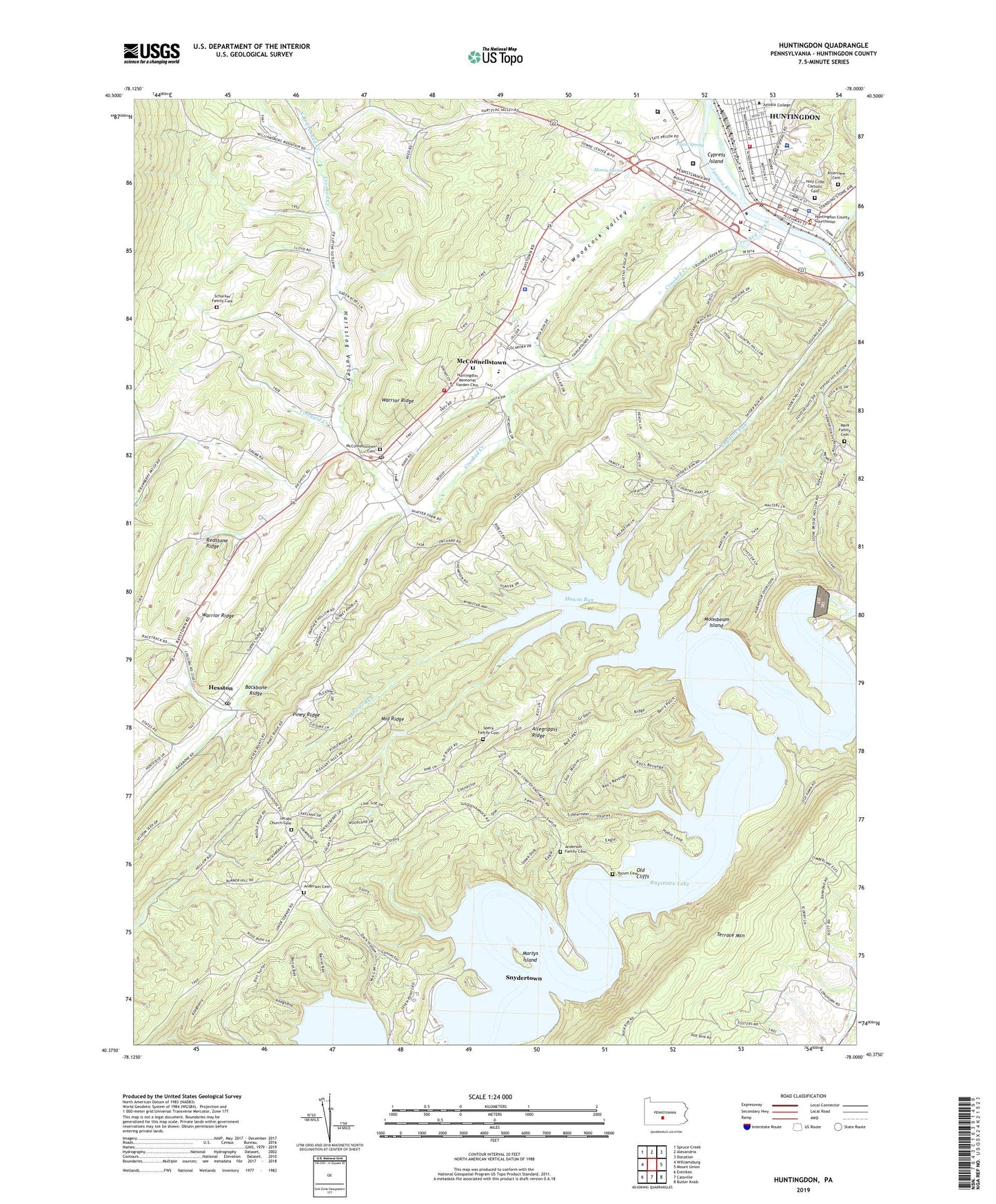
Huntingdon Pennsylvania US Topo Map
Couldn't load pickup availability
2023 topographic map quadrangle Huntingdon in the state of Pennsylvania. Scale: 1:24000. Based on the newly updated USGS 7.5' US Topo map series, this map is in the following counties: Huntingdon. The map contains contour data, water features, and other items you are used to seeing on USGS maps, but also has updated roads and other features. This is the next generation of topographic maps. Printed on high-quality waterproof paper with UV fade-resistant inks.
Quads adjacent to this one:
West: Williamsburg
Northwest: Spruce Creek
North: Alexandria
Northeast: Donation
East: Mount Union
Southeast: Butler Knob
South: Cassville
Southwest: Entriken
This map covers the same area as the classic USGS quad with code o40078d1.
Contains the following named places: Alfarata School, Anderson Cemetery, Anderson Family Cemetery, Borough of Huntingdon, Camp Myler, Camp Shaffer, Cliffs Picnic Area, Corbins Island Fishing Access, Crooked Creek, Cypress Island, Fink Bridge, Hartslog Valley, Hawn Cemetery, Hawns Bridge, Hawns Overlook, Hawns Run, Hesston, Hesston Post Office, Holy Cross Catholic Cemetery, Huntingdon, Huntingdon Ambulance Authority Company 500, Huntingdon Borough Police Department, Huntingdon County Sheriff's Office, Huntingdon Fire Department 65 Station 5, Huntingdon Memorial Garden Cemetery, Huntingdon Post Office, Huntingdon Regional Fire and Rescue Department 65 Station 6, Huntingdon Smithfield Dam, Jacobs Church Cemetery, Jims Anchorage, Jims Anchorage Docks and Campsite, Juniata College, Mark Family Cemetery, Martys Island, Mason Spring, McConnellstown, McConnellstown Cemetery, McConnellstown Census Designated Place, McConnellstown Post Office, Middle Ridge, Moonbeam Island, North Branch Crooked Creek, Old Cliffs, Old Raystown Dam, Penn Highlands Healthcare, Pennsylvania Fish Commission Launch, Pennsylvania State Police Troop G Huntingdon Station, Prices Spring, Raystown Dam, Ridenour Cemetery, Ridenour Overlook, Ridge Campground, Riverview Cemetery, Saint Jacobs Church, Schucker Family Cemetery, Seven Points Public Launch, Seven Points Recreation Area, Sheep Rock Trail, Shenecoy Field, Smithfield Volunteer Fire Company Station 10, Smithfield-Juniata Elementary School, Snyder Run Access Area, Snydertown, Speck Family Cemetery, Standing Stone Creek, State Correctional Institution Huntingdon, State Correctional Institution Smithfield, Susquehannock Campground, Township of Juniata, Township of Penn, Township of Smithfield, Township of Walker, Valley Campground, Vineyard Creek, Walkers Hollow, Warrior Ridge, Woodcock Valley, Woodcock Valley Elementary School, WQRO-AM (Huntingdon), Yocum Cemetery, Yocums Boat House, ZIP Code: 16647