MyTopo
Fairhope Pennsylvania US Topo Map
Couldn't load pickup availability
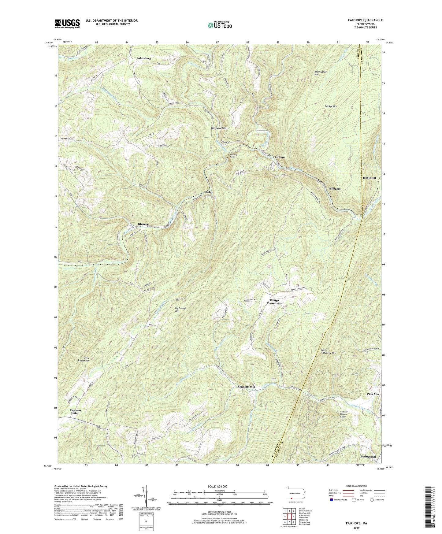
2023 topographic map quadrangle Fairhope in the state of Pennsylvania. Scale: 1:24000. Based on the newly updated USGS 7.5' US Topo map series, this map is in the following counties: Somerset, Bedford. The map contains contour data, water features, and other items you are used to seeing on USGS maps, but also has updated roads and other features. This is the next generation of topographic maps. Printed on high-quality waterproof paper with UV fade-resistant inks.
Quads adjacent to this one:
West: Wittenberg
Northwest: Berlin
North: New Baltimore
Northeast: Buffalo Mills
East: Hyndman
Southeast: Evitts Creek
South: Cumberland
Southwest: Frostburg
This map covers the same area as the classic USGS quad with code o39078g7.
Contains the following named places: Bearwallow Mountain, Becks Cut Station, Big Savage Mountain, Bittners Mill, Bradigum School, Brush Creek, Comps Crossroads, Crossroads School, Fairhope, Fairhope Post Office, Falls Cut Tunnel, Fitchner Covered Bridge, Foley, Foley Station, Glencoe, Hoblitzell, Johnsburg, Kennells Mill, Korns School, Laurel Run, Leapley Run, Mountain Run, Mountain School, Palo Alto, Palo Alto United Methodist Church Cemetery, Philson School, Pleasant Union, Poorbaugh Run, Powder Run, Roddys Station, Rush Run, Shaffers Run, Shoemaker Run, Southampton Mills, Southampton School, Stringtown, Township of Fairhope, Township of Southampton, Union Gospel Mission, Welch Station, Williams, ZIP Codes: 15538, 15545