MyTopo
Cumberland Maryland US Topo Map
Couldn't load pickup availability
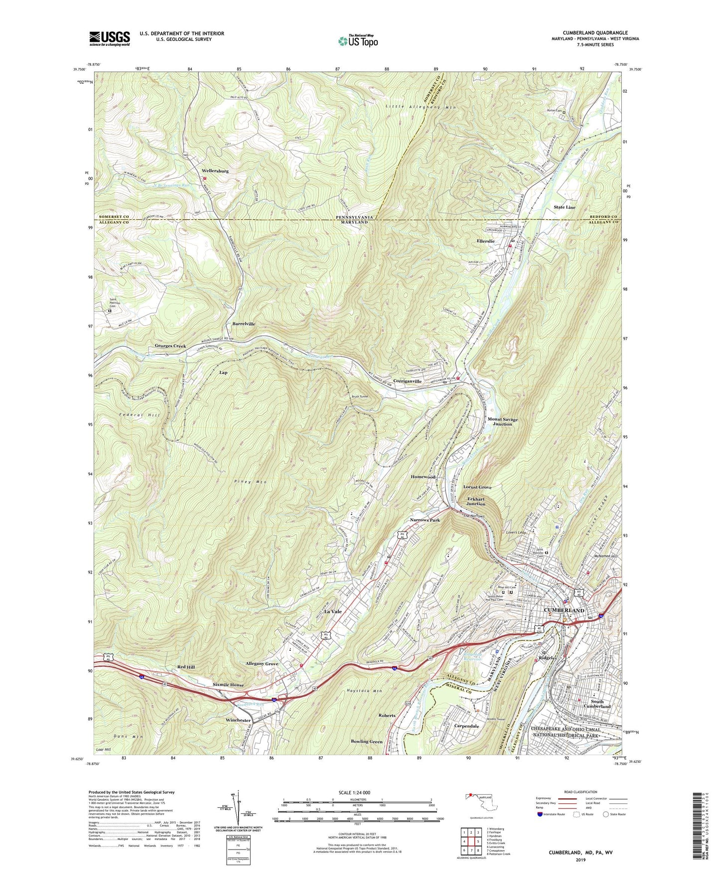
2023 topographic map quadrangle Cumberland in the states of Maryland, Pennsylvania, West Virginia. Scale: 1:24000. Based on the newly updated USGS 7.5' US Topo map series, this map is in the following counties: Allegany, Somerset, Bedford, Mineral. The map contains contour data, water features, and other items you are used to seeing on USGS maps, but also has updated roads and other features. This is the next generation of topographic maps. Printed on high-quality waterproof paper with UV fade-resistant inks.
Quads adjacent to this one:
West: Frostburg
Northwest: Wittenberg
North: Fairhope
Northeast: Hyndman
East: Evitts Creek
Southeast: Patterson Creek
Southwest: Lonaconing
Contains the following named places: Allegany County Courthouse, Allegany County Infirmary, Allegany County Public Library, Allegany County Sheriff's Office, Allegany Grove, Allegany High School, Barrelville, Barrelville Census Designated Place, Barrelville Presbyterian Church, Ber Chayim Temple, Beth Jacob Synagogue, Bethel United Methodist Church, Big Blue Spring, Bishop Walsh School, Borough of Wellersburg, Bowling Green Census Designated Place, Bowmans Addition Census Designated Place, Braddock Hospital, Braddock Middle School, Braddock Run, Brush Tunnel, Carpendale, Central Assembly of God Church, Central Fire Station, Central Methodist Episcopal Church, Centre Street Public School, Centre Street United Methodist Church, Chapel Hill Temple Church, Church of Christ, Church of God, Church of the Nazarene, City of Cumberland, Columbia Street School, Corriganville, Corriganville Census Designated Place, Corriganville Post Office, Corriganville School, Corriganville Volunteer Fire Department, Country Club Mall Shopping Center, Cumberland, Cumberland City Hall, Cumberland East Side Fire Station 3, Cumberland Fire Department - Headquarters Station 1, Cumberland Heights, Cumberland Police Department, Cumberland Post Office, Cumberland Shopping Center, Cumberland South End Fire Station 2, Cumberland Visitor Center, Dingle School, District 14 Central, District 14 Cumberland, District 20 Corriganville/Ellerslie, District 20 Ellerslie, District 23 Decatur, District 29 La Vale, District 4 Canal, District 4 Cumberland, District 6 Cumberland, District 6 Potomac River, Downtown Cumberland Historic District, Dry Run, East Side Fire Station Number 4, East Side School, Ebenezer Baptist Church, Eckhart Junction, Ellerslie, Ellerslie Census Designated Place, Ellerslie Post Office, Ellerslie Volunteer Fire Company, Emmanuel Episcopal Church, Emmanuel United Methodist Church, Fairview Avenue United Methodist Church, Federal Hill, First Assembly of God Church, First Baptist Church, First Brethren Church, First Christian Church, First Church of Christ Scientist, First Presbyterian Church, Fort Cumberland, Fort Ohio, Georges Creek, Gephart School, Gladdens Run, Grace Baptist Church, Grace United Methodist Church, Guard Lock Number 8, Haystack Mountain, Hills Plaza Shopping Center, Homewood, Jennings Run, John Humbird Elementary School, Johnson Heights Public School, Kingsley United Methodist Church, Knobly Tunnel, Knobmount, Kreigbaum, La Vale, La Vale Census Designated Place, La Vale Post Office, Lap, LaSalle High School, LaVale Public School, LaVale United Methodist Church, LaVale Volunteer Fire Department Station 1, Lavale Volunteer Fire Department Station 2, LaVale Volunteer Rescue Squad, Little Allegheny Mountain, Living Stone Church of the Brethren, Locust Grove, Lovers Leap, Lucas Heights, Mapleside United Methodist Church, Maryland Forestry Service Cumberland, Maryland Junction, McKendree Church, Melvin United Methodist Church, Memorial Hospital of Cumberland Heliport, Mount Savage Junction, Narrows Park, North Branch Jennings Run, Parkside Elementary School, Pentecost Church, Petnecostal Holiness Church, Piney Mountain, Porter Cemetery, Red Hill, Ridgedale Reservoir, Ridgeley, Ridgeley Police Department, Ridgeley Post Office, Ridgeley Primary School, Ridgeley Volunteer Fire Department Company 25, Riverside Park, Roberts, Rose Hill Cemetery, Sacred Heart Hospital, Sacred Heart Hospital Heliport, Saint Anthony's Catholic Church, Saint Johns Evangelical Lutheran Church, Saint Marks United Church of Christ, Saint Mary Catholic Church, Saint Marys School, Saint Patricks Cemetery, Saint Patricks Roman Catholic Church, Saint Pauls Lutheran Church, Saint Peter and Pauls Roman Catholic Church, Saint Peter and Pauls School, Saints Peter and Paul Cemetery, Second Baptist Church, Shanty Town, Sixmile House, South Cumberland, South End Playground, South Penn Elementary School, South Side Fire Station Number 2, Southminster Presbyterian Church, State Line, Station A Post Office, The Church of Jesus Christ of Latter Day Saints, The Narrows, Town of Carpendale, Town of Ridgeley, Trinity Evangelical Lutheran Church, Trinity United Methodist Church, Upper Potomac Industrial Park, Virginia Avenue Public School, Washington Street Historic District, WCBC-AM (Cumberland), Wellersburg, Wellersburg District Volunteer Fire Company - Station 630, West Side Elementary School, West Side Fire Station, Western Maryland Health System, Willis Creek, Willow Brook, Wills Creek, Wills Mountain State Park, Winchester, WTBO-AM (Cumberland), Zion United Church of Christ, ZIP Codes: 15564, 21502, 21524, 21529, 21545


