MyTopo
Lake Como Pennsylvania US Topo Map
Couldn't load pickup availability
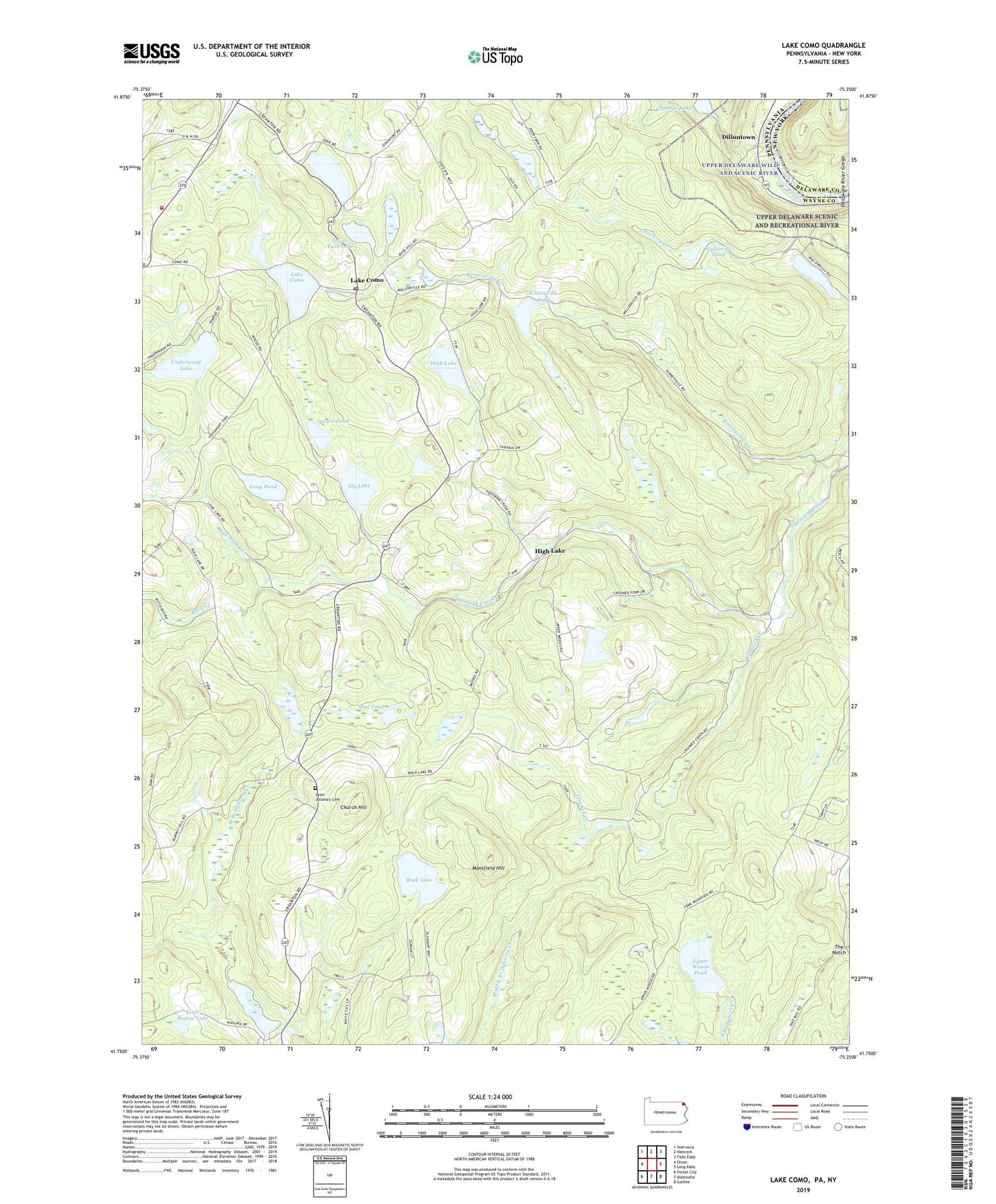
2023 topographic map quadrangle Lake Como in the state of Pennsylvania. Scale: 1:24000. Based on the newly updated USGS 7.5' US Topo map series, this map is in the following counties: Wayne, Delaware. The map contains contour data, water features, and other items you are used to seeing on USGS maps, but also has updated roads and other features. This is the next generation of topographic maps. Printed on high-quality waterproof paper with UV fade-resistant inks.
Quads adjacent to this one:
West: Orson
Northwest: Starrucca
North: Hancock
Northeast: Fishs Eddy
East: Long Eddy
Southeast: Galilee
South: Aldenville
Southwest: Forest City
This map covers the same area as the classic USGS quad with code o41075g3.
Contains the following named places: Buckingham Access Point, Camp Geneva, Camp Onibar, Camp Tabor, Camp Tioga, Camp Wayne, Camp Winona, Church Hill, Congo School, Crooked Creek, Crosby School, Dillontown, East Spruce, Fork Mountain Pond, High Lake, High Lake School, Howell Pond, Howell Pond Dam, Kinneyville Creek, Kinneyville Pond, Kinneyville Pond Dam, Lake Charlotte, Lake Charlotte Dam, Lake Como, Lake Como Dam, Lake Como Post Office, Lake Hamilton Dam, Lake Underwood Dam, Little Biglow Lake, Long Pond, Lower Twin Dam, Lower Twin Lake, Lower Twin Lake Dam, Mansfield Hill, Mount Tone Ski Area, Mud Pond, Northern Wayne Fire Company Station 3, Preston Corner, Riley Creek, Rock Lake, Rock Lake School, Rudes Corner, Saint Juliana's Cemetery, Saint Julianas Church, Sly Lake, Spruce Pond, State Game Lands Number 159, The Notch, Township of Buckingham, Underwood Lake, Upper Twin Dam, Upper Twin Lake, Upper Woods Pond, Wallerville Pond, ZIP Codes: 18437, 18439, 18453