MyTopo
Hackett Pennsylvania US Topo Map
Couldn't load pickup availability
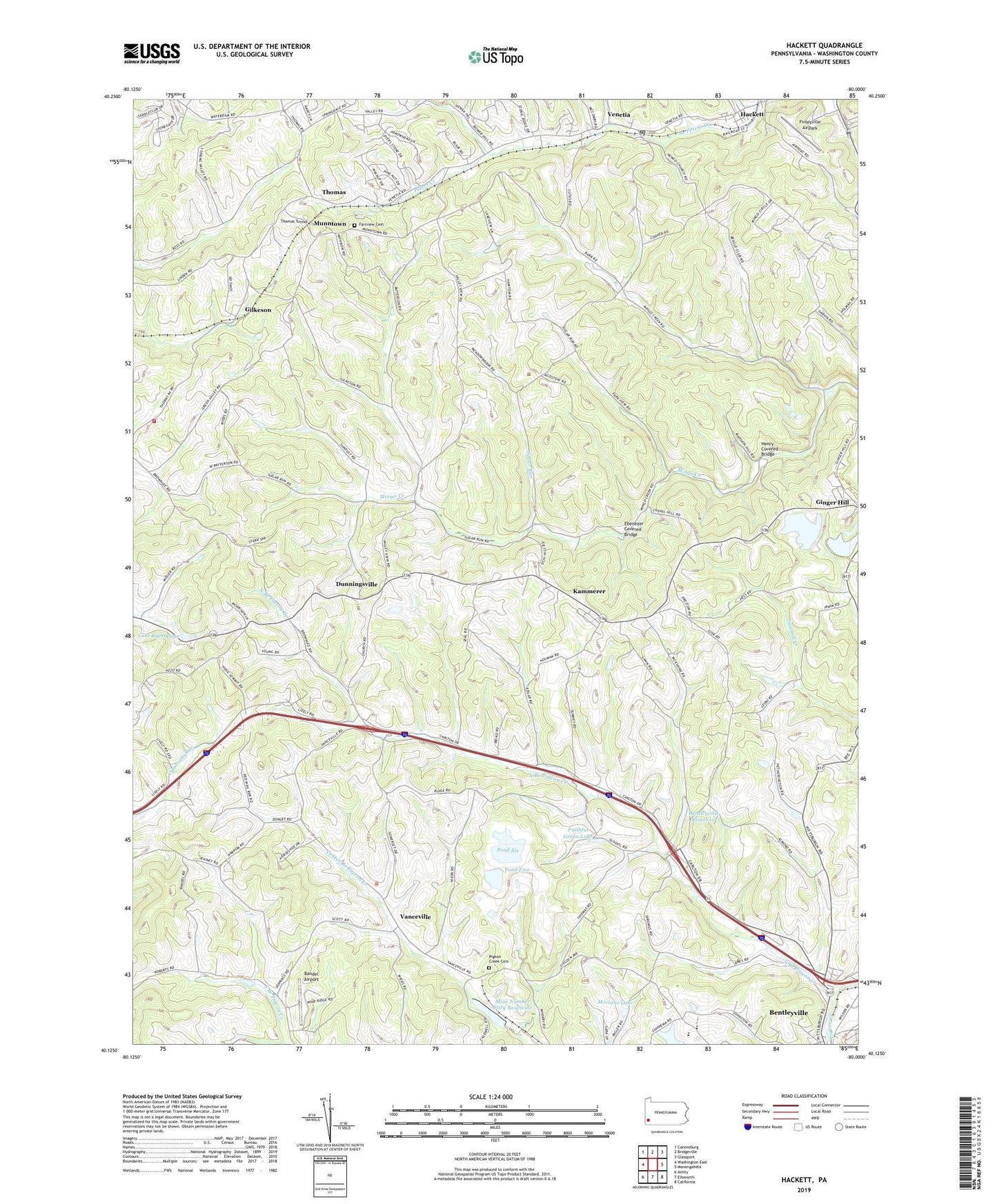
2023 topographic map quadrangle Hackett in the state of Pennsylvania. Scale: 1:24000. Based on the newly updated USGS 7.5' US Topo map series, this map is in the following counties: Washington. The map contains contour data, water features, and other items you are used to seeing on USGS maps, but also has updated roads and other features. This is the next generation of topographic maps. Printed on high-quality waterproof paper with UV fade-resistant inks.
Quads adjacent to this one:
West: Washington East
Northwest: Canonsburg
North: Bridgeville
Northeast: Glassport
East: Monongahela
Southeast: California
South: Ellsworth
Southwest: Amity
This map covers the same area as the classic USGS quad with code o40080b1.
Contains the following named places: Anderson Station, Bandel Airport, Bentleyville Dam, Bentleyville Reservoir, Bentworth Ambulance Service, Crouches Station, Dunningsville, Ebenezer Covered Bridge, Edwards Chapel, Emery, Fairview Cemetery, Faithful Green Lake, Farquhar, Finleyville Airpark, Gilkeson, Hackett, Henry Covered Bridge, Hern, Kammerer, Lake Calydon, Lake Eightyfour, Lil Tots Day Care Center, Mine Number Six-Pond Six Dam, Mine Number Sixty Reservoir, Mine Number Sixty-Pond Five Dam, Mingo Creek County Park, Mortons Lake, Munntown, North Branch Pigeon Creek, North Strabane Volunteer Fire Department Station 2 Substation, Nottingham Christian Center, Nottingham Township School, Peters Township School, Pigeon Creek Cemetery, Pigeon Creek Church, Pond Five, Pond Six, Raw Water Pond Dam, Refuse Stilling Basin Dam, Rolling Green, Somerset Township Municipal Building, Somerset Township School, Steel Dam, Sugar Run, Thomas, Thomas Presbyterian Church, Thomas Tunnel, Township of Nottingham, Township of Somerset, Treated Water Pond Dam, Vanceville, Venetia, Venetia Post Office, Wrights United Methodist Church, ZIP Codes: 15314, 15330