
MyTopo
Harmonsburg Pennsylvania US Topo Map
Couldn't load pickup availability
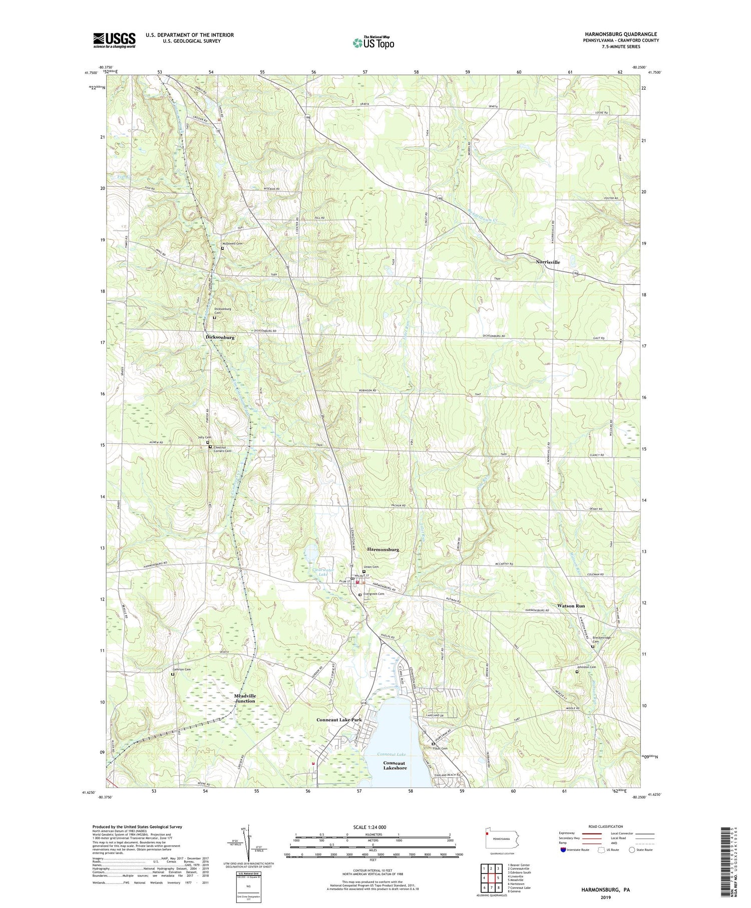
2019 topographic map quadrangle Harmonsburg in the state of Pennsylvania. Scale: 1:24000. Based on the newly updated USGS 7.5' US Topo map series, this map is in the following counties: Crawford. The map contains contour data, water features, and other items you are used to seeing on USGS maps, but also has updated roads and other features. This is the next generation of topographic maps. Printed on high-quality waterproof paper with UV fade-resistant inks.
Quads adjacent to this one:
West: Linesville
Northwest: Beaver Center
North: Conneautville
Northeast: Edinboro South
East: Meadville
Southeast: Geneva
South: Conneaut Lake
Southwest: Hartstown
Contains the following named places: Beech School, Big Road School, Breckenridge Cemetery, Breckenridge School, Carr School, Center School, Chestnut Corners, Chestnut Corners Cemetery, Clearwater Lake, Conneaut Lake Park, Conneaut Lake Park Volunteer Fire Department 5, Conneaut Lakeshore Census Designated Place, Cooper School, Dicksonburg, Dicksonburg Cemetery, Evergreen Cemetery, Fish Corners, Fish Creek, Foust Cemetery, Gehrton Cemetery, Gehrton School, Harmonsburg, Harmonsburg Census Designated Place, Harmonsburg Post Office, Harmonsburg Station, Inlet Run, Inlet School, Iron Wood Golf Course, Johnston Cemetery, Jolly Cemetery, Lefevre School, McDowell Cemetery, Meadville Junction, Norrisville, Park Golf Course, Pine Run, Putnam School, Rockwall School, Shermansville, Smith School, Stanford School, Summit Township Volunteer Fire Department 20, Townline School, Township of Summerhill, Township of Summit, Union Cemetery, Watson Run, Whiting Corners, ZIP Codes: 16406, 16422


