MyTopo
Conneautville Pennsylvania US Topo Map
Couldn't load pickup availability
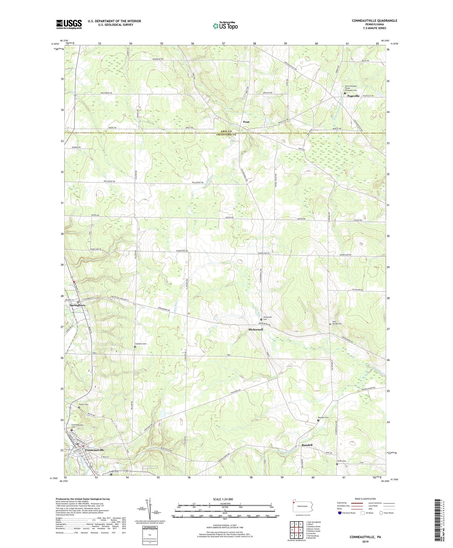
2023 topographic map quadrangle Conneautville in the state of Pennsylvania. Scale: 1:24000. Based on the newly updated USGS 7.5' US Topo map series, this map is in the following counties: Crawford, Erie. The map contains contour data, water features, and other items you are used to seeing on USGS maps, but also has updated roads and other features. This is the next generation of topographic maps. Printed on high-quality waterproof paper with UV fade-resistant inks.
Quads adjacent to this one:
West: Beaver Center
Northwest: East Springfield
North: Albion
Northeast: Edinboro North
East: Edinboro South
Southeast: Meadville
South: Harmonsburg
Southwest: Linesville
This map covers the same area as the classic USGS quad with code o41080g3.
Contains the following named places: Borough of Conneautville, Borough of Springboro, Coblentz Cemetery, Conneaut Valley Elementary School, Conneaut Valley High School, Conneautville, Conneautville Cemetery, Conneautville Post Office, Cribbs Cemetery, East Spring Cemetery, East Spring Church, Fellow's Club Volunteer Fire Department and Ambulance Service Department 8, Foster Cemetery, Foster Run, Hickernell, Hickernell Cemetery, Meyler Run, Pageville, Paperville, Pont, Ridgeview Greenhouse, Rundell, Rundell Cemetery, Rundelltown Creek, Saint Nicholas Church, Saint Nicholas Greek Orthodox Cemetery, Smith Cemetery, Spring, Springboro, Springboro Post Office, Springboro Volunteer Fire Department 21, Taylor Farms, Township of Spring, Winterbreeze Farm