MyTopo
Holbrook Pennsylvania US Topo Map
Couldn't load pickup availability
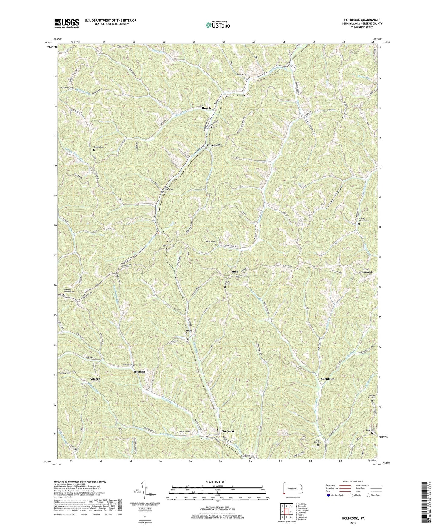
2019 topographic map quadrangle Holbrook in the state of Pennsylvania. Scale: 1:24000. Based on the newly updated USGS 7.5' US Topo map series, this map is in the following counties: Greene. The map contains contour data, water features, and other items you are used to seeing on USGS maps, but also has updated roads and other features. This is the next generation of topographic maps. Printed on high-quality waterproof paper with UV fade-resistant inks.
Quads adjacent to this one:
West: New Freeport
Northwest: Wind Ridge
North: Rogersville
Northeast: Waynesburg
East: Oak Forest
Southeast: Blacksville
South: Wadestown
Southwest: Hundred
Contains the following named places: Ashtree, Bells Run, Bethany Church, Bethany Church Cemetery, Blockhouse Run, Bluff, Bulldog Run, Buzz, Eddy Cemetery, Fordyce Cemetery, Garner Run, Grinage Run, Hargus Creek, Higgins Cemetery, Hoge Run, Holbrook, Holbrook Post Office, House Run, Kennedy Cemetery, King - Hoy Cemetery, Kuhntown, Macedonia Cemetery, Macedonia Church, McCourtney Run, Morris Cemetery, Mount Zion Cemetery, Phillips Church, Phillips New Cemetery, Pine Bank, Pine Bank Cemetery, Pursley Church, Pursley Church Cemetery, Roberts Run, Roseberry Cemetery, Rush Crossroads, Smith Cemetery, Township of Jackson, Triumph, Turkey Hollow, Tustin Run, Valley Chapel Cemetery, Valley Chapel Church, West Greene High School, White Cottage, Willow Grove Church, Woodruff, ZIP Code: 15341