MyTopo
New Freeport Pennsylvania US Topo Map
Couldn't load pickup availability
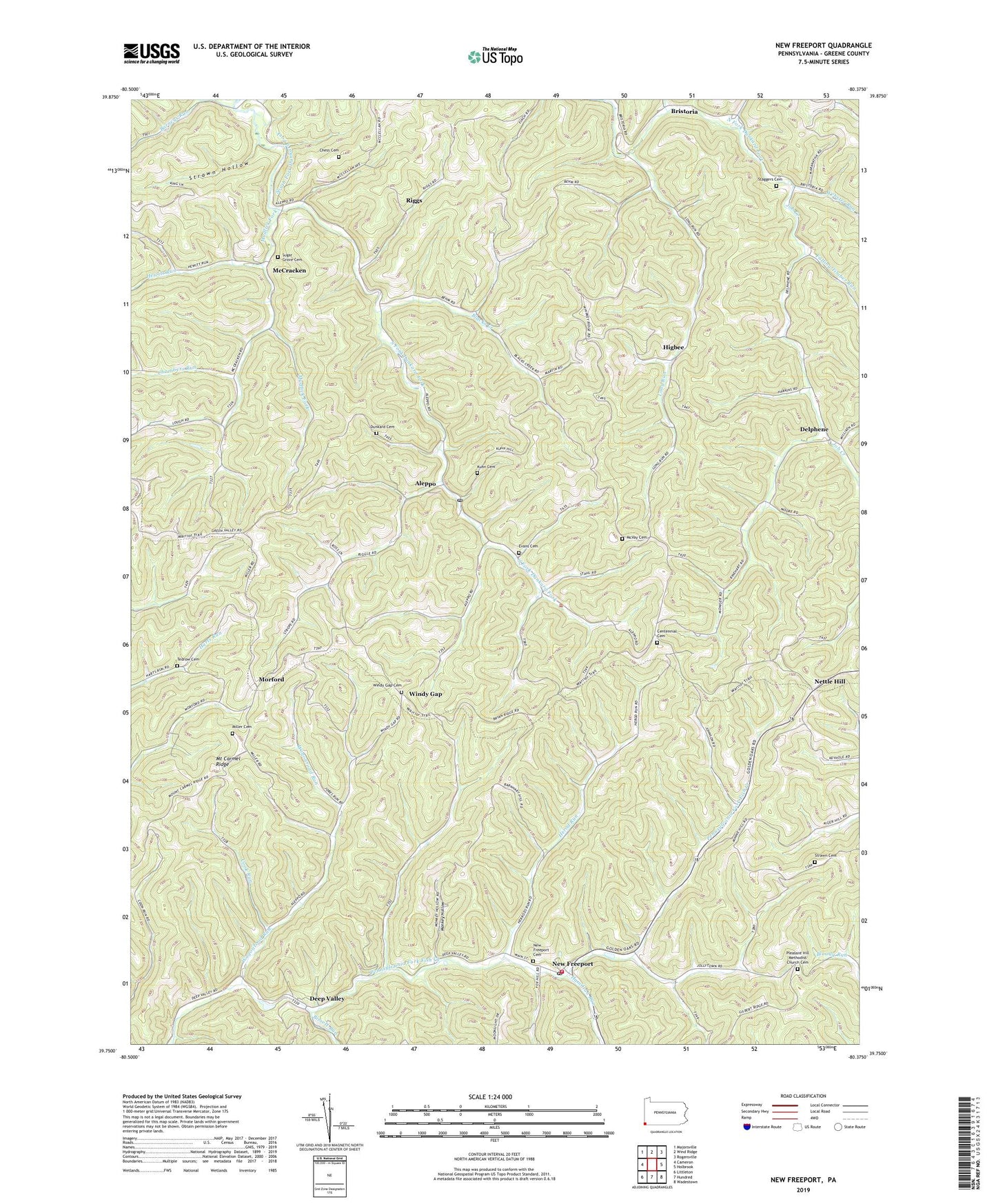
2023 topographic map quadrangle New Freeport in the state of Pennsylvania. Scale: 1:24000. Based on the newly updated USGS 7.5' US Topo map series, this map is in the following counties: Greene. The map contains contour data, water features, and other items you are used to seeing on USGS maps, but also has updated roads and other features. This is the next generation of topographic maps. Printed on high-quality waterproof paper with UV fade-resistant inks.
Quads adjacent to this one:
West: Cameron
Northwest: Majorsville
North: Wind Ridge
Northeast: Rogersville
East: Holbrook
Southeast: Wadestown
South: Hundred
Southwest: Littleton
This map covers the same area as the classic USGS quad with code o39080g4.
Contains the following named places: Aleppo, Aleppo Post Office, Barneys Run, Bissett Run, Blacks Creek, Bristoria, Centennial Cemetery, Centennial Church, Chambers Run, Chess Cemetery, Cook Run, Deep Valley, Delphene, Dunkard Cemetery, Evans Cemetery, Falling Timber Run, Hamilton Run, Herod Run, Hewitt Run, Higbee, Highbee Post Office, Job Creek, Kuhn Cemetery, Laurel Run, Laurel Run Church, Long Run, Long Run Church, McCracken, McVay Cemetery, Miller Cemetery, Monkey Hollow, Morford, Mount Carmel Ridge, Mudlick Fork, Nettle Hill, New Freeport, New Freeport Cemetery, New Freeport Census Designated Place, New Freeport Post Office, New Freeport Volunteer Fire Department Company 71, Pleasant Hill Church, Pleasant Hill Methodist Church Cemetery, Riggs, Smith Bridge, Springhill-Freeport School, Staggers Cemetery, State Game Lands Number 179, Strawn Cemetery, Strawn Hollow, Sugar Grove Cemetery, Sugar Grove Church, Tedrow Cemetery, Township of Aleppo, Township of Springhill, Wagonroad Run, Webster Run, Whitethorn Run, Windy Gap, Windy Gap Cemetery, ZIP Codes: 15310, 15352, 15380