MyTopo
Rogersville Pennsylvania US Topo Map
Couldn't load pickup availability
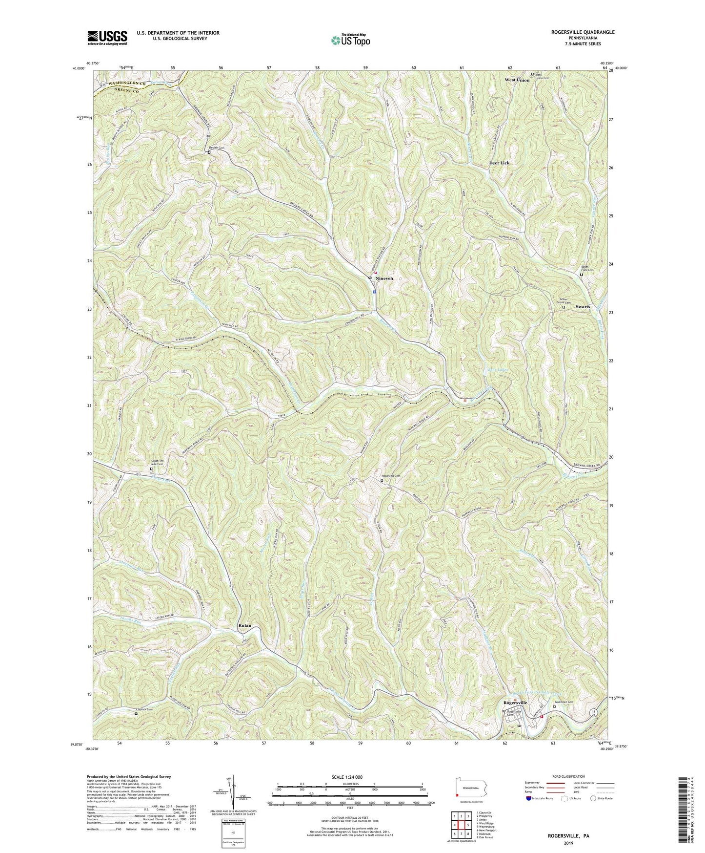
2023 topographic map quadrangle Rogersville in the state of Pennsylvania. Scale: 1:24000. Based on the newly updated USGS 7.5' US Topo map series, this map is in the following counties: Greene, Washington. The map contains contour data, water features, and other items you are used to seeing on USGS maps, but also has updated roads and other features. This is the next generation of topographic maps. Printed on high-quality waterproof paper with UV fade-resistant inks.
Quads adjacent to this one:
West: Wind Ridge
Northwest: Claysville
North: Prosperity
Northeast: Amity
East: Waynesburg
Southeast: Oak Forest
South: Holbrook
Southwest: New Freeport
This map covers the same area as the classic USGS quad with code o39080h3.
Contains the following named places: Bates Fork Cemetery, Bear Lakes, Beulah Cemetery, Beulah Church, Center Township Volunteer Fire Department Company 91, Claylick Cemetery, Claylick Church, Claylick Run, Clinto, Clinton, Deer Lick, Dille Run, Enon Church, Fonner Run, Grays Fork, Green Grove Cemetery, Hopewell Cemetery, Hopewell Church, Hunters Cave, Jacobs Run, Lightner Run, Maranda Run, Morris Run, Morris Township Volunteer Fire Department, Nineveh, Nineveh Post Office, Patterson Creek, Rogersville, Rogersville Cemetery, Rogersville Census Designated Place, Rogersville Post Office, Rosemont Cemetery, Rutan, Scott Run, South Ten Mile Cemetery, Swarts, Time, Township of Center, Township of Morris, West Run, West Union Cemetery, ZIP Codes: 15353, 15359, 15364