MyTopo
Waynesburg Pennsylvania US Topo Map
Couldn't load pickup availability
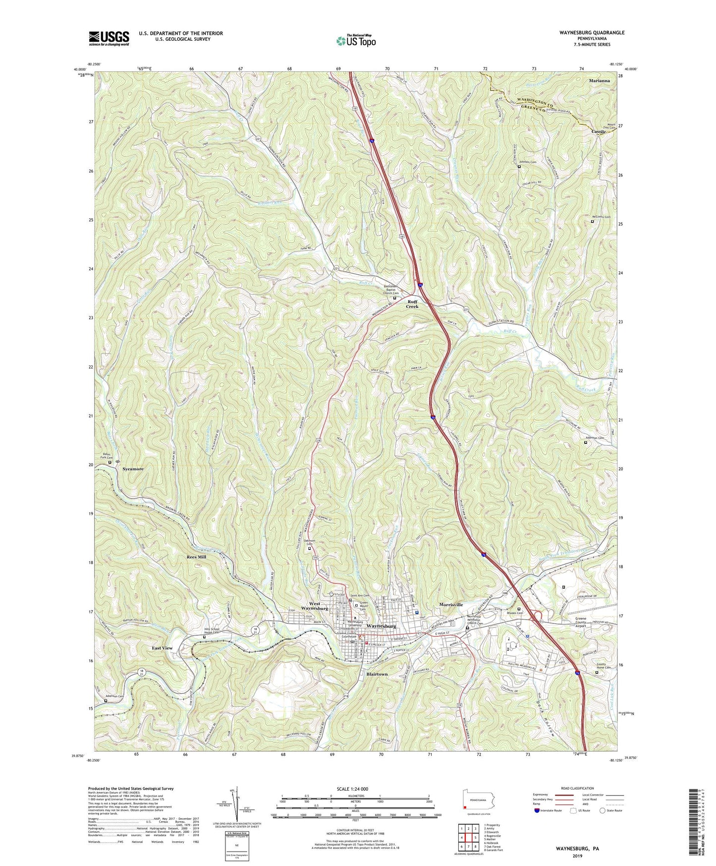
2023 topographic map quadrangle Waynesburg in the state of Pennsylvania. Scale: 1:24000. Based on the newly updated USGS 7.5' US Topo map series, this map is in the following counties: Greene, Washington. The map contains contour data, water features, and other items you are used to seeing on USGS maps, but also has updated roads and other features. This is the next generation of topographic maps. Printed on high-quality waterproof paper with UV fade-resistant inks.
Quads adjacent to this one:
West: Rogersville
Northwest: Prosperity
North: Amity
Northeast: Ellsworth
East: Mather
Southeast: Garards Fort
South: Oak Forest
Southwest: Holbrook
This map covers the same area as the classic USGS quad with code o39080h2.
Contains the following named places: Adamson Cemetery, Alumni Conference Building, Bates Fork, Bates Fork Cemetery, Behl Humanites Building, Bethlehem Baptist Church Cemetery, Blairtown, Borough of Waynesburg, Boyd Run, Browns Creek, Burns Hall, Carl D Johnson Commons, Castile, Clear Run, Coal Lick Church, College Field, County Home Cemetery, Craig Run, Craynes Run, Curry Memorial Home, Dark Hollow, Denny Hall, East View, East Ward Elementary School, Eberty Library, Emerald Ball Park, Emergency Medical Services Southwest Waynesburg, Garners Run, Goodwin House, Green Mount Cemetery, Greene County Airport, Greene County Sheriff's Office, Greene Plaza, Grimes Portal, Grimes Run, Hills School House Cemetery, Jackson Run, Jersey Run, Johnson Cemetery, Laurel Run, Marisa Fieldhouse, McGinnis Cemetery, Morrisville, Morrisville Census Designated Place, Morrisville Methodist Church Cemetery, Mud Lick Run, North Ward School, Oakmont Cemetery, Paul R Stewart Museum, Paul R Stewart Science Center, Pennsylvania State Police Troop B Waynesburg Station, Pettit Run, Pollock Hall, Poverty Run, President's Home - Waynesburg College, Purman Run, Pursley Creek, Ray Hall, Rees Mill, Rhodes Cemetery, Ruff Creek, Rush Run, Saint Ann Cemetery, Smith Creek, South Ward School, State Correctional Institution Greene, Stover Campus Center, Sugar Run, Sycamore, Sycamore Post Office, Throckmorton Run, Toll Gate Run, Township of Franklin, Township of Washington, Veterans Memorial Plaza, Walkers Run, Washington Health System Greene Hospital, Waynesburg, Waynesburg Borough Police Department, Waynesburg College, Waynesburg Franklin Township Volunteer Fire Company, Waynesburg Franklin Township Volunteer Fire Department Company 61, Waynesburg Post Office, Waynesburg Water Company Dam, Waynesburg Water Company Reservoir, WCYJ-FM (Waynesburg), West Waynesburg, West Waynesburg Census Designated Place, Wisecarver Run, ZIP Code: 15370