MyTopo
Hop Bottom Pennsylvania US Topo Map
Couldn't load pickup availability
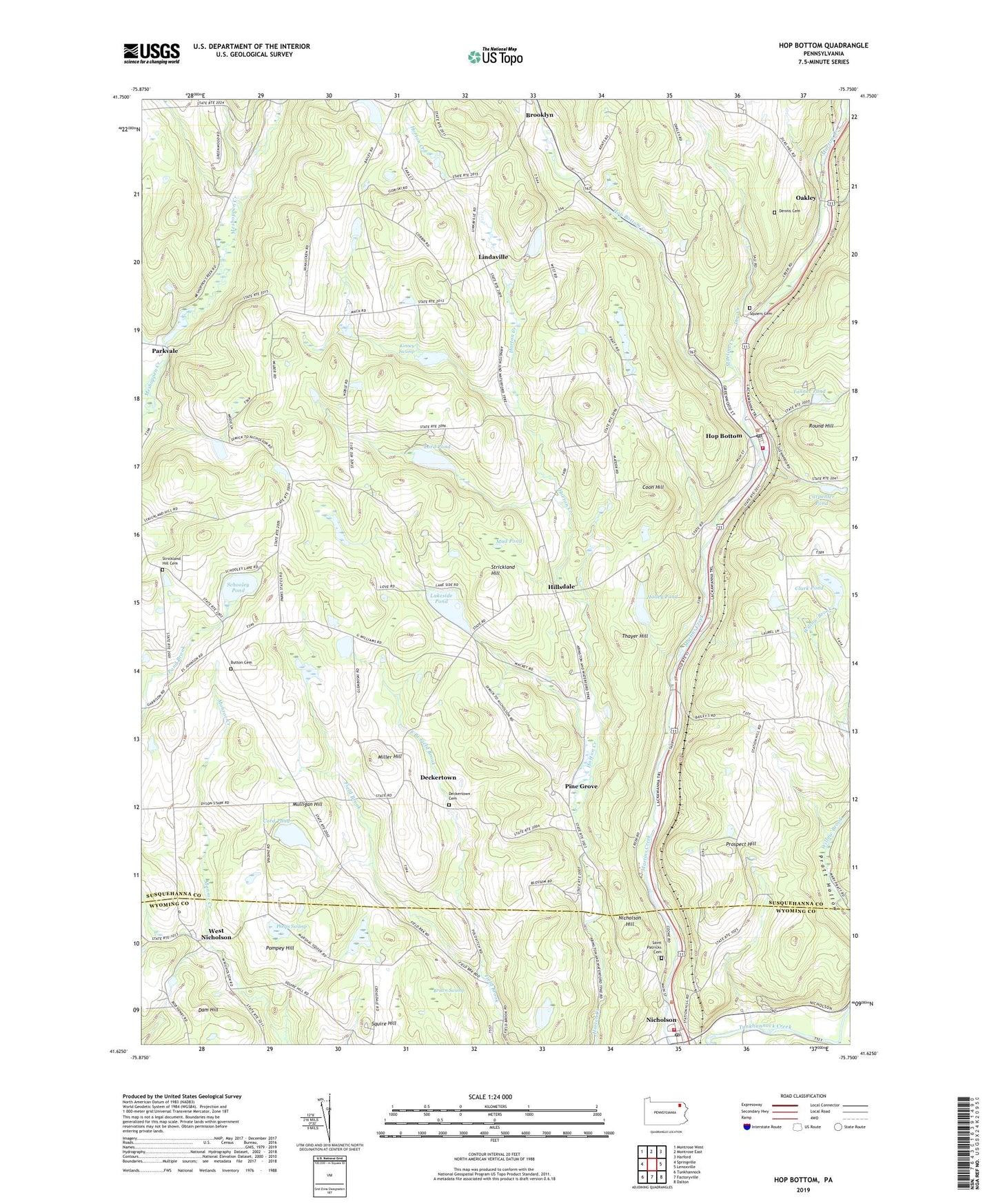
2023 topographic map quadrangle Hop Bottom in the state of Pennsylvania. Scale: 1:24000. Based on the newly updated USGS 7.5' US Topo map series, this map is in the following counties: Susquehanna, Wyoming. The map contains contour data, water features, and other items you are used to seeing on USGS maps, but also has updated roads and other features. This is the next generation of topographic maps. Printed on high-quality waterproof paper with UV fade-resistant inks.
Quads adjacent to this one:
West: Springville
Northwest: Montrose West
North: Montrose East
Northeast: Harford
East: Lenoxville
Southeast: Dalton
South: Factoryville
Southwest: Tunkhannock
This map covers the same area as the classic USGS quad with code o41075f7.
Contains the following named places: Borough of Hop Bottom, Borough of Nicholson, Brown Swamp, Burdick Creek, Button Cemetery, Carpenter Pond, Clark Pond, Coon Hill, Cord Pond, Dam Hill, Deckertown, Deckertown Cemetery, Dennis Cemetery, Dry Creek, East Branch Field Brook, Foster Station, Grace Lutheran Church, Hillsdale, Holley Pond, Hop Bottom, Hop Bottom Creek, Hop Bottom Fire Company, Hop Bottom Post Office, Kinney Swamp, Lakeside Pond, Lakeside Pond Dam, Lathrop - Squier Cemetery, Lindaville, Lord Pond, Miller Hill, Mud Pond, Mulligan Hill, Nicholson, Nicholson Fire Company Station 7, Nicholson Hill, Nicholson Post Office, Niven Corners, Oakley, Parkvale, Phelps Swamp, Pine Grove, Pompey Hill, Prospect Hill, Round Hill, Saint Patricks Cemetery, Schooley Pond, Squier Hill School, Squire Hill, Strickland Hill, Strickland Hill Cemetery, Tanner Pond, Thayer Hill, Township of Lathrop, Union Church, Utley Brook, West Nicholson, ZIP Codes: 18446, 18824