MyTopo
Montrose West Pennsylvania US Topo Map
Couldn't load pickup availability
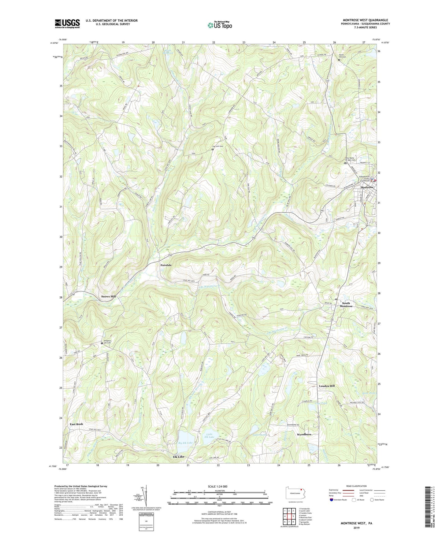
2023 topographic map quadrangle Montrose West in the state of Pennsylvania. Scale: 1:24000. Based on the newly updated USGS 7.5' US Topo map series, this map is in the following counties: Susquehanna. The map contains contour data, water features, and other items you are used to seeing on USGS maps, but also has updated roads and other features. This is the next generation of topographic maps. Printed on high-quality waterproof paper with UV fade-resistant inks.
Quads adjacent to this one:
West: Lawton
Northwest: Friendsville
North: Laurel Lake
Northeast: Franklin Forks
East: Montrose East
Southeast: Hop Bottom
South: Springville
Southwest: Auburn Center
This map covers the same area as the classic USGS quad with code o41075g8.
Contains the following named places: Beebe Creek, Big Elk Lake, Big Elk Lake Dam, Booth Millpond, Borough of Montrose, Bumps Corners, Bush Pond, Cope Pond, East Rush, Elk Lake, Fair Hill Cemetery, Fair Hill School, Fairdale, Fancher Cemetery, Forest Lake Creek, Hamlin School, Holy Name of Mary Cemetery, Husky Haven Airport, Indian Lake, Indian Lake Dam, Jessup Overlook, Little Elk Lake, Louden Hill, Montrose, Montrose Post Office, Pettis Creek, Prospect Hill Cemetery, Roe Creek, Shelp Creek, Snows Mill, South Branch Wyalusing Creek, South Montrose, South Montrose Post Office, Township of Jessup, Tyler School, United Fire Company, Woodburn, ZIP Codes: 18801, 18816, 18843