MyTopo
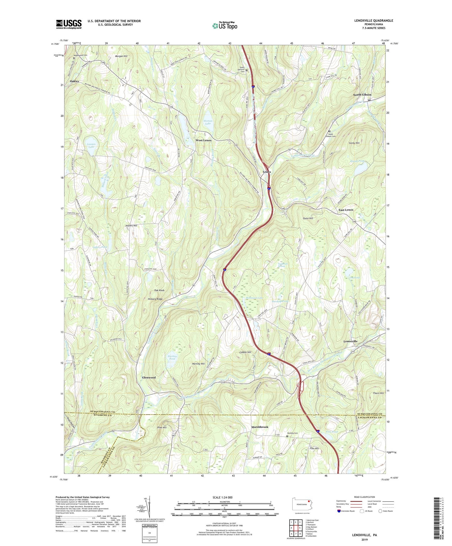
Lenoxville Pennsylvania US Topo Map
Couldn't load pickup availability
2023 topographic map quadrangle Lenoxville in the state of Pennsylvania. Scale: 1:24000. Based on the newly updated USGS 7.5' US Topo map series, this map is in the following counties: Susquehanna, Lackawanna, Wyoming. The map contains contour data, water features, and other items you are used to seeing on USGS maps, but also has updated roads and other features. This is the next generation of topographic maps. Printed on high-quality waterproof paper with UV fade-resistant inks.
Quads adjacent to this one:
West: Hop Bottom
Northwest: Montrose East
North: Harford
Northeast: Thompson
East: Clifford
Southeast: Carbondale
South: Dalton
Southwest: Factoryville
This map covers the same area as the classic USGS quad with code o41075f6.
Contains the following named places: Acre Pond, Acre Pond Dam, Bear Swamp Creek, Bell Creek, Butler Creek, Carey Hill, Cobble Hill, Columbia Corners, East Branch Tunkhannock Creek, East Lenox, Finn Hill, Finn Pond, Glenwood, Green Grove School, Gunn Hill, Harding Cemetery, Harding Corners, Harding Pond, Hartley Hill, Hartley Pond, Hickory Ridge, Horton Lake, Horton Lake Dam, Jeffers Hill, Jeffers Pond, Jeffers Pond Dam, Lenox, Lenoxville, Loomis Lake, Maplewood Cemetery, Marshbrook, Millard Creek, Morgan Hill, Nine Partners Creek, Oak Knob, Partners Creek, Pine Hill, Pratt Hollow, Robinson Lake, Round Pond, South Gibson, South Gibson Cemetery, South Gibson Post Office, South Harford Cemetery, Sterling Brook, Tamarack Swamp, Tea Pond, Thorn Hill, Tower Branch, Township of Lenox, West Lenox, West Lenox Church, Willow Brook, Wright School, ZIP Code: 18826