MyTopo
Indiana Pennsylvania US Topo Map
Couldn't load pickup availability
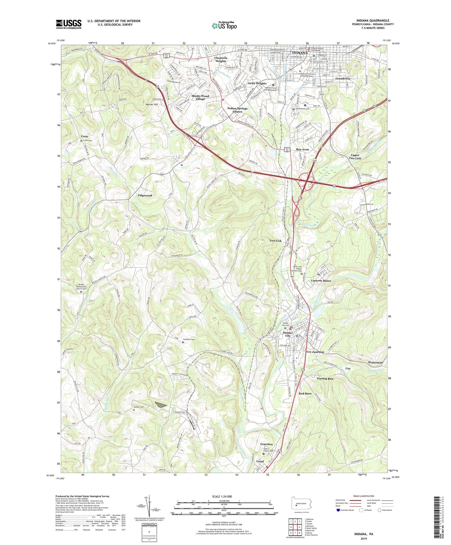
2019 topographic map quadrangle Indiana in the state of Pennsylvania. Scale: 1:24000. Based on the newly updated USGS 7.5' US Topo map series, this map is in the following counties: Indiana. The map contains contour data, water features, and other items you are used to seeing on USGS maps, but also has updated roads and other features. This is the next generation of topographic maps. Printed on high-quality waterproof paper with UV fade-resistant inks.
Quads adjacent to this one:
West: McIntyre
Northwest: Elderton
North: Ernest
Northeast: Clymer
East: Brush Valley
Southeast: New Florence
South: Bolivar
Southwest: Blairsville
Contains the following named places: Ben Avon, Benjamin Franklin Elementary School, Bethel Church, Bethel Presbyterian Church Cemetery, Borough of Homer City, Borough of Indiana, Cherry Run, Cherry Run Dam, Cherry Run Lake, Citizens Ambulance Service Indiana Station Headquarters, Claypoole Heights, Coke Company Pond, Coral Census Designated Place, Coral Graceton Volunteer Fire Department Station 160, Coy, Coy Junction, Crete, Crete Cemetery, East Pike Elementary School, Edgewood, Eisenhower Elementary School, Getty Heights, Graceton, Graceton Census Designated Place, Grandview, Greenwood Cemetery, Homer City, Homer City Cemetery, Homer City Police Department, Homer City Post Office, Homer City Volunteer Fire Department Station 180, Horace Mann Elementary School, Indian Springs Estates, Indiana, Indiana Borough Police Department, Indiana County Fire Academy, Indiana County Sheriff's Office, Indiana Fire Association Central, Indiana Fire Association West - White Township Station 100, Indiana Mall, Indiana Post Office, Indiana Regional Medical Center, Indiana University of Pennsylvania, Kunkle Cemetery, Lamar High School, Life Flight 3 Indiana Regional Medical Center, Lucerne Mines, Lucerne Mines Census Designated Place, Lucerne Mines Post Office, Mack Memorial Park, Marsh Run, McCarthy Run, Oakland Cemetery and Mausoleum, Pennsylvania State Police Troop A Indiana Station, Red Barn, Regency Mall, Risinger School, Saint Francis Cemetery, Saint Louis Church, Saint Louis Roman Catholic Cemetery, Shado-Wood Village, Smathers, Smathers Cemetery, Special Medical Response Team, Stoney Run, Tearing Run, Tide, Township of Center, Township of White, Two Lick, University Elementary School, Upper Two Lick, Vfw Country Club, Warner Hill, Waterman, WCQO-FM (Blairsville), WDAD-AM (Indiana), Whites Run, Willard Orphanage Country Home, WIUP-FM (Indiana), WQMU-FM (Indiana), WRID-AM (Homer City), Yellow Creek, ZIP Codes: 15731, 15754