MyTopo
Clymer Pennsylvania US Topo Map
Couldn't load pickup availability
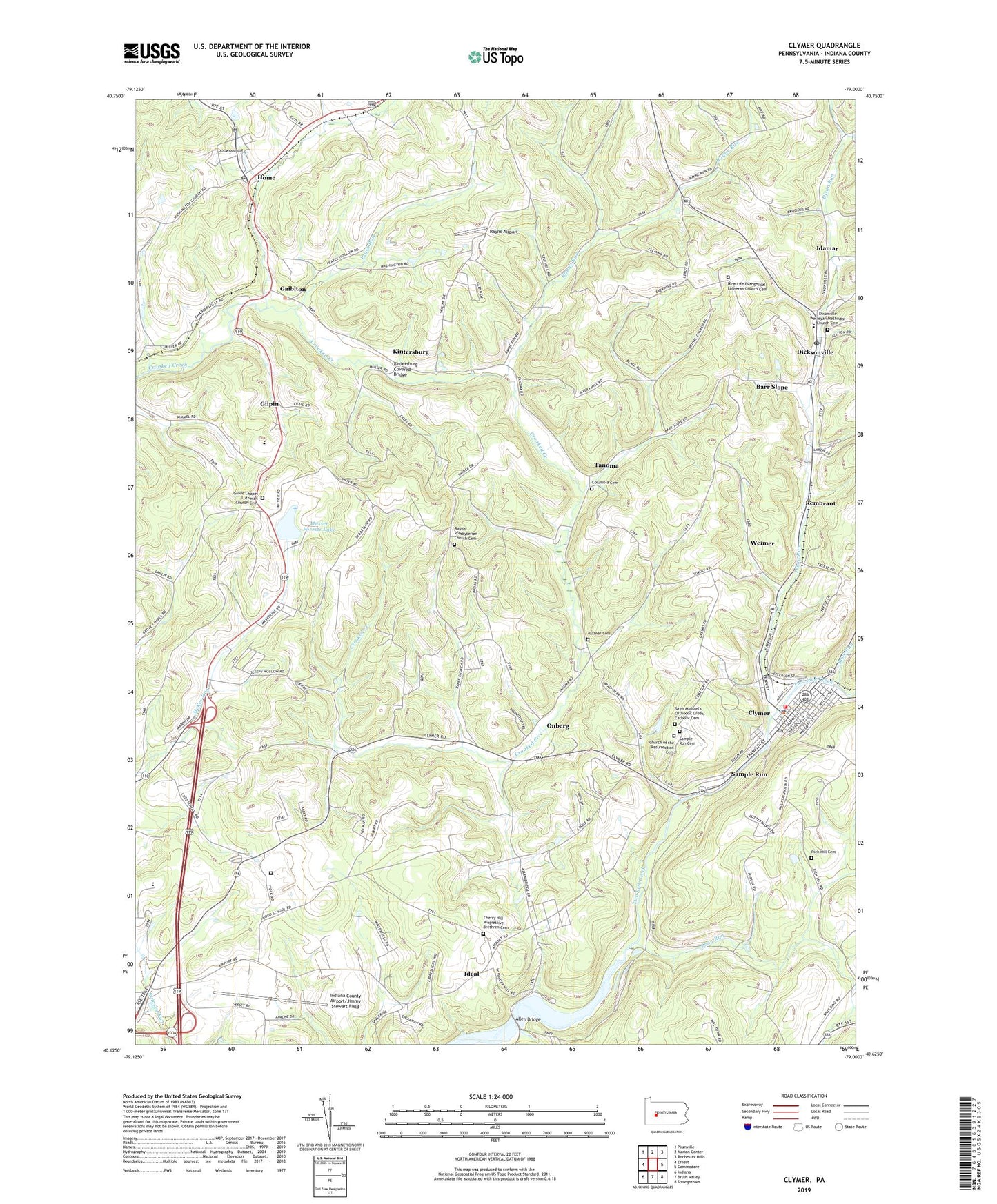
2023 topographic map quadrangle Clymer in the state of Pennsylvania. Scale: 1:24000. Based on the newly updated USGS 7.5' US Topo map series, this map is in the following counties: Indiana. The map contains contour data, water features, and other items you are used to seeing on USGS maps, but also has updated roads and other features. This is the next generation of topographic maps. Printed on high-quality waterproof paper with UV fade-resistant inks.
Quads adjacent to this one:
West: Ernest
Northwest: Plumville
North: Marion Center
Northeast: Rochester Mills
East: Commodore
Southeast: Strongstown
South: Brush Valley
Southwest: Indiana
This map covers the same area as the classic USGS quad with code o40079f1.
Contains the following named places: Allen Bridge, Allen Run, Barr Slope, Bethel Church, Borough of Clymer, Brush Run, Buck Run, Cherry Hill Progressive Brethren Cemetery, Church of the Resurrection Cemetery, Clymer, Clymer Borough Police Department, Clymer Post Office, Clymer Volunteer Fire Department Station 150, Columbia Cemetery, Dixon Run, Dixonville, Dixonville Census Designated Place, Dixonville Post Office, Dixonville Wesleyan Methodist Church Cemetery, Gaiblton, Gilpin, Grove Chapel, Grove Chapel Lutheran Church Cemetery, Home, Home Post Office, Idamar, Ideal, Indiana County, Indiana County Airport/Jimmy Stewart Field, Indiana Wesleyan School, Kellysburg, Kintersburg, Kintersburg Covered Bridge, Musser Forests Dam, Musser Forests Lake, New Life Evangelical Lutheran Church Cemetery, Onberg, Penn Run, Pine Run, Rayne, Rayne Airport, Rayne Church, Rayne Presbyterian Church Cemetery, Rayne Run, Rembrant, Rich Hill Cemetery, Ruffner Cemetery, Ruffner Church, Saint Michael's Orthodox Greek Catholic Cemetery, Sample Run, Sample Run Cemetery, State Correctional Institution Pine Grove, Tanoma, Township of Cherryhill, Township of Rayne, Weimer, ZIP Code: 15734