MyTopo
Brush Valley Pennsylvania US Topo Map
Couldn't load pickup availability
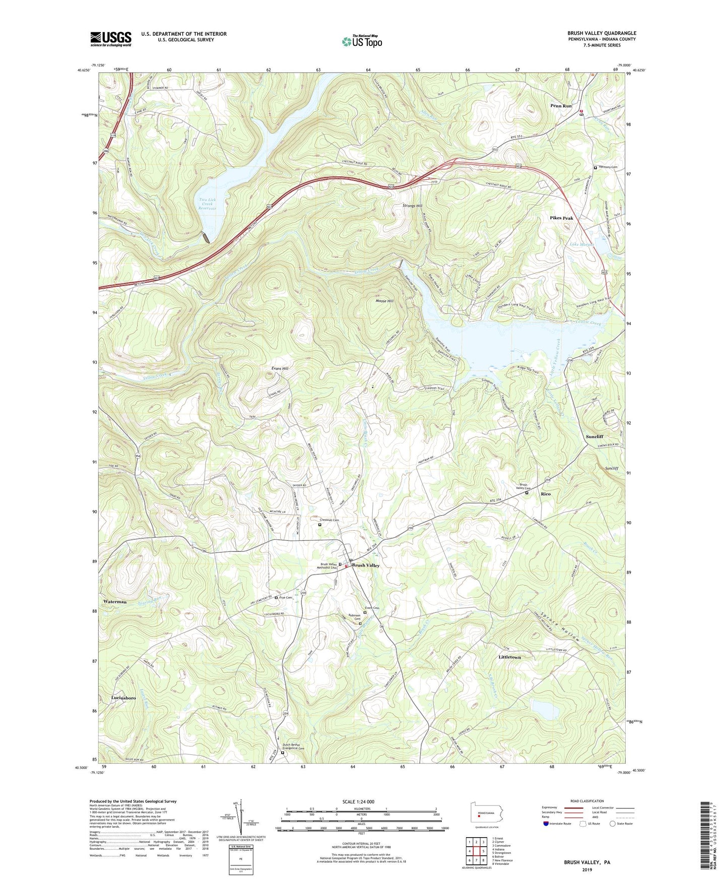
2023 topographic map quadrangle Brush Valley in the state of Pennsylvania. Scale: 1:24000. Based on the newly updated USGS 7.5' US Topo map series, this map is in the following counties: Indiana. The map contains contour data, water features, and other items you are used to seeing on USGS maps, but also has updated roads and other features. This is the next generation of topographic maps. Printed on high-quality waterproof paper with UV fade-resistant inks.
Quads adjacent to this one:
West: Indiana
Northwest: Ernest
North: Clymer
Northeast: Commodore
East: Strongstown
Southeast: Vintondale
South: New Florence
Southwest: Bolivar
This map covers the same area as the classic USGS quad with code o40079e1.
Contains the following named places: Bennett Airport, Brush Valley, Brush Valley Cemetery, Brush Valley Methodist Cemetery, Brush Valley Post Office, Brush Valley Volunteer Fire Department Station 230, Cherryhill Township Volunteer Fire Department Station 240, Cresswell Cemetery, Dutch Bethel Evangelical Cemetery, Elroy Face Dam, Evans Cemetery, Evans Field, Evans Hill, Ferrier Run, Frye Cemetery, Gillhouser Run, Greenville, Harmony Cemetery, Lake Margus, Laurel Run, Little Brush Creek, Little Yellow Creek, Littletown, Lucerne Dam, Luciusboro, Mechanicsburg, Mentch, Moose Hill, Penn Run, Penn Run Post Office, Pikes Peak, Pond Number Four, Pond Number Four Dam, Ramsey Run, Rico, Robinson Cemetery, South Branch Brush Creek, Spruce Hollow, Spruce Hollow Run, Stake Church, State Game Lands Number 248, State Game Lands Number 273, Strongs Hill, Suncliff, Township of Brush Valley, Two Lick Creek Dam, Two Lick Creek Reservoir, Yellow Creek State Park, Yellow Creek State Park Dam, ZIP Code: 15748